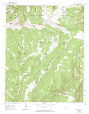
Pecos Falls Topo Map New Mexico
To zoom in, hover over the map of Pecos Falls
USGS Topo Quad 35105h5 - 1:24,000 scale
| Topo Map Name: | Pecos Falls |
| USGS Topo Quad ID: | 35105h5 |
| Print Size: | ca. 21 1/4" wide x 27" high |
| Southeast Coordinates: | 35.875° N latitude / 105.5° W longitude |
| Map Center Coordinates: | 35.9375° N latitude / 105.5625° W longitude |
| U.S. State: | NM |
| Filename: | o35105h5.jpg |
| Download Map JPG Image: | Pecos Falls topo map 1:24,000 scale |
| Map Type: | Topographic |
| Topo Series: | 7.5´ |
| Map Scale: | 1:24,000 |
| Source of Map Images: | United States Geological Survey (USGS) |
| Alternate Map Versions: |
Pecos Falls NM 1963, updated 1965 Download PDF Buy paper map Pecos Falls NM 1963, updated 1970 Download PDF Buy paper map Pecos Falls NM 1995, updated 1997 Download PDF Buy paper map Pecos Falls NM 2011 Download PDF Buy paper map Pecos Falls NM 2013 Download PDF Buy paper map Pecos Falls NM 2017 Download PDF Buy paper map |
| FStopo: | US Forest Service topo Pecos Falls is available: Download FStopo PDF Download FStopo TIF |
1:24,000 Topo Quads surrounding Pecos Falls
> Back to 35105e1 at 1:100,000 scale
> Back to 35104a1 at 1:250,000 scale
> Back to U.S. Topo Maps home
Pecos Falls topo map: Gazetteer
Pecos Falls: Areas
Rincon Bonito elevation 3549m 11643′Pecos Falls: Falls
Pecos Falls elevation 3195m 10482′Pecos Falls: Lakes
Lost Bear Lake elevation 3449m 11315′Middle Fork Lake elevation 3569m 11709′
Pecos Falls: Ranges
Santa Fe Mountains elevation 3342m 10964′Pecos Falls: Ridges
Bordo Del Medio elevation 3331m 10928′Pecos Falls: Streams
Beatty Creek elevation 2839m 9314′Rito Azul elevation 3031m 9944′
Rito de los Chimayosos elevation 2953m 9688′
Rito del Padre elevation 2878m 9442′
Rito Maestas elevation 3131m 10272′
Rito Sebadilloses elevation 2912m 9553′
South Fork Rito Azul elevation 3119m 10232′
Pecos Falls: Summits
Cerrito del Padre elevation 3272m 10734′Chimayosos Peak elevation 3908m 12821′
Hamilton Mesa elevation 3197m 10488′
Pecos Falls: Valleys
Jarosa Canyon elevation 3127m 10259′Pecos Falls digital topo map on disk
Buy this Pecos Falls topo map showing relief, roads, GPS coordinates and other geographical features, as a high-resolution digital map file on DVD:


