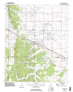
Edgewood Topo Map New Mexico
To zoom in, hover over the map of Edgewood
USGS Topo Quad 35106a2 - 1:24,000 scale
| Topo Map Name: | Edgewood |
| USGS Topo Quad ID: | 35106a2 |
| Print Size: | ca. 21 1/4" wide x 27" high |
| Southeast Coordinates: | 35° N latitude / 106.125° W longitude |
| Map Center Coordinates: | 35.0625° N latitude / 106.1875° W longitude |
| U.S. State: | NM |
| Filename: | o35106a2.jpg |
| Download Map JPG Image: | Edgewood topo map 1:24,000 scale |
| Map Type: | Topographic |
| Topo Series: | 7.5´ |
| Map Scale: | 1:24,000 |
| Source of Map Images: | United States Geological Survey (USGS) |
| Alternate Map Versions: |
Edgewood NM 1954, updated 1955 Download PDF Buy paper map Edgewood NM 1954, updated 1963 Download PDF Buy paper map Edgewood NM 1954, updated 1978 Download PDF Buy paper map Edgewood NM 1990, updated 1996 Download PDF Buy paper map Edgewood NM 2010 Download PDF Buy paper map Edgewood NM 2013 Download PDF Buy paper map Edgewood NM 2017 Download PDF Buy paper map |
1:24,000 Topo Quads surrounding Edgewood
> Back to 35106a1 at 1:100,000 scale
> Back to 35106a1 at 1:250,000 scale
> Back to U.S. Topo Maps home
Edgewood topo map: Gazetteer
Edgewood: Airports
New Mexico Soaring Ranch Airport elevation 1992m 6535′Sandia Airpark Estates East Airport elevation 2001m 6564′
Edgewood: Arroyos
Arroyo de San Jose elevation 2006m 6581′Edgewood: Mines
La Don Mine elevation 2119m 6952′McClendon elevation 1976m 6482′
Schockley elevation 2133m 6998′
Tina elevation 2102m 6896′
Tina Barite Deposit elevation 2117m 6945′
Edgewood: Populated Places
Barton elevation 2056m 6745′Blackwell Place elevation 1968m 6456′
Briggs Place elevation 1994m 6541′
Edgewood elevation 2026m 6646′
Gallegos elevation 1999m 6558′
Jarett Place elevation 1973m 6473′
Edgewood: Post Offices
Barton Post Office (historical) elevation 2056m 6745′Edgewood Post Office elevation 2026m 6646′
Edgewood: Valleys
Cañon de Gallegos elevation 1941m 6368′Juan Tomas Canyon elevation 2024m 6640′
Edgewood: Wells
100613224 Water Well elevation 2049m 6722′10064 Water Well elevation 1991m 6532′
110724121 Water Well elevation 1971m 6466′
253 Water Well elevation 2056m 6745′
451 Water Well elevation 1998m 6555′
454 Water Well elevation 1998m 6555′
457 Water Well elevation 2006m 6581′
458 Water Well elevation 2025m 6643′
459 Water Well elevation 2011m 6597′
460 Water Well elevation 2007m 6584′
461 Water Well elevation 2012m 6601′
463 Water Well elevation 2009m 6591′
465 Water Well elevation 2043m 6702′
466 Water Well elevation 2039m 6689′
473 Water Well elevation 2025m 6643′
474 Water Well elevation 2010m 6594′
535 Water Well elevation 2011m 6597′
E-1175 Water Well elevation 1994m 6541′
E1723-S-2 Water Well elevation 2019m 6624′
E-2291 Water Well elevation 2069m 6788′
E-2772 Water Well elevation 2032m 6666′
E-2779 Water Well elevation 2012m 6601′
E-286-S Water Well elevation 1966m 6450′
E-3042 Water Well elevation 2011m 6597′
E-3493 Water Well elevation 2005m 6578′
E-3522 Water Well elevation 2003m 6571′
E-3806 Water Well elevation 2116m 6942′
E-3909 Water Well elevation 1998m 6555′
E-483 Water Well elevation 1960m 6430′
E-761 Water Well elevation 2007m 6584′
E-761-S-2 Water Well elevation 2012m 6601′
Water Well 10000 elevation 1975m 6479′
Edgewood digital topo map on disk
Buy this Edgewood topo map showing relief, roads, GPS coordinates and other geographical features, as a high-resolution digital map file on DVD:


