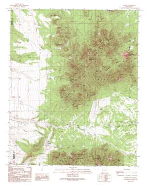
Golden Topo Map New Mexico
To zoom in, hover over the map of Golden
USGS Topo Quad 35106c2 - 1:24,000 scale
| Topo Map Name: | Golden |
| USGS Topo Quad ID: | 35106c2 |
| Print Size: | ca. 21 1/4" wide x 27" high |
| Southeast Coordinates: | 35.25° N latitude / 106.125° W longitude |
| Map Center Coordinates: | 35.3125° N latitude / 106.1875° W longitude |
| U.S. State: | NM |
| Filename: | o35106c2.jpg |
| Download Map JPG Image: | Golden topo map 1:24,000 scale |
| Map Type: | Topographic |
| Topo Series: | 7.5´ |
| Map Scale: | 1:24,000 |
| Source of Map Images: | United States Geological Survey (USGS) |
| Alternate Map Versions: |
Golden NM 1990, updated 1990 Download PDF Buy paper map Golden NM 1990, updated 1990 Download PDF Buy paper map Golden NM 2010 Download PDF Buy paper map Golden NM 2013 Download PDF Buy paper map Golden NM 2017 Download PDF Buy paper map |
1:24,000 Topo Quads surrounding Golden
> Back to 35106a1 at 1:100,000 scale
> Back to 35106a1 at 1:250,000 scale
> Back to U.S. Topo Maps home
Golden topo map: Gazetteer
Golden: Areas
Las Lomas de la Bolsa elevation 2152m 7060′Golden: Gaps
San Pedro Pass elevation 2079m 6820′Golden: Mines
Birds Eye elevation 2307m 7568′Golden Placer elevation 2081m 6827′
Gypsy Queen Mine elevation 2215m 7267′
Iron Princess elevation 2374m 7788′
Jamison elevation 2316m 7598′
Jessie elevation 2246m 7368′
JIC elevation 2204m 7230′
Mine del Candelario elevation 2154m 7066′
New Mexico elevation 2213m 7260′
New Years elevation 2236m 7335′
Ninety-Nine Mine elevation 2186m 7171′
Old Timer elevation 2265m 7431′
Ortiz Mine elevation 2159m 7083′
Ortiz Mine elevation 2273m 7457′
Saint Luke Mine elevation 2188m 7178′
Saint Paul Mine elevation 2250m 7381′
San Pedro elevation 2202m 7224′
Shamrock Mine elevation 2314m 7591′
Sunnyside elevation 2470m 8103′
Sunset elevation 2404m 7887′
Tennessee elevation 2205m 7234′
Triangle Lode elevation 2186m 7171′
Golden: Populated Places
Golden elevation 2023m 6637′Ortiz (historical) elevation 2273m 7457′
Golden: Post Offices
Golden Post Office (historical) elevation 2023m 6637′Golden: Ranges
Ortiz Mountains elevation 2481m 8139′Golden: Springs
Deer Spring elevation 2056m 6745′Tuerto Spring elevation 1972m 6469′
Golden: Summits
Cedar Mountain elevation 2146m 7040′Cerro Columbo elevation 2290m 7513′
Cunningham Hill elevation 2171m 7122′
El Punto elevation 2288m 7506′
Placer Mountain elevation 2700m 8858′
Golden: Valleys
Buckeye Canyon elevation 2164m 7099′Cañon de Perry elevation 2129m 6984′
Cañon Monte del Largo elevation 2132m 6994′
Carache Canyon elevation 2193m 7194′
Cunningham Gulch elevation 2111m 6925′
Eagle Canyon elevation 2192m 7191′
Gypsy Queen Canyon elevation 2148m 7047′
Lukas Canyon elevation 2050m 6725′
Oldtimer Canyon elevation 2018m 6620′
Pine Tree Canyon elevation 2146m 7040′
San Francisco Canyon elevation 2074m 6804′
Stagecoach Canyon elevation 2061m 6761′
Golden: Wells
CD-1 Water Well elevation 2161m 7089′Dolores Gulch Water Well elevation 2155m 7070′
Old LS NOR Water Well elevation 2044m 6706′
OR-3 Water Well elevation 2120m 6955′
Golden digital topo map on disk
Buy this Golden topo map showing relief, roads, GPS coordinates and other geographical features, as a high-resolution digital map file on DVD:


