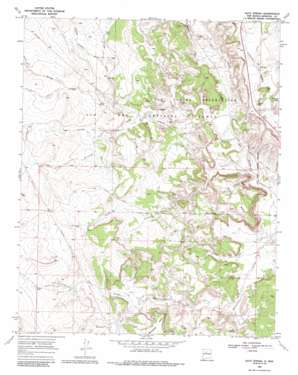
Ojito Spring Topo Map New Mexico
To zoom in, hover over the map of Ojito Spring
USGS Topo Quad 35106e8 - 1:24,000 scale
| Topo Map Name: | Ojito Spring |
| USGS Topo Quad ID: | 35106e8 |
| Print Size: | ca. 21 1/4" wide x 27" high |
| Southeast Coordinates: | 35.5° N latitude / 106.875° W longitude |
| Map Center Coordinates: | 35.5625° N latitude / 106.9375° W longitude |
| U.S. State: | NM |
| Filename: | o35106e8.jpg |
| Download Map JPG Image: | Ojito Spring topo map 1:24,000 scale |
| Map Type: | Topographic |
| Topo Series: | 7.5´ |
| Map Scale: | 1:24,000 |
| Source of Map Images: | United States Geological Survey (USGS) |
| Alternate Map Versions: |
Ojito Spring NM 1969, updated 1972 Download PDF Buy paper map Ojito Spring NM 1969, updated 1985 Download PDF Buy paper map Ojito Spring NM 2010 Download PDF Buy paper map Ojito Spring NM 2013 Download PDF Buy paper map Ojito Spring NM 2017 Download PDF Buy paper map |
1:24,000 Topo Quads surrounding Ojito Spring
> Back to 35106e1 at 1:100,000 scale
> Back to 35106a1 at 1:250,000 scale
> Back to U.S. Topo Maps home
Ojito Spring topo map: Gazetteer
Ojito Spring: Dams
Rio Salado Detention Dam Number 18 elevation 1823m 5980′Rio Salado North Detention Dam Number Seven elevation 1799m 5902′
Ojito Spring: Mines
Lone Wolf Group elevation 1738m 5702′Polka Dot Uranium Group elevation 1795m 5889′
Rattlesnake Group elevation 1810m 5938′
Yellow Cliffs Group elevation 1790m 5872′
Ojito Spring: Parks
Ojito Wilderness Study Area elevation 1765m 5790′Ojito Spring: Pillars
Los Posos elevation 1758m 5767′Ojito Spring: Reservoirs
Ojito Tank elevation 1800m 5905′Peñasco Tank elevation 1795m 5889′
Tenorio Tank (historical) elevation 1789m 5869′
Ojito Spring: Springs
Ojito Spring elevation 1765m 5790′Ojito Spring: Streams
Arroyo Alamito elevation 1775m 5823′Arroyo Alamo elevation 1760m 5774′
Arroyo Armiento elevation 1744m 5721′
Arroyo Bernalillito elevation 1720m 5643′
Arroyo Corrales elevation 1781m 5843′
Arroyo Cucho elevation 1707m 5600′
Arroyo la Jara elevation 1732m 5682′
Arroyo Ojito elevation 1720m 5643′
Arroyo Ojitos elevation 1775m 5823′
Cuchilla Arroyo elevation 1723m 5652′
Marquez Wash elevation 1775m 5823′
Ojito Spring: Summits
Bernalillito Mesa elevation 1878m 6161′Cucho Mesa elevation 1870m 6135′
Ojito Spring: Wells
Pipeline Well Water Well elevation 1873m 6145′Ojito Spring digital topo map on disk
Buy this Ojito Spring topo map showing relief, roads, GPS coordinates and other geographical features, as a high-resolution digital map file on DVD:


