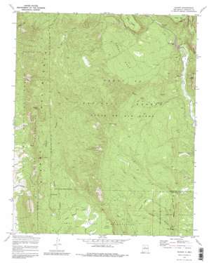
Gilman Topo Map New Mexico
To zoom in, hover over the map of Gilman
USGS Topo Quad 35106f7 - 1:24,000 scale
| Topo Map Name: | Gilman |
| USGS Topo Quad ID: | 35106f7 |
| Print Size: | ca. 21 1/4" wide x 27" high |
| Southeast Coordinates: | 35.625° N latitude / 106.75° W longitude |
| Map Center Coordinates: | 35.6875° N latitude / 106.8125° W longitude |
| U.S. State: | NM |
| Filename: | o35106f7.jpg |
| Download Map JPG Image: | Gilman topo map 1:24,000 scale |
| Map Type: | Topographic |
| Topo Series: | 7.5´ |
| Map Scale: | 1:24,000 |
| Source of Map Images: | United States Geological Survey (USGS) |
| Alternate Map Versions: |
Gilman NM 1970, updated 1973 Download PDF Buy paper map Gilman NM 1970, updated 1982 Download PDF Buy paper map Gilman NM 2002, updated 2003 Download PDF Buy paper map Gilman NM 2011 Download PDF Buy paper map Gilman NM 2013 Download PDF Buy paper map Gilman NM 2017 Download PDF Buy paper map |
| FStopo: | US Forest Service topo Gilman is available: Download FStopo PDF Download FStopo TIF |
1:24,000 Topo Quads surrounding Gilman
> Back to 35106e1 at 1:100,000 scale
> Back to 35106a1 at 1:250,000 scale
> Back to U.S. Topo Maps home
Gilman topo map: Gazetteer
Gilman: Flats
Coyote Flats elevation 1913m 6276′Jack Rabbit Flats elevation 2106m 6909′
Gilman: Mines
Deer Creek Prospect elevation 2182m 7158′Gilman: Populated Places
Deer Creek Landing elevation 1921m 6302′Gilman elevation 1799m 5902′
Gilman: Ridges
Hard Rock Ridge elevation 1964m 6443′Gilman: Springs
Barrel Spring elevation 2229m 7312′Crow Springs elevation 2181m 7155′
Log Springs elevation 2192m 7191′
Navajo Springs elevation 2337m 7667′
Owl Springs elevation 1763m 5784′
Gilman: Streams
Deer Creek elevation 1937m 6354′Gilman: Summits
Guadalupita Mesa elevation 2275m 7463′Mesa Garcia elevation 2117m 6945′
Pajarito Peak elevation 2749m 9019′
Peggy Mesa elevation 2317m 7601′
Gilman: Valleys
Guadalupe Box elevation 1868m 6128′Osha Canyon elevation 1769m 5803′
Peñasco Canyon elevation 2065m 6774′
Tecolote Canyon elevation 1739m 5705′
Virgin Canyon elevation 1767m 5797′
Gilman: Wells
Guadalupe 3 in Water Well elevation 1943m 6374′Gilman digital topo map on disk
Buy this Gilman topo map showing relief, roads, GPS coordinates and other geographical features, as a high-resolution digital map file on DVD:


