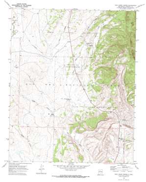
Holy Ghost Spring Topo Map New Mexico
To zoom in, hover over the map of Holy Ghost Spring
USGS Topo Quad 35106f8 - 1:24,000 scale
| Topo Map Name: | Holy Ghost Spring |
| USGS Topo Quad ID: | 35106f8 |
| Print Size: | ca. 21 1/4" wide x 27" high |
| Southeast Coordinates: | 35.625° N latitude / 106.875° W longitude |
| Map Center Coordinates: | 35.6875° N latitude / 106.9375° W longitude |
| U.S. State: | NM |
| Filename: | o35106f8.jpg |
| Download Map JPG Image: | Holy Ghost Spring topo map 1:24,000 scale |
| Map Type: | Topographic |
| Topo Series: | 7.5´ |
| Map Scale: | 1:24,000 |
| Source of Map Images: | United States Geological Survey (USGS) |
| Alternate Map Versions: |
Holy Ghost Spring NM 1969, updated 1972 Download PDF Buy paper map Holy Ghost Spring NM 2010 Download PDF Buy paper map Holy Ghost Spring NM 2013 Download PDF Buy paper map Holy Ghost Spring NM 2017 Download PDF Buy paper map |
1:24,000 Topo Quads surrounding Holy Ghost Spring
> Back to 35106e1 at 1:100,000 scale
> Back to 35106a1 at 1:250,000 scale
> Back to U.S. Topo Maps home
Holy Ghost Spring topo map: Gazetteer
Holy Ghost Spring: Falls
Chamisa Vega Spring Falls elevation 1861m 6105′Holy Ghost Spring: Mines
Burcar Prospect elevation 2184m 7165′Collins Mine elevation 2044m 6706′
Goodner Section 24 and 25 Mine elevation 2016m 6614′
Goodner Section Eleven Prospect elevation 2040m 6692′
Kaseman Number One Mine elevation 1843m 6046′
Warm Springs Mine elevation 2044m 6706′
Holy Ghost Spring: Reservoirs
San Luis Tank elevation 1903m 6243′Holy Ghost Spring: Ridges
Cuchilla Blanca Hill elevation 1957m 6420′Holy Ghost Spring: Springs
Cachana Spring elevation 1872m 6141′Holy Ghost Spring elevation 1953m 6407′
Soda Spring elevation 1830m 6003′
Warm Springs elevation 1836m 6023′
Holy Ghost Spring: Streams
Arroyo Cachulie elevation 1807m 5928′Arroyo Lopez elevation 1873m 6145′
Arroyo Semilla elevation 1901m 6236′
Cachana Arroyo elevation 1863m 6112′
Los Pinos Arroyo elevation 1829m 6000′
Holy Ghost Spring: Valleys
Semilla Canyon elevation 2173m 7129′Holy Ghost Spring: Wells
RWP 1 Water Well elevation 1934m 6345′RWP 4 Water Well elevation 2039m 6689′
RWP 4 Water Well elevation 1933m 6341′
Warm Springs Water Well elevation 1838m 6030′
Holy Ghost Spring digital topo map on disk
Buy this Holy Ghost Spring topo map showing relief, roads, GPS coordinates and other geographical features, as a high-resolution digital map file on DVD:


