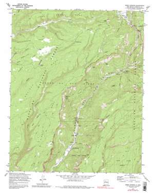
Jemez Springs Topo Map New Mexico
To zoom in, hover over the map of Jemez Springs
USGS Topo Quad 35106g6 - 1:24,000 scale
| Topo Map Name: | Jemez Springs |
| USGS Topo Quad ID: | 35106g6 |
| Print Size: | ca. 21 1/4" wide x 27" high |
| Southeast Coordinates: | 35.75° N latitude / 106.625° W longitude |
| Map Center Coordinates: | 35.8125° N latitude / 106.6875° W longitude |
| U.S. State: | NM |
| Filename: | o35106g6.jpg |
| Download Map JPG Image: | Jemez Springs topo map 1:24,000 scale |
| Map Type: | Topographic |
| Topo Series: | 7.5´ |
| Map Scale: | 1:24,000 |
| Source of Map Images: | United States Geological Survey (USGS) |
| Alternate Map Versions: |
Jemez Springs NM 1970, updated 1973 Download PDF Buy paper map Jemez Springs NM 1970, updated 1981 Download PDF Buy paper map Jemez Springs NM 1970, updated 1988 Download PDF Buy paper map Jemez Springs NM 2002, updated 2003 Download PDF Buy paper map Jemez Springs NM 2011 Download PDF Buy paper map Jemez Springs NM 2013 Download PDF Buy paper map Jemez Springs NM 2017 Download PDF Buy paper map |
| FStopo: | US Forest Service topo Jemez Springs is available: Download FStopo PDF Download FStopo TIF |
1:24,000 Topo Quads surrounding Jemez Springs
> Back to 35106e1 at 1:100,000 scale
> Back to 35106a1 at 1:250,000 scale
> Back to U.S. Topo Maps home
Jemez Springs topo map: Gazetteer
Jemez Springs: Benches
Cat Mesa elevation 2102m 6896′Holiday Mesa elevation 2481m 8139′
Stable Mesa elevation 2502m 8208′
Virgin Mesa elevation 2427m 7962′
West Mesa elevation 2417m 7929′
Jemez Springs: Dams
Lower Vallecito Dam elevation 2425m 7956′Soda Dam elevation 1930m 6332′
Jemez Springs: Forests
Jemez Ranger District elevation 2442m 8011′Jemez Springs: Mines
Jemez Hot Springs elevation 2354m 7723′La Plata Placer elevation 2237m 7339′
NE Soda Dam Prospect elevation 2050m 6725′
Soda Dam Springs elevation 1943m 6374′
Jemez Springs: Parks
Jemez Mountains Historical Marker elevation 1889m 6197′Jemez State Monument elevation 1928m 6325′
Soda Dam Historical Marker elevation 1930m 6332′
Valle Grande Historical Marker elevation 2469m 8100′
Jemez Springs: Pillars
Rincon Negro elevation 2306m 7565′Jemez Springs: Populated Places
Jemez Springs elevation 1889m 6197′Jemez Springs: Post Offices
Jemez Springs Post Office elevation 1889m 6197′Jemez Springs: Reservoirs
Cass Tank elevation 2523m 8277′Cebollita Tank elevation 2570m 8431′
Lower Vallecito Reservoir elevation 2425m 7956′
Jemez Springs: Slopes
Tent Rocks elevation 2612m 8569′Jemez Springs: Springs
Agua Durme Spring elevation 2233m 7326′Alamo Spring elevation 2278m 7473′
Aqua Durme Springs elevation 2271m 7450′
Cebollita Spring elevation 2473m 8113′
Jemez Hot Springs elevation 1891m 6204′
Jemez Hot Springs elevation 1885m 6184′
Jemez Hot Springs Original Springs elevation 1892m 6207′
McCauley Spring elevation 2242m 7355′
Sino Spring elevation 2317m 7601′
Soda Dam Springs East elevation 1924m 6312′
Soda Dam Springs West elevation 1957m 6420′
Spence Hot Spring elevation 2250m 7381′
Jemez Springs: Streams
East Fork Jemez River elevation 2062m 6765′San Antonio Creek elevation 2063m 6768′
Sulphur Creek elevation 2322m 7618′
Jemez Springs: Summits
Battleship Rock elevation 2139m 7017′Cebollita Mesa elevation 2647m 8684′
Cerro Colorado elevation 2369m 7772′
Lake Fork Mesa elevation 2574m 8444′
Schoolhouse Mesa elevation 2563m 8408′
Jemez Springs: Trails
Padre Alonzo Trail elevation 2059m 6755′Jemez Springs: Valleys
Church Canyon elevation 1911m 6269′Ojito Canyon elevation 1892m 6207′
Spring Canyon elevation 2327m 7634′
Wildcat Canyon elevation 2326m 7631′
Jemez Springs: Wells
Hole A Water Well elevation 2553m 8375′Jemez Springs digital topo map on disk
Buy this Jemez Springs topo map showing relief, roads, GPS coordinates and other geographical features, as a high-resolution digital map file on DVD:


