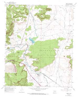
Mesita Topo Map New Mexico
To zoom in, hover over the map of Mesita
USGS Topo Quad 35107a3 - 1:24,000 scale
| Topo Map Name: | Mesita |
| USGS Topo Quad ID: | 35107a3 |
| Print Size: | ca. 21 1/4" wide x 27" high |
| Southeast Coordinates: | 35° N latitude / 107.25° W longitude |
| Map Center Coordinates: | 35.0625° N latitude / 107.3125° W longitude |
| U.S. State: | NM |
| Filename: | o35107a3.jpg |
| Download Map JPG Image: | Mesita topo map 1:24,000 scale |
| Map Type: | Topographic |
| Topo Series: | 7.5´ |
| Map Scale: | 1:24,000 |
| Source of Map Images: | United States Geological Survey (USGS) |
| Alternate Map Versions: |
Mesita NM 1957, updated 1959 Download PDF Buy paper map Mesita NM 1957, updated 1973 Download PDF Buy paper map Mesita NM 2010 Download PDF Buy paper map Mesita NM 2013 Download PDF Buy paper map Mesita NM 2017 Download PDF Buy paper map |
1:24,000 Topo Quads surrounding Mesita
> Back to 35107a1 at 1:100,000 scale
> Back to 35106a1 at 1:250,000 scale
> Back to U.S. Topo Maps home
Mesita topo map: Gazetteer
Mesita: Crossings
114-Laguna Interchange elevation 1792m 5879′Mesita: Lakes
Snowbird Lake elevation 1799m 5902′Mesita: Mines
Alpine Miner Test Area elevation 1792m 5879′F-9-2 Mine elevation 1850m 6069′
H-1 Mine elevation 1856m 6089′
M-6 elevation 1767m 5797′
Mesita Well elevation 1763m 5784′
Oak Creek Canyon Deposit elevation 1848m 6062′
Wilcox Ranch Deposit elevation 1775m 5823′
Mesita: Populated Places
Marmon elevation 1715m 5626′Mesita elevation 1728m 5669′
Mesita: Reservoirs
Paguate Reservoir elevation 1747m 5731′Mesita: Streams
Arroyo de Piedra Lumbre elevation 1776m 5826′Arroyo del Valle elevation 1776m 5826′
Arroyo Gigante elevation 1743m 5718′
Bell Rock Arroyo elevation 1750m 5741′
Rio Paguate elevation 1737m 5698′
Mesita: Summits
Flint Peak elevation 1808m 5931′Heart Peak elevation 1859m 6099′
North Oak Canyon Mesa elevation 1886m 6187′
Snowbird Mesa elevation 1935m 6348′
South Oak Canyon Mesa elevation 1916m 6286′
Sunhouse Peaks elevation 1890m 6200′
Wiener Mesa elevation 1937m 6354′
Yellow Hill elevation 1802m 5912′
Mesita: Valleys
Oak Canyon elevation 1777m 5830′Mesita: Wells
BIA-RWP16A Water Well elevation 1714m 5623′ECW-3 Water Well elevation 1799m 5902′
Mesita Water Well elevation 1723m 5652′
Mesita Well elevation 1724m 5656′
RWP-28 Water Well elevation 1790m 5872′
Mesita digital topo map on disk
Buy this Mesita topo map showing relief, roads, GPS coordinates and other geographical features, as a high-resolution digital map file on DVD:


