Grants Se Topo Map New Mexico
To zoom in, hover over the map of Grants Se
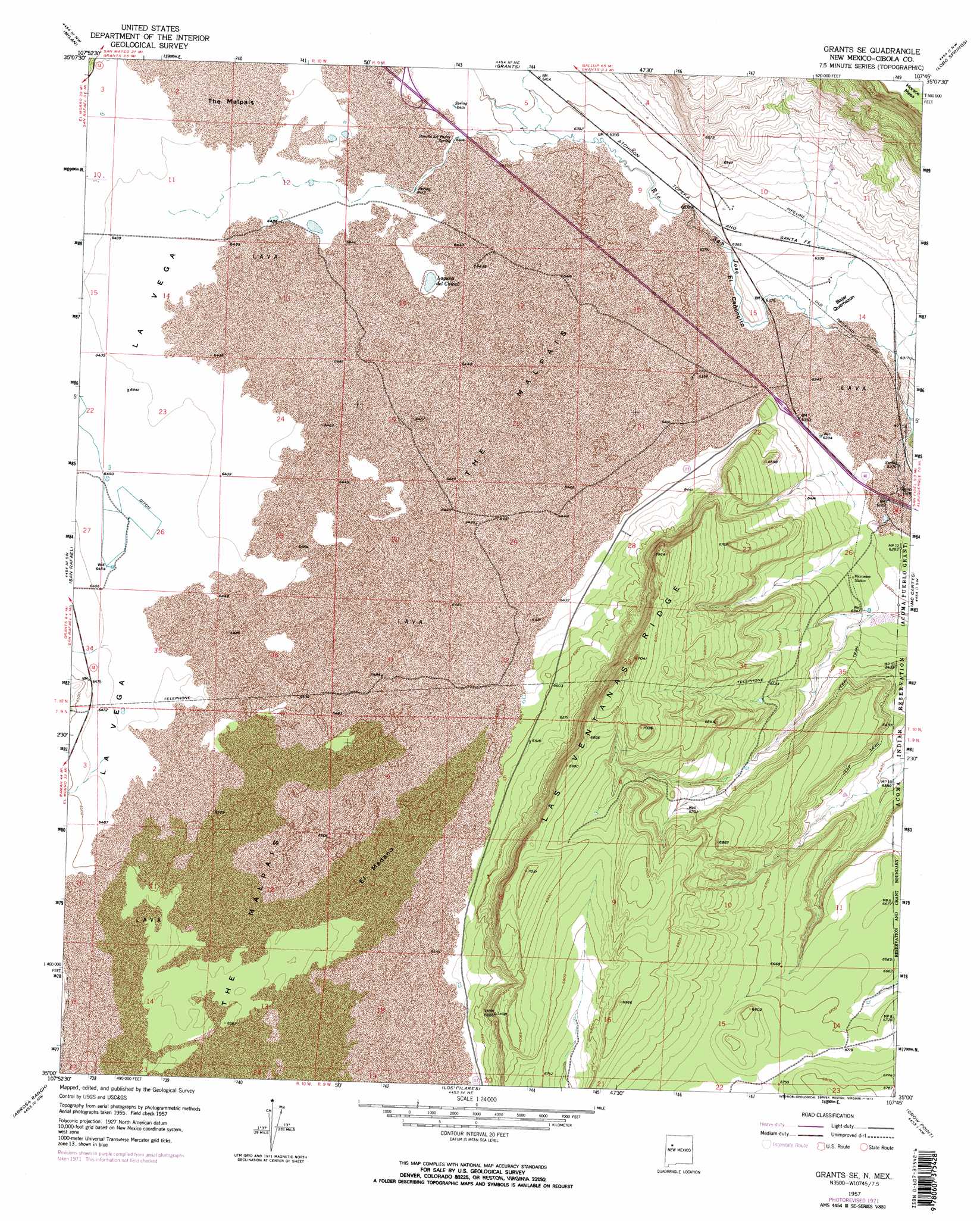
USGS Topo Quad 35107a7 - 1:24,000 scale
| Topo Map Name: | Grants Se |
| USGS Topo Quad ID: | 35107a7 |
| Print Size: | ca. 21 1/4" wide x 27" high |
| Southeast Coordinates: | 35° N latitude / 107.75° W longitude |
| Map Center Coordinates: | 35.0625° N latitude / 107.8125° W longitude |
| U.S. State: | NM |
| Filename: | o35107a7.jpg |
| Download Map JPG Image: | Grants Se topo map 1:24,000 scale |
| Map Type: | Topographic |
| Topo Series: | 7.5´ |
| Map Scale: | 1:24,000 |
| Source of Map Images: | United States Geological Survey (USGS) |
| Alternate Map Versions: |
Grants SE NM 1957, updated 1959 Download PDF Buy paper map Grants SE NM 1957, updated 1973 Download PDF Buy paper map Grants SE NM 1957, updated 1973 Download PDF Buy paper map Grants SE NM 2010 Download PDF Buy paper map Grants SE NM 2013 Download PDF Buy paper map |
1:24,000 Topo Quads surrounding Grants Se
Prewitt |
Bluewater |
Dos Lomas |
San Mateo |
Cerro Pelon |
Mount Sedgwick |
Milan |
Grants |
Lobo Springs |
Mount Taylor |
Paxton Springs |
San Rafael |
Grants Se |
Mccartys |
Cubero |
Ice Caves |
Arrosa Ranch |
Los Pilares |
Crow Point |
Acoma Pueblo |
Ice Caves Se |
North Pasture |
Laguna Honda |
Blue Mesa |
East Mesa |
> Back to 35107a1 at 1:100,000 scale
> Back to 35106a1 at 1:250,000 scale
> Back to U.S. Topo Maps home
Grants Se topo map: Gazetteer
Grants Se: Areas
Bajar Quemazon elevation 1925m 6315′El Medano elevation 1982m 6502′
Grants Se: Flats
La Vega elevation 1969m 6459′Grants Se: Lakes
Laguna del Chical elevation 1951m 6400′Grants Se: Ridges
Las Ventanas Ridge elevation 2149m 7050′Grants Se: Springs
Horace Springs elevation 1915m 6282′Rancho del Padre Spring elevation 1953m 6407′
Grants Se: Valleys
El Cañoncito elevation 1930m 6332′Grants Se: Wells
10029 Water Well elevation 1951m 6400′10030 Water Well elevation 1951m 6400′
10034 Water Well elevation 1969m 6459′
10035 Water Well elevation 1976m 6482′
10040 Water Well elevation 1965m 6446′
10041 Water Well elevation 1964m 6443′
10042 Water Well elevation 1969m 6459′
Grants Se digital topo map on disk
Buy this Grants Se topo map showing relief, roads, GPS coordinates and other geographical features, as a high-resolution digital map file on DVD: