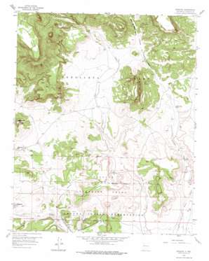
Moquino Topo Map New Mexico
To zoom in, hover over the map of Moquino
USGS Topo Quad 35107b3 - 1:24,000 scale
| Topo Map Name: | Moquino |
| USGS Topo Quad ID: | 35107b3 |
| Print Size: | ca. 21 1/4" wide x 27" high |
| Southeast Coordinates: | 35.125° N latitude / 107.25° W longitude |
| Map Center Coordinates: | 35.1875° N latitude / 107.3125° W longitude |
| U.S. State: | NM |
| Filename: | o35107b3.jpg |
| Download Map JPG Image: | Moquino topo map 1:24,000 scale |
| Map Type: | Topographic |
| Topo Series: | 7.5´ |
| Map Scale: | 1:24,000 |
| Source of Map Images: | United States Geological Survey (USGS) |
| Alternate Map Versions: |
Moquino NM 1957, updated 1959 Download PDF Buy paper map Moquino NM 1957, updated 1976 Download PDF Buy paper map Moquino NM 2010 Download PDF Buy paper map Moquino NM 2013 Download PDF Buy paper map Moquino NM 2017 Download PDF Buy paper map |
1:24,000 Topo Quads surrounding Moquino
> Back to 35107a1 at 1:100,000 scale
> Back to 35106a1 at 1:250,000 scale
> Back to U.S. Topo Maps home
Moquino topo map: Gazetteer
Moquino: Crossings
117 Mesita Interchange elevation 1945m 6381′Moquino: Dams
Sohio L-Bar Tailings Dam elevation 1878m 6161′Moquino: Mines
Jackpile Mine elevation 1853m 6079′JJ Number 1 elevation 1914m 6279′
L Bar Mine elevation 1956m 6417′
Saint Anthony Mine elevation 1860m 6102′
Saint Anthonys Shaft Number Two elevation 1936m 6351′
Seboyeta Project elevation 1951m 6400′
Sohio Uranium Mine elevation 1896m 6220′
Wind Whip elevation 1831m 6007′
Woodrow Mine elevation 1825m 5987′
Moquino: Populated Places
Moquino elevation 1869m 6131′Moquino: Streams
Arroyo Moquino elevation 1794m 5885′Rio Moquino elevation 1794m 5885′
Moquino: Summits
Cerro de la Celosa elevation 2033m 6669′Cerro Negro elevation 2198m 7211′
Gavilan Mesa elevation 1969m 6459′
Mesa del Lobo elevation 2159m 7083′
Moquino: Valleys
Cañada de Pedro Padilla elevation 1810m 5938′Cañon de Pedro Padilla elevation 1971m 6466′
Moquino: Wells
Anaconda Water Well elevation 1880m 6167′Diablo Water Well elevation 1892m 6207′
Jackpile Number 1 Water Well elevation 1799m 5902′
Jackpile Number 2 Water Well elevation 1800m 5905′
L-Bar 2 Water Well elevation 1870m 6135′
LJ 205 Water Well elevation 1878m 6161′
Lobo Camp Water Well elevation 1888m 6194′
Number 1 Water Well elevation 1884m 6181′
Number 10 Water Well elevation 1917m 6289′
Number 11 Water Well elevation 1920m 6299′
Number 12 Water Well elevation 1928m 6325′
Number 13 Water Well elevation 1930m 6332′
Number 14 Water Well elevation 1949m 6394′
Number 16 Water Well elevation 1939m 6361′
Number 2 Water Well elevation 1879m 6164′
Number 3 Water Well elevation 1880m 6167′
Number 4 Water Well elevation 1879m 6164′
Number 4 Water Well elevation 1825m 5987′
Number 5 Water Well elevation 1885m 6184′
Number 6 Water Well elevation 1879m 6164′
Number 7 Water Well elevation 1898m 6227′
Number 8 Water Well elevation 1967m 6453′
Number 8A Water Well elevation 1951m 6400′
Old Water Well elevation 1905m 6250′
Rusty Water Well elevation 1849m 6066′
Sohio A1 Water Well elevation 1909m 6263′
Well Number 9 Water Well elevation 1910m 6266′
Moquino digital topo map on disk
Buy this Moquino topo map showing relief, roads, GPS coordinates and other geographical features, as a high-resolution digital map file on DVD:


