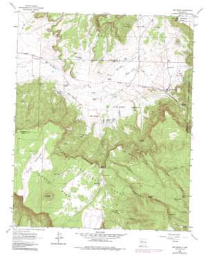
San Mateo Topo Map New Mexico
To zoom in, hover over the map of San Mateo
USGS Topo Quad 35107c6 - 1:24,000 scale
| Topo Map Name: | San Mateo |
| USGS Topo Quad ID: | 35107c6 |
| Print Size: | ca. 21 1/4" wide x 27" high |
| Southeast Coordinates: | 35.25° N latitude / 107.625° W longitude |
| Map Center Coordinates: | 35.3125° N latitude / 107.6875° W longitude |
| U.S. State: | NM |
| Filename: | o35107c6.jpg |
| Download Map JPG Image: | San Mateo topo map 1:24,000 scale |
| Map Type: | Topographic |
| Topo Series: | 7.5´ |
| Map Scale: | 1:24,000 |
| Source of Map Images: | United States Geological Survey (USGS) |
| Alternate Map Versions: |
San Mateo NM 1963, updated 1965 Download PDF Buy paper map San Mateo NM 1963, updated 1975 Download PDF Buy paper map San Mateo NM 1963, updated 1981 Download PDF Buy paper map San Mateo NM 1963, updated 1986 Download PDF Buy paper map San Mateo NM 1995, updated 1997 Download PDF Buy paper map San Mateo NM 2011 Download PDF Buy paper map San Mateo NM 2013 Download PDF Buy paper map |
| FStopo: | US Forest Service topo San Mateo is available: Download FStopo PDF Download FStopo TIF |
1:24,000 Topo Quads surrounding San Mateo
> Back to 35107a1 at 1:100,000 scale
> Back to 35106a1 at 1:250,000 scale
> Back to U.S. Topo Maps home
San Mateo topo map: Gazetteer
San Mateo: Areas
Bajios Largo elevation 2501m 8205′Bajios Redondos elevation 2445m 8021′
San Mateo: Dams
San Mateo Lake Dam elevation 2286m 7500′San Mateo: Mines
Johnny M Mine elevation 2199m 7214′June Mine elevation 2173m 7129′
Palo Verde Group elevation 2185m 7168′
San Mateo Mine elevation 2173m 7129′
Uranium Deposit elevation 2248m 7375′
Uranium Prospects elevation 2146m 7040′
WX Lobo Pit elevation 2699m 8854′
San Mateo: Populated Places
San Mateo elevation 2229m 7312′San Mateo: Post Offices
San Mateo Post Office elevation 2229m 7312′San Mateo: Reservoirs
Buck Tank elevation 2160m 7086′Bull Pasture Tank elevation 2158m 7080′
Campbell Tank elevation 2132m 6994′
Duck Tank elevation 2189m 7181′
El Rito Tank elevation 2473m 8113′
La Mosca Tank elevation 2658m 8720′
Lee Stock Tank elevation 2173m 7129′
Mimes Tank elevation 2481m 8139′
Mormon Tank elevation 2192m 7191′
Mule Tank elevation 2501m 8205′
Rock Tank elevation 2842m 9324′
San Mateo Reservoir elevation 2286m 7500′
San Mateo Tank elevation 2199m 7214′
Youngs Tank elevation 2151m 7057′
San Mateo: Springs
Bridge Spring elevation 2147m 7043′Buckhorn Spring elevation 2642m 8667′
Cienaga Spring elevation 2884m 9461′
El Rito Spring elevation 2442m 8011′
La Mosca Spring elevation 2351m 7713′
Lower Lillies Spring elevation 2789m 9150′
Rock Spring elevation 2782m 9127′
Upper Lillies Spring elevation 2792m 9160′
San Mateo: Summits
Cerro Colorado elevation 2612m 8569′Jesus Mesa elevation 2391m 7844′
La Jara Mesa elevation 2612m 8569′
San Mateo: Valleys
Dry Canyon elevation 2175m 7135′El Rito Canyon elevation 2165m 7103′
La Mosca Canyon elevation 2156m 7073′
Marquez Canyon elevation 2161m 7089′
Rafael Canyon elevation 2149m 7050′
Salazar Canyon elevation 2319m 7608′
San Mateo Canyon elevation 2168m 7112′
San Mateo digital topo map on disk
Buy this San Mateo topo map showing relief, roads, GPS coordinates and other geographical features, as a high-resolution digital map file on DVD:


