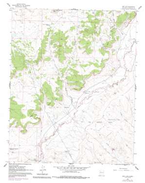
San Luis Topo Map New Mexico
To zoom in, hover over the map of San Luis
USGS Topo Quad 35107f1 - 1:24,000 scale
| Topo Map Name: | San Luis |
| USGS Topo Quad ID: | 35107f1 |
| Print Size: | ca. 21 1/4" wide x 27" high |
| Southeast Coordinates: | 35.625° N latitude / 107° W longitude |
| Map Center Coordinates: | 35.6875° N latitude / 107.0625° W longitude |
| U.S. State: | NM |
| Filename: | o35107f1.jpg |
| Download Map JPG Image: | San Luis topo map 1:24,000 scale |
| Map Type: | Topographic |
| Topo Series: | 7.5´ |
| Map Scale: | 1:24,000 |
| Source of Map Images: | United States Geological Survey (USGS) |
| Alternate Map Versions: |
San Luis NM 1961, updated 1964 Download PDF Buy paper map San Luis NM 1961, updated 1978 Download PDF Buy paper map San Luis NM 1961, updated 1989 Download PDF Buy paper map San Luis NM 2010 Download PDF Buy paper map San Luis NM 2013 Download PDF Buy paper map San Luis NM 2017 Download PDF Buy paper map |
1:24,000 Topo Quads surrounding San Luis
> Back to 35107e1 at 1:100,000 scale
> Back to 35106a1 at 1:250,000 scale
> Back to U.S. Topo Maps home
San Luis topo map: Gazetteer
San Luis: Dams
Rio Puerco Detention Dam Number 65 elevation 1879m 6164′San Luis: Mines
Arroyo Mines elevation 1959m 6427′San Luis: Populated Places
Cabezon elevation 1864m 6115′San Luis elevation 1903m 6243′
San Luis: Post Offices
Cabezon Post Office (historical) elevation 1864m 6115′San Luis: Reservoirs
Alamito Tank Number Sixteen elevation 1895m 6217′Baño Tank elevation 1998m 6555′
Cabezon Tank Number 6 elevation 1851m 6072′
Cerro Colorado Tank elevation 1990m 6528′
Divide Tank elevation 1913m 6276′
Pipeline Tank elevation 1899m 6230′
San Luis: Streams
Arroyo Balcon elevation 1874m 6148′Arroyo Chavez elevation 1857m 6092′
Arroyo Cuevitas elevation 1905m 6250′
Arroyo de los Cerros Colorados elevation 1906m 6253′
San Luis: Summits
Angostura Hill elevation 1994m 6541′Bosque Grande Mesa elevation 1988m 6522′
Cerro Colorado elevation 2127m 6978′
Mesa San Luis elevation 1996m 6548′
San Luis: Valleys
Rincon de los Viejos elevation 1924m 6312′Rincon Leandro elevation 1948m 6391′
San Luis: Wells
Cabezon Well elevation 1853m 6079′San Luis digital topo map on disk
Buy this San Luis topo map showing relief, roads, GPS coordinates and other geographical features, as a high-resolution digital map file on DVD:


