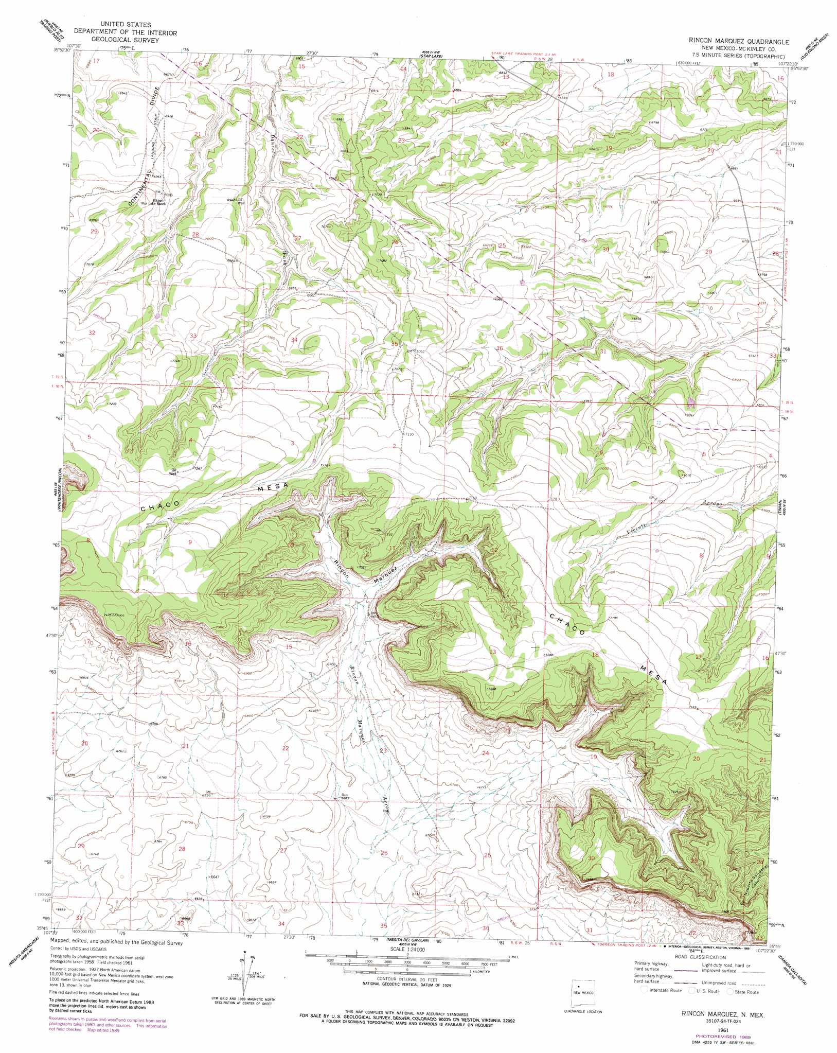
Rincon Marquez Topo Map New Mexico
To zoom in, hover over the map of Rincon Marquez
USGS Topo Quad 35107g4 - 1:24,000 scale
| Topo Map Name: | Rincon Marquez |
| USGS Topo Quad ID: | 35107g4 |
| Print Size: | ca. 21 1/4" wide x 27" high |
| Southeast Coordinates: | 35.75° N latitude / 107.375° W longitude |
| Map Center Coordinates: | 35.8125° N latitude / 107.4375° W longitude |
| U.S. State: | NM |
| Filename: | o35107g4.jpg |
| Download Map JPG Image: | Rincon Marquez topo map 1:24,000 scale |
| Map Type: | Topographic |
| Topo Series: | 7.5´ |
| Map Scale: | 1:24,000 |
| Source of Map Images: | United States Geological Survey (USGS) |
| Alternate Map Versions: |
Rincon Marquez NM 1961, updated 1964 Download PDF Buy paper map Rincon Marquez NM 1961, updated 1989 Download PDF Buy paper map Rincon Marquez NM 2010 Download PDF Buy paper map Rincon Marquez NM 2013 Download PDF Buy paper map Rincon Marquez NM 2017 Download PDF Buy paper map |
1:24,000 Topo Quads surrounding Rincon Marquez
Fire Rock Well |
Lybrook Se |
Mule Dam |
Deer Mesa |
Taylor Ranch |
Pueblo Pintado |
Pueblo Alto Trading Post |
Star Lake |
Ojo Encino Mesa |
Johnson Trading Post |
Whitehorse |
Whitehorse Rincon |
Rincon Marquez |
Tinian |
Wolf Stand |
Hospah |
Mesita Americana |
Mesita Del Gavilan |
Canada Calladita |
Arroyo Empedrado |
Piedra De La Aguila |
El Dado |
Mesa Cortada |
Cerro Parido |
Guadalupe |
> Back to 35107e1 at 1:100,000 scale
> Back to 35106a1 at 1:250,000 scale
> Back to U.S. Topo Maps home
Rincon Marquez topo map: Gazetteer
Rincon Marquez: Summits
Chaco Mesa elevation 2276m 7467′Rincon Marquez: Valleys
Rincon Marquez elevation 2116m 6942′Rincon Marquez: Wells
15R-314 Water Well elevation 2043m 6702′Pinto Water Well elevation 2153m 7063′
Rincon Marquez digital topo map on disk
Buy this Rincon Marquez topo map showing relief, roads, GPS coordinates and other geographical features, as a high-resolution digital map file on DVD: