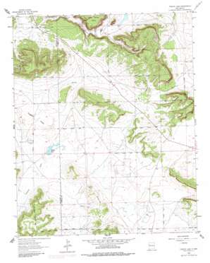
Togeye Lake Topo Map New Mexico
To zoom in, hover over the map of Togeye Lake
USGS Topo Quad 35108a4 - 1:24,000 scale
| Topo Map Name: | Togeye Lake |
| USGS Topo Quad ID: | 35108a4 |
| Print Size: | ca. 21 1/4" wide x 27" high |
| Southeast Coordinates: | 35° N latitude / 108.375° W longitude |
| Map Center Coordinates: | 35.0625° N latitude / 108.4375° W longitude |
| U.S. State: | NM |
| Filename: | o35108a4.jpg |
| Download Map JPG Image: | Togeye Lake topo map 1:24,000 scale |
| Map Type: | Topographic |
| Topo Series: | 7.5´ |
| Map Scale: | 1:24,000 |
| Source of Map Images: | United States Geological Survey (USGS) |
| Alternate Map Versions: |
Togeye Lake NM 1963, updated 1965 Download PDF Buy paper map Togeye Lake NM 1963, updated 1979 Download PDF Buy paper map Togeye Lake NM 1963, updated 1982 Download PDF Buy paper map Togeye Lake NM 2010 Download PDF Buy paper map Togeye Lake NM 2013 Download PDF Buy paper map Togeye Lake NM 2017 Download PDF Buy paper map |
| FStopo: | US Forest Service topo Togeye Lake is available: Download FStopo PDF Download FStopo TIF |
1:24,000 Topo Quads surrounding Togeye Lake
> Back to 35108a1 at 1:100,000 scale
> Back to 35108a1 at 1:250,000 scale
> Back to U.S. Topo Maps home
Togeye Lake topo map: Gazetteer
Togeye Lake: Cliffs
Los Gigantes elevation 2208m 7244′Togeye Lake: Flats
Togeye Flats elevation 2144m 7034′Togeye Lake: Lakes
Dog Lake elevation 2149m 7050′Togeye Lake elevation 2144m 7034′
Togeye Lake: Summits
Loma Medios elevation 2196m 7204′Togeye Lake: Valleys
Carrizozo Draw elevation 2161m 7089′Crockett Draw elevation 2144m 7034′
Loma del Medio Draw elevation 2145m 7037′
White Horse Draw elevation 2146m 7040′
Togeye Lake: Wells
BIA-MOO-87-21 Water Well elevation 2191m 7188′Togeye Lake digital topo map on disk
Buy this Togeye Lake topo map showing relief, roads, GPS coordinates and other geographical features, as a high-resolution digital map file on DVD:


