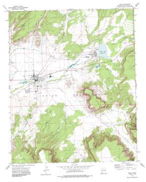
Zuni Topo Map New Mexico
To zoom in, hover over the map of Zuni
USGS Topo Quad 35108a7 - 1:24,000 scale
| Topo Map Name: | Zuni |
| USGS Topo Quad ID: | 35108a7 |
| Print Size: | ca. 21 1/4" wide x 27" high |
| Southeast Coordinates: | 35° N latitude / 108.75° W longitude |
| Map Center Coordinates: | 35.0625° N latitude / 108.8125° W longitude |
| U.S. State: | NM |
| Filename: | o35108a7.jpg |
| Download Map JPG Image: | Zuni topo map 1:24,000 scale |
| Map Type: | Topographic |
| Topo Series: | 7.5´ |
| Map Scale: | 1:24,000 |
| Source of Map Images: | United States Geological Survey (USGS) |
| Alternate Map Versions: |
Zuni NM 1972, updated 1976 Download PDF Buy paper map Zuni NM 1972, updated 1986 Download PDF Buy paper map Zuni NM 2010 Download PDF Buy paper map Zuni NM 2013 Download PDF Buy paper map |
1:24,000 Topo Quads surrounding Zuni
> Back to 35108a1 at 1:100,000 scale
> Back to 35108a1 at 1:250,000 scale
> Back to U.S. Topo Maps home
Zuni topo map: Gazetteer
Zuni: Airports
Black Rock Airport elevation 1965m 6446′Zuni: Canals
Zuni Canal elevation 1933m 6341′Zuni: Dams
Black Rock Dam elevation 1966m 6450′Eustace Dam elevation 1925m 6315′
Zuni: Parks
Pueblo of Zuni Historical Marker elevation 1917m 6289′Zuni: Populated Places
Black Rock elevation 1967m 6453′Zuni elevation 1917m 6289′
Zuni Pueblo elevation 1918m 6292′
Zuni: Post Offices
Black Rock Post Office (historical) elevation 1967m 6453′Zuni Post Office elevation 1917m 6289′
Zuni: Reservoirs
Black Rock Reservoir elevation 1960m 6430′Eustace Lake elevation 1926m 6318′
Zuni: Springs
Black Rock elevation 1978m 6489′Zuni: Streams
Oak Wash elevation 1917m 6289′Zuni: Summits
Dowa Yalanne elevation 2196m 7204′Zuni: Valleys
Galestina Canyon elevation 1923m 6309′Mullen Canyon elevation 1962m 6437′
Peach Orchard Draw elevation 1924m 6312′
Prairie Dog Draw elevation 1934m 6345′
Stinking Water Draw elevation 1932m 6338′
Trapped Rock Draw elevation 1918m 6292′
Zuni digital topo map on disk
Buy this Zuni topo map showing relief, roads, GPS coordinates and other geographical features, as a high-resolution digital map file on DVD:


