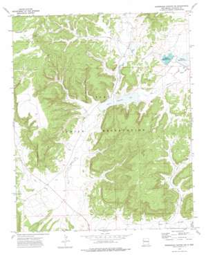
Horsehead Canyon Nw Topo Map New Mexico
To zoom in, hover over the map of Horsehead Canyon Nw
USGS Topo Quad 35108b6 - 1:24,000 scale
| Topo Map Name: | Horsehead Canyon Nw |
| USGS Topo Quad ID: | 35108b6 |
| Print Size: | ca. 21 1/4" wide x 27" high |
| Southeast Coordinates: | 35.125° N latitude / 108.625° W longitude |
| Map Center Coordinates: | 35.1875° N latitude / 108.6875° W longitude |
| U.S. State: | NM |
| Filename: | o35108b6.jpg |
| Download Map JPG Image: | Horsehead Canyon Nw topo map 1:24,000 scale |
| Map Type: | Topographic |
| Topo Series: | 7.5´ |
| Map Scale: | 1:24,000 |
| Source of Map Images: | United States Geological Survey (USGS) |
| Alternate Map Versions: |
Horsehead Canyon NW NM 1972, updated 1976 Download PDF Buy paper map Horsehead Canyon NW NM 2010 Download PDF Buy paper map Horsehead Canyon NW NM 2013 Download PDF Buy paper map Horsehead Canyon NW NM 2017 Download PDF Buy paper map |
1:24,000 Topo Quads surrounding Horsehead Canyon Nw
> Back to 35108a1 at 1:100,000 scale
> Back to 35108a1 at 1:250,000 scale
> Back to U.S. Topo Maps home
Horsehead Canyon Nw topo map: Gazetteer
Horsehead Canyon Nw: Reservoirs
Nutria Reservoir Number 2 elevation 2036m 6679′Nutria Reservoir Number 3 elevation 2049m 6722′
Nutria Reservoir Number 4 elevation 2048m 6719′
Horsehead Canyon Nw: Valleys
Burned Timber Canyon elevation 2051m 6729′Coal Mine Canyon elevation 2036m 6679′
Coal Mine Canyon elevation 2031m 6663′
Nutria Road Draw elevation 2028m 6653′
Y Unit Draw elevation 2011m 6597′
Horsehead Canyon Nw digital topo map on disk
Buy this Horsehead Canyon Nw topo map showing relief, roads, GPS coordinates and other geographical features, as a high-resolution digital map file on DVD:


