Jones Ranch School Topo Map New Mexico
To zoom in, hover over the map of Jones Ranch School
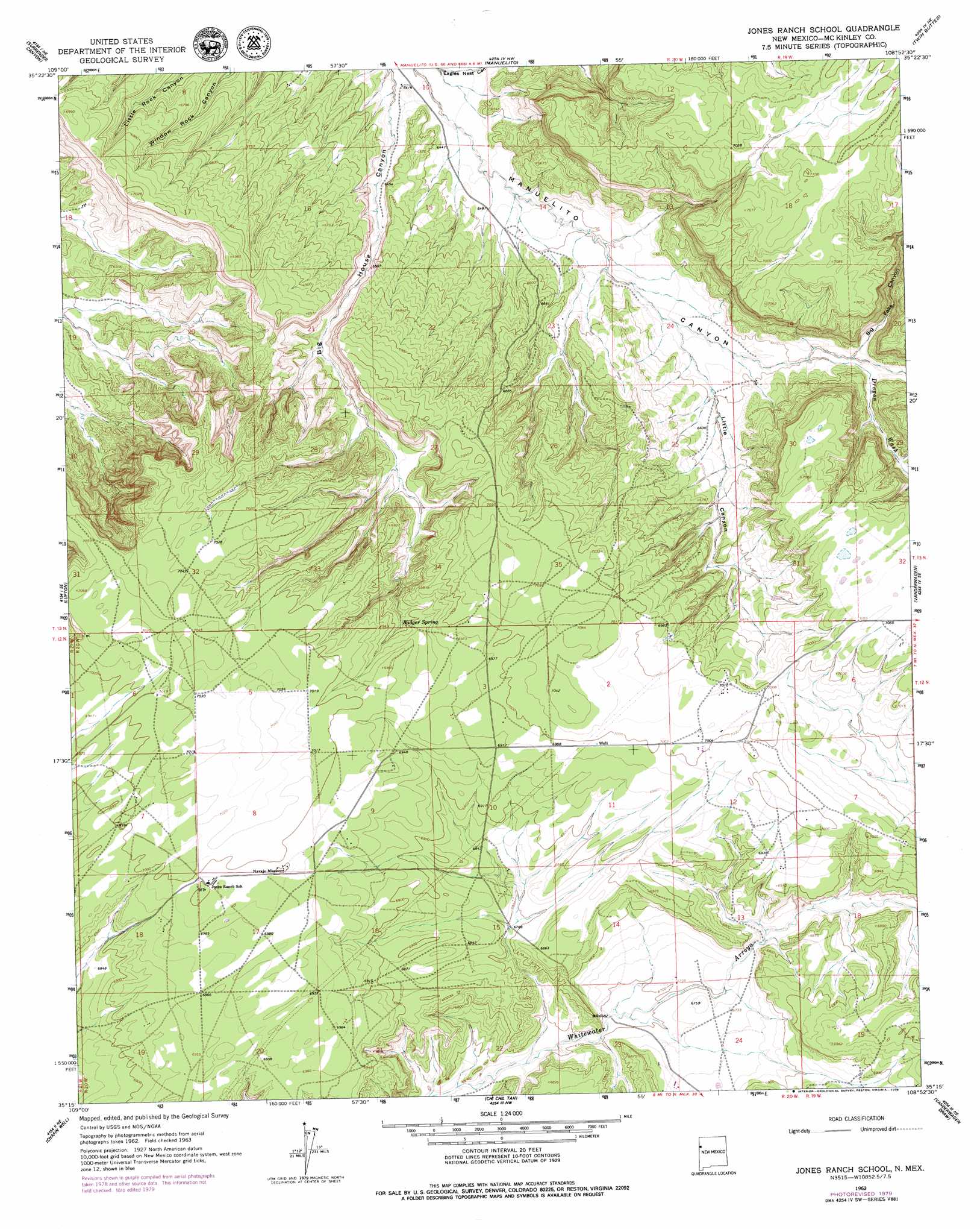
USGS Topo Quad 35108c8 - 1:24,000 scale
| Topo Map Name: | Jones Ranch School |
| USGS Topo Quad ID: | 35108c8 |
| Print Size: | ca. 21 1/4" wide x 27" high |
| Southeast Coordinates: | 35.25° N latitude / 108.875° W longitude |
| Map Center Coordinates: | 35.3125° N latitude / 108.9375° W longitude |
| U.S. State: | NM |
| Filename: | o35108c8.jpg |
| Download Map JPG Image: | Jones Ranch School topo map 1:24,000 scale |
| Map Type: | Topographic |
| Topo Series: | 7.5´ |
| Map Scale: | 1:24,000 |
| Source of Map Images: | United States Geological Survey (USGS) |
| Alternate Map Versions: |
Jones Ranch School NM 1963, updated 1967 Download PDF Buy paper map Jones Ranch School NM 2010 Download PDF Buy paper map Jones Ranch School NM 2013 Download PDF Buy paper map |
1:24,000 Topo Quads surrounding Jones Ranch School
Joe Woody Well |
Hunters Point |
Samson Lake |
Gallup West |
Gallup East |
Uranium Spring |
Surrender Canyon |
Manuelito |
Twin Buttes |
Bread Springs |
Houck |
Lupton |
Jones Ranch School |
Vander Wagen |
Pinehaven |
Tolapai Spring |
Chafin Well |
Chi Chil Tah |
Vanderwagen Draw |
Horsehead Canyon Nw |
Deep Lake |
High Lonesome Well |
Tekapo |
Zuni |
Horsehead Canyon |
> Back to 35108a1 at 1:100,000 scale
> Back to 35108a1 at 1:250,000 scale
> Back to U.S. Topo Maps home
Jones Ranch School topo map: Gazetteer
Jones Ranch School: Springs
Badger Spring elevation 2094m 6870′Jones Ranch School: Streams
Dragon Wash elevation 2024m 6640′Jones Ranch School: Valleys
Big Falls Canyon elevation 2014m 6607′Little Canyon elevation 2006m 6581′
Jones Ranch School digital topo map on disk
Buy this Jones Ranch School topo map showing relief, roads, GPS coordinates and other geographical features, as a high-resolution digital map file on DVD: