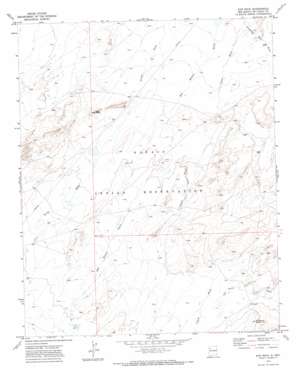
Ear Rock Topo Map New Mexico
To zoom in, hover over the map of Ear Rock
USGS Topo Quad 35108h5 - 1:24,000 scale
| Topo Map Name: | Ear Rock |
| USGS Topo Quad ID: | 35108h5 |
| Print Size: | ca. 21 1/4" wide x 27" high |
| Southeast Coordinates: | 35.875° N latitude / 108.5° W longitude |
| Map Center Coordinates: | 35.9375° N latitude / 108.5625° W longitude |
| U.S. State: | NM |
| Filename: | o35108h5.jpg |
| Download Map JPG Image: | Ear Rock topo map 1:24,000 scale |
| Map Type: | Topographic |
| Topo Series: | 7.5´ |
| Map Scale: | 1:24,000 |
| Source of Map Images: | United States Geological Survey (USGS) |
| Alternate Map Versions: |
Ear Rock NM 1970, updated 1973 Download PDF Buy paper map Ear Rock NM 2010 Download PDF Buy paper map Ear Rock NM 2013 Download PDF Buy paper map Ear Rock NM 2017 Download PDF Buy paper map |
1:24,000 Topo Quads surrounding Ear Rock
> Back to 35108e1 at 1:100,000 scale
> Back to 35108a1 at 1:250,000 scale
> Back to U.S. Topo Maps home
Ear Rock topo map: Gazetteer
Ear Rock: Pillars
Ear Rock elevation 1789m 5869′Ear Rock: Springs
Big Thumb Spring elevation 1825m 5987′Ear Rock: Streams
Red Willow Wash elevation 1742m 5715′Soft Water Wash elevation 1790m 5872′
Standing Rock Wash elevation 1744m 5721′
Ear Rock: Wells
14M-16 Water Well elevation 1755m 5757′14M-26 Water Well elevation 1795m 5889′
14T-534 Water Well elevation 1799m 5902′
14T-536 Water Well elevation 1780m 5839′
Ear Rock digital topo map on disk
Buy this Ear Rock topo map showing relief, roads, GPS coordinates and other geographical features, as a high-resolution digital map file on DVD:


