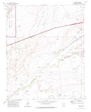
Pinta Topo Map Arizona
To zoom in, hover over the map of Pinta
USGS Topo Quad 35109a6 - 1:24,000 scale
| Topo Map Name: | Pinta |
| USGS Topo Quad ID: | 35109a6 |
| Print Size: | ca. 21 1/4" wide x 27" high |
| Southeast Coordinates: | 35° N latitude / 109.625° W longitude |
| Map Center Coordinates: | 35.0625° N latitude / 109.6875° W longitude |
| U.S. State: | AZ |
| Filename: | o35109a6.jpg |
| Download Map JPG Image: | Pinta topo map 1:24,000 scale |
| Map Type: | Topographic |
| Topo Series: | 7.5´ |
| Map Scale: | 1:24,000 |
| Source of Map Images: | United States Geological Survey (USGS) |
| Alternate Map Versions: |
Pinta AZ 1972, updated 1975 Download PDF Buy paper map Pinta AZ 2011 Download PDF Buy paper map Pinta AZ 2014 Download PDF Buy paper map |
1:24,000 Topo Quads surrounding Pinta
> Back to 35109a1 at 1:100,000 scale
> Back to 35108a1 at 1:250,000 scale
> Back to U.S. Topo Maps home
Pinta topo map: Gazetteer
Pinta: Bridges
Dead River Bridge elevation 1686m 5531′Pinta: Crossings
Pinta Road Interchange elevation 1701m 5580′Pinta: Populated Places
Pinta elevation 1678m 5505′Pinta: Reservoirs
Alley Way Tank elevation 1725m 5659′Big Draw Tank elevation 1715m 5626′
Last Chance Tank elevation 1671m 5482′
Rock Bottom Tank elevation 1719m 5639′
Saddle Horse Tank elevation 0m 0′
Shipping Pasture Tank elevation 0m 0′
Pinta: Valleys
Saddle Horse Draw elevation 0m 0′Pinta: Wells
Bar in Well elevation 1647m 5403′McCray Well elevation 1656m 5433′
Sweetwater Well elevation 1654m 5426′
Pinta digital topo map on disk
Buy this Pinta topo map showing relief, roads, GPS coordinates and other geographical features, as a high-resolution digital map file on DVD:


