Sanders Topo Map Arizona
To zoom in, hover over the map of Sanders
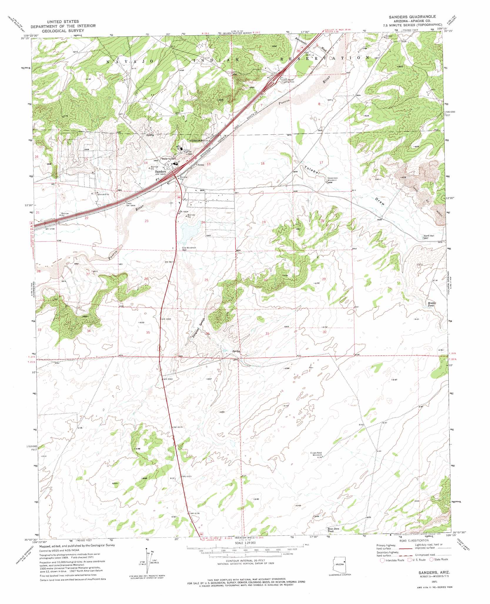
USGS Topo Quad 35109b3 - 1:24,000 scale
| Topo Map Name: | Sanders |
| USGS Topo Quad ID: | 35109b3 |
| Print Size: | ca. 21 1/4" wide x 27" high |
| Southeast Coordinates: | 35.125° N latitude / 109.25° W longitude |
| Map Center Coordinates: | 35.1875° N latitude / 109.3125° W longitude |
| U.S. State: | AZ |
| Filename: | o35109b3.jpg |
| Download Map JPG Image: | Sanders topo map 1:24,000 scale |
| Map Type: | Topographic |
| Topo Series: | 7.5´ |
| Map Scale: | 1:24,000 |
| Source of Map Images: | United States Geological Survey (USGS) |
| Alternate Map Versions: |
Sanders AZ 1971, updated 1975 Download PDF Buy paper map Sanders AZ 2011 Download PDF Buy paper map Sanders AZ 2014 Download PDF Buy paper map |
1:24,000 Topo Quads surrounding Sanders
Klagetoh South |
Wide Ruins |
Pine Springs |
Uranium Spring |
Surrender Canyon |
Dipping Water Well |
Wide Ruins Sw |
Burntwater Wash |
Houck |
Lupton |
Navajo North |
Chambers |
Sanders |
Tolapai Spring |
Chafin Well |
Navajo South |
Navajo Springs |
Beacon Well |
Deep Lake |
High Lonesome Well |
Ninemile Seep |
Hogan Well |
Fairchild Well |
Wild Cow Lake |
Barth Well |
> Back to 35109a1 at 1:100,000 scale
> Back to 35108a1 at 1:250,000 scale
> Back to U.S. Topo Maps home
Sanders topo map: Gazetteer
Sanders: Crossings
Cedar Point Interchange elevation 1805m 5921′Sanders Interchange elevation 1787m 5862′
Sanders: Populated Places
Chetco elevation 1788m 5866′Sanders elevation 0m 0′
Sanders: Post Offices
Sanders Post Office elevation 1784m 5853′Sanders: Reservoirs
Bens Dam Tank elevation 1896m 6220′Middle Tank elevation 1851m 6072′
Sanders: Springs
Emigrant Springs elevation 1805m 5921′Sanders: Valleys
Burntwater Wash elevation 1793m 5882′Tolapai Draw elevation 1779m 5836′
Sanders: Wells
North Well elevation 1817m 5961′One Windmill Well elevation 1773m 5816′
Sanders digital topo map on disk
Buy this Sanders topo map showing relief, roads, GPS coordinates and other geographical features, as a high-resolution digital map file on DVD: