Chambers Topo Map Arizona
To zoom in, hover over the map of Chambers
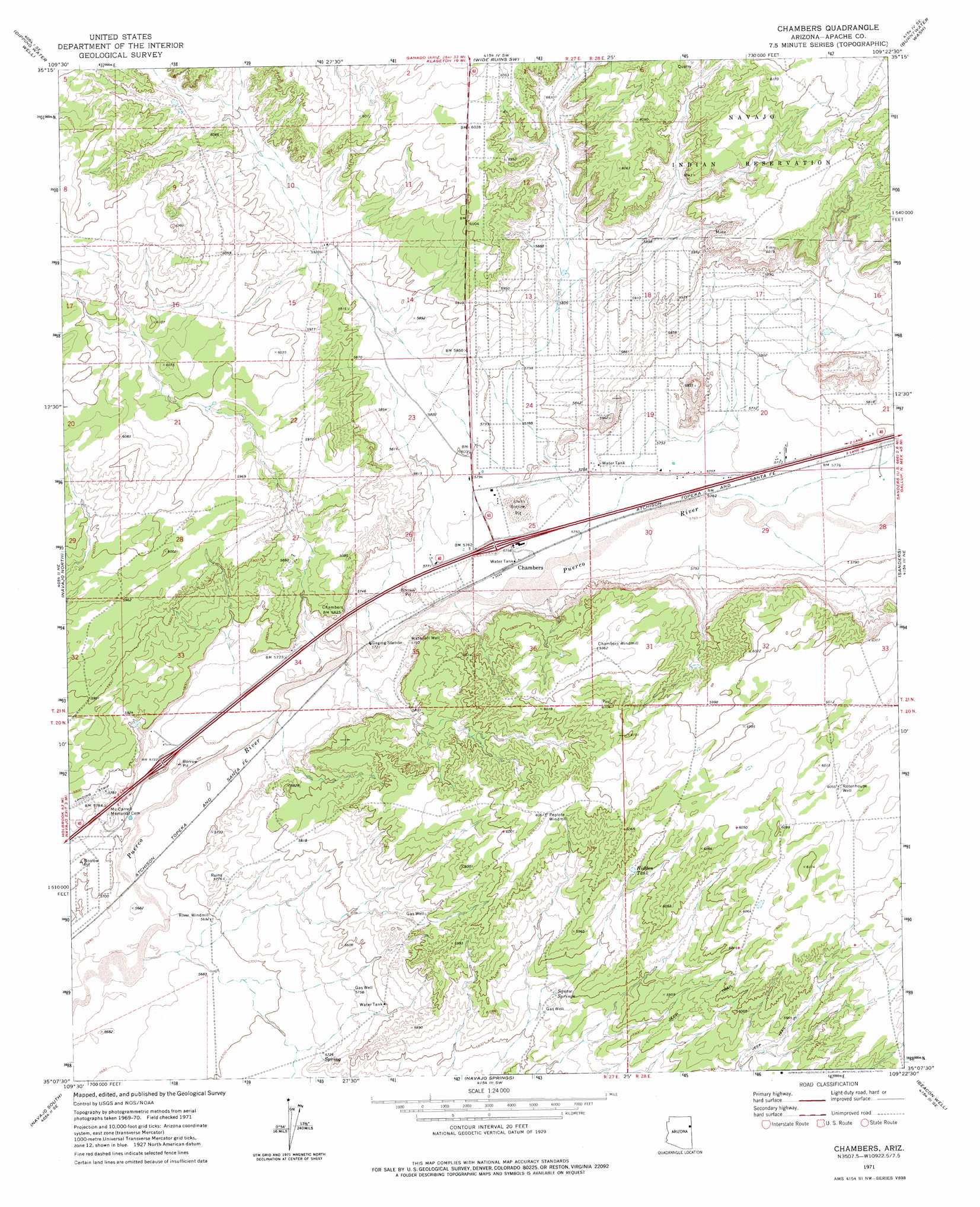
USGS Topo Quad 35109b4 - 1:24,000 scale
| Topo Map Name: | Chambers |
| USGS Topo Quad ID: | 35109b4 |
| Print Size: | ca. 21 1/4" wide x 27" high |
| Southeast Coordinates: | 35.125° N latitude / 109.375° W longitude |
| Map Center Coordinates: | 35.1875° N latitude / 109.4375° W longitude |
| U.S. State: | AZ |
| Filename: | o35109b4.jpg |
| Download Map JPG Image: | Chambers topo map 1:24,000 scale |
| Map Type: | Topographic |
| Topo Series: | 7.5´ |
| Map Scale: | 1:24,000 |
| Source of Map Images: | United States Geological Survey (USGS) |
| Alternate Map Versions: |
Chambers AZ 1971, updated 1975 Download PDF Buy paper map Chambers AZ 2011 Download PDF Buy paper map Chambers AZ 2014 Download PDF Buy paper map |
1:24,000 Topo Quads surrounding Chambers
Boggy Lake Well |
Klagetoh South |
Wide Ruins |
Pine Springs |
Uranium Spring |
Tanner Springs |
Dipping Water Well |
Wide Ruins Sw |
Burntwater Wash |
Houck |
North Mill Well |
Navajo North |
Chambers |
Sanders |
Tolapai Spring |
Pinta |
Navajo South |
Navajo Springs |
Beacon Well |
Deep Lake |
Sorrel Horse Mesa |
Ninemile Seep |
Hogan Well |
Fairchild Well |
Wild Cow Lake |
> Back to 35109a1 at 1:100,000 scale
> Back to 35108a1 at 1:250,000 scale
> Back to U.S. Topo Maps home
Chambers topo map: Gazetteer
Chambers: Crossings
Chambers Interchange elevation 1762m 5780′McCarroll Interchange elevation 1773m 5816′
Chambers: Populated Places
Chambers elevation 1754m 5754′Chambers: Reservoirs
Hidden Tank elevation 1822m 5977′Chambers: Springs
Squaw Springs elevation 1782m 5846′Chambers: Wells
Rotenhouse Well elevation 1843m 6046′Waterfall Well elevation 1755m 5757′
Chambers digital topo map on disk
Buy this Chambers topo map showing relief, roads, GPS coordinates and other geographical features, as a high-resolution digital map file on DVD: