Arrowhead Butte Topo Map Arizona
To zoom in, hover over the map of Arrowhead Butte
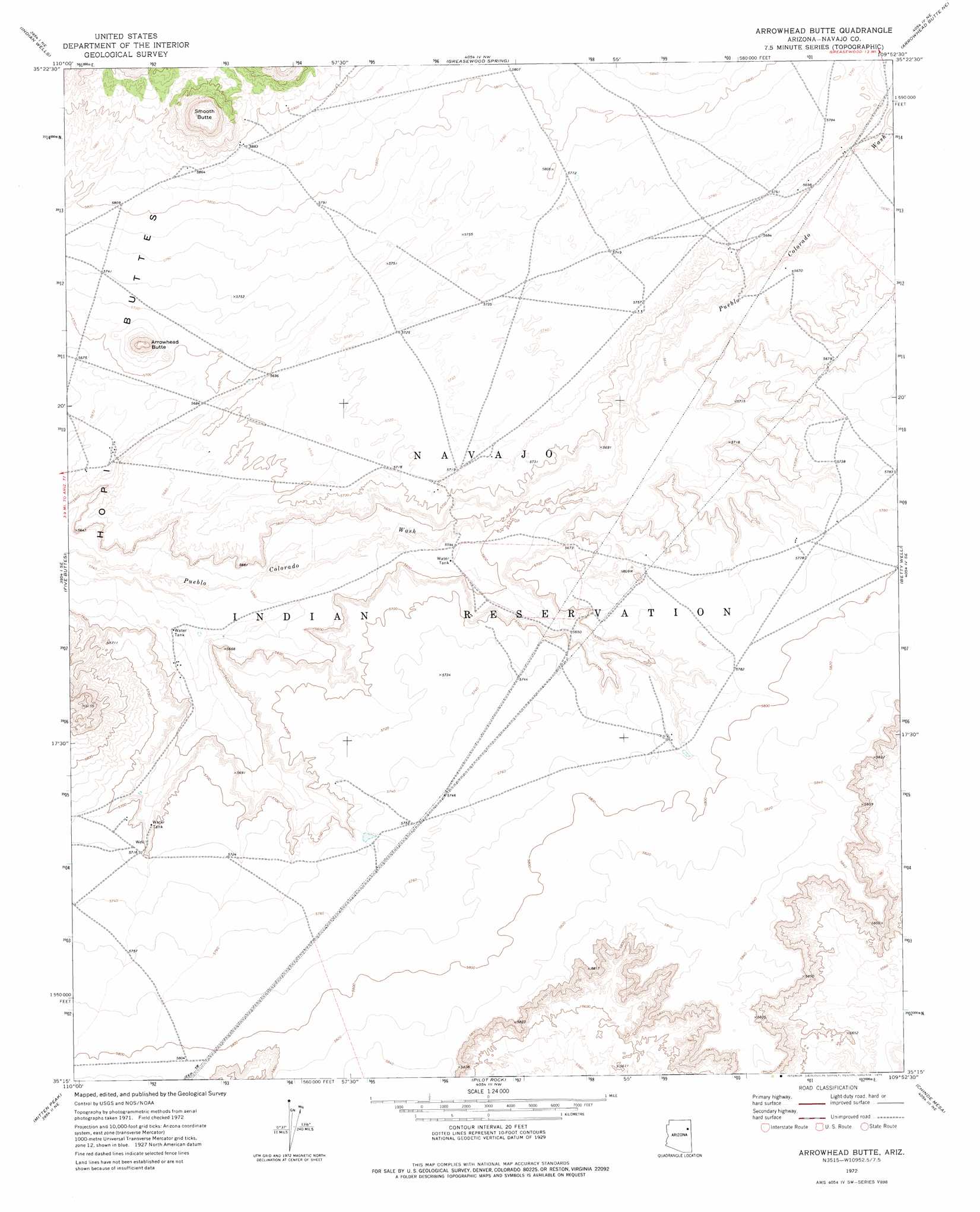
USGS Topo Quad 35109c8 - 1:24,000 scale
| Topo Map Name: | Arrowhead Butte |
| USGS Topo Quad ID: | 35109c8 |
| Print Size: | ca. 21 1/4" wide x 27" high |
| Southeast Coordinates: | 35.25° N latitude / 109.875° W longitude |
| Map Center Coordinates: | 35.3125° N latitude / 109.9375° W longitude |
| U.S. State: | AZ |
| Filename: | o35109c8.jpg |
| Download Map JPG Image: | Arrowhead Butte topo map 1:24,000 scale |
| Map Type: | Topographic |
| Topo Series: | 7.5´ |
| Map Scale: | 1:24,000 |
| Source of Map Images: | United States Geological Survey (USGS) |
| Alternate Map Versions: |
Arrowhead Butte AZ 1972, updated 1975 Download PDF Buy paper map Arrowhead Butte AZ 2011 Download PDF Buy paper map Arrowhead Butte AZ 2014 Download PDF Buy paper map |
1:24,000 Topo Quads surrounding Arrowhead Butte
First Flat Mesa |
White Cone |
Satan Butte |
Greasewood |
Sunrise Springs |
Na Ah Tee Canyon |
Indian Wells |
Greasewood Spring |
Arrowhead Butte Ne |
Boggy Lake Well |
Sunflower Butte |
Five Buttes |
Arrowhead Butte |
Betty Well |
Tanner Springs |
Turkey Track Butte |
Mitten Peak |
Pilot Rock |
Chinde Mesa |
North Mill Well |
Lee Mountain |
Hennessy Buttes |
Little Lithodendron Tank |
Kachina Point |
Pinta |
> Back to 35109a1 at 1:100,000 scale
> Back to 35108a1 at 1:250,000 scale
> Back to U.S. Topo Maps home
Arrowhead Butte topo map: Gazetteer
Arrowhead Butte: Summits
Arrowhead Butte elevation 1821m 5974′Smooth Butte elevation 1922m 6305′
Arrowhead Butte digital topo map on disk
Buy this Arrowhead Butte topo map showing relief, roads, GPS coordinates and other geographical features, as a high-resolution digital map file on DVD: