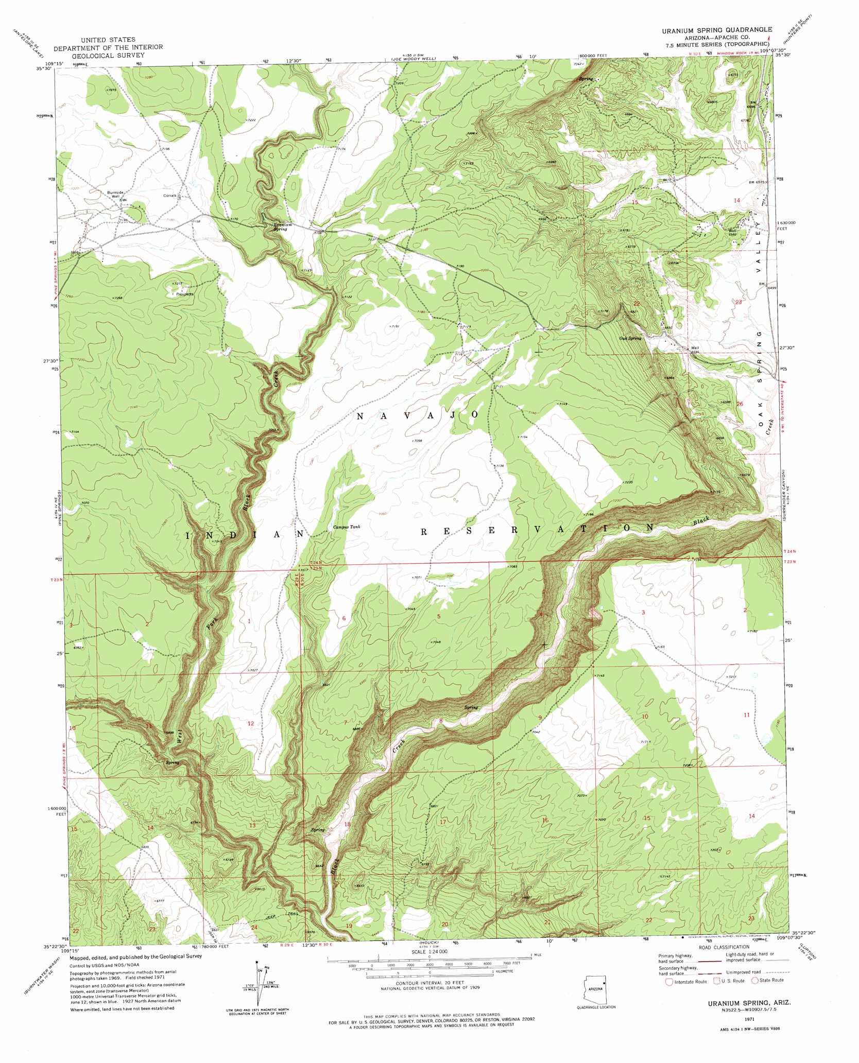
Uranium Spring Topo Map Arizona
To zoom in, hover over the map of Uranium Spring
USGS Topo Quad 35109d2 - 1:24,000 scale
| Topo Map Name: | Uranium Spring |
| USGS Topo Quad ID: | 35109d2 |
| Print Size: | ca. 21 1/4" wide x 27" high |
| Southeast Coordinates: | 35.375° N latitude / 109.125° W longitude |
| Map Center Coordinates: | 35.4375° N latitude / 109.1875° W longitude |
| U.S. State: | AZ |
| Filename: | o35109d2.jpg |
| Download Map JPG Image: | Uranium Spring topo map 1:24,000 scale |
| Map Type: | Topographic |
| Topo Series: | 7.5´ |
| Map Scale: | 1:24,000 |
| Source of Map Images: | United States Geological Survey (USGS) |
| Alternate Map Versions: |
Uranium Spring AZ 1971, updated 1975 Download PDF Buy paper map Uranium Spring AZ 2011 Download PDF Buy paper map Uranium Spring AZ 2014 Download PDF Buy paper map |
1:24,000 Topo Quads surrounding Uranium Spring
Kinlichee |
East Of Kinlichee |
West Of Window Rock |
Window Rock |
Tse Bonita School |
Tudecoz Spring |
Antelope Lake |
Joe Woody Well |
Hunters Point |
Samson Lake |
Wide Ruins |
Pine Springs |
Uranium Spring |
Surrender Canyon |
Manuelito |
Wide Ruins Sw |
Burntwater Wash |
Houck |
Lupton |
Jones Ranch School |
Chambers |
Sanders |
Tolapai Spring |
Chafin Well |
Chi Chil Tah |
> Back to 35109a1 at 1:100,000 scale
> Back to 35108a1 at 1:250,000 scale
> Back to U.S. Topo Maps home
Uranium Spring topo map: Gazetteer
Uranium Spring: Populated Places
Oak Springs elevation 1994m 6541′Uranium Spring: Reservoirs
Campus Tank elevation 2136m 7007′Uranium Spring: Springs
Oak Spring elevation 2045m 6709′Uranium Spring elevation 2148m 7047′
Uranium Spring: Streams
West Fork Black Creek elevation 1909m 6263′Uranium Spring: Valleys
Oak Spring Valley elevation 1960m 6430′Uranium Spring: Wells
Burnside Well elevation 2191m 7188′Uranium Spring digital topo map on disk
Buy this Uranium Spring topo map showing relief, roads, GPS coordinates and other geographical features, as a high-resolution digital map file on DVD: