Pine Springs Topo Map Arizona
To zoom in, hover over the map of Pine Springs
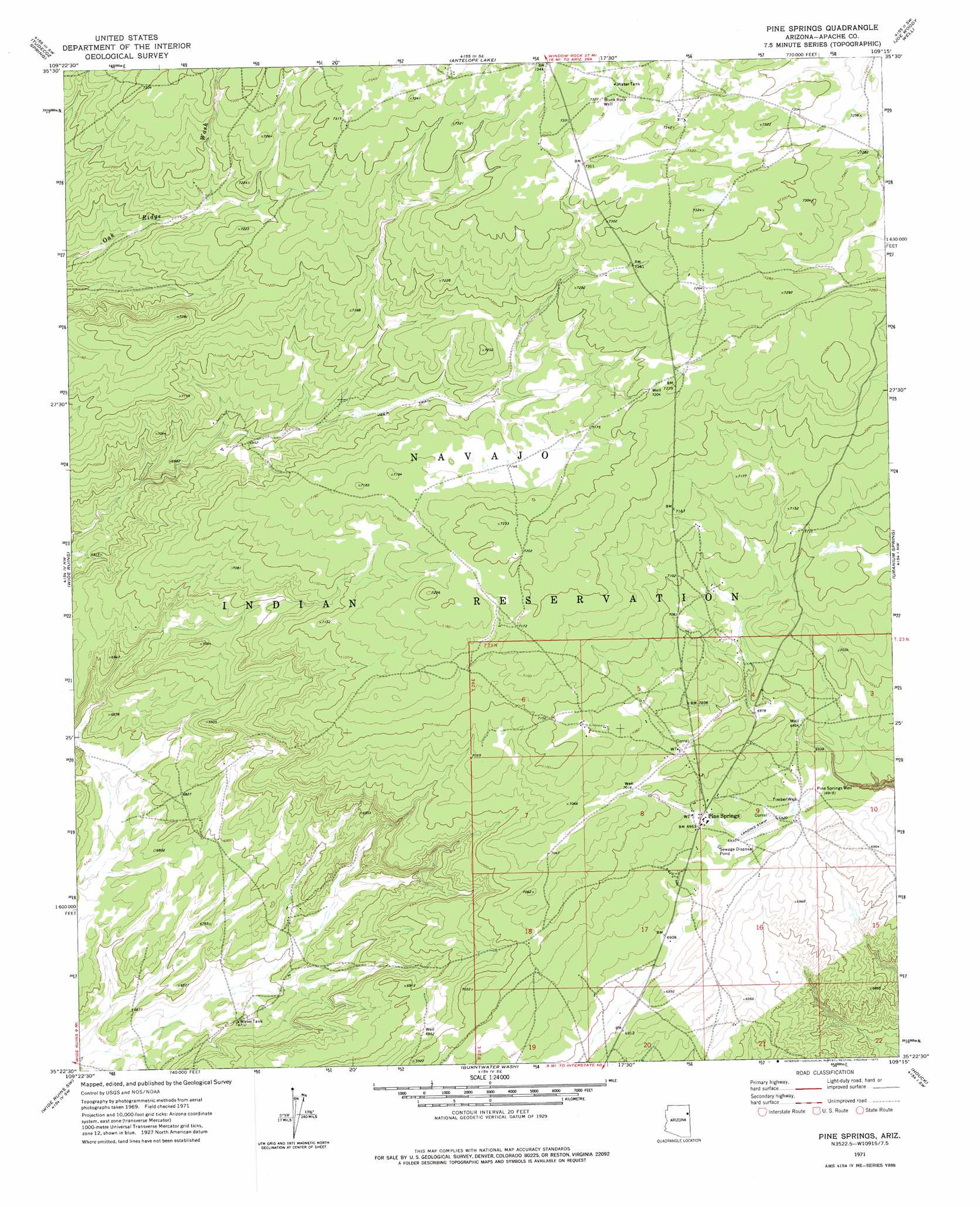
USGS Topo Quad 35109d3 - 1:24,000 scale
| Topo Map Name: | Pine Springs |
| USGS Topo Quad ID: | 35109d3 |
| Print Size: | ca. 21 1/4" wide x 27" high |
| Southeast Coordinates: | 35.375° N latitude / 109.25° W longitude |
| Map Center Coordinates: | 35.4375° N latitude / 109.3125° W longitude |
| U.S. State: | AZ |
| Filename: | o35109d3.jpg |
| Download Map JPG Image: | Pine Springs topo map 1:24,000 scale |
| Map Type: | Topographic |
| Topo Series: | 7.5´ |
| Map Scale: | 1:24,000 |
| Source of Map Images: | United States Geological Survey (USGS) |
| Alternate Map Versions: |
Pine Springs AZ 1971, updated 1975 Download PDF Buy paper map Pine Springs AZ 2011 Download PDF Buy paper map Pine Springs AZ 2014 Download PDF Buy paper map |
1:24,000 Topo Quads surrounding Pine Springs
Ganado |
Kinlichee |
East Of Kinlichee |
West Of Window Rock |
Window Rock |
Klagetoh North |
Tudecoz Spring |
Antelope Lake |
Joe Woody Well |
Hunters Point |
Klagetoh South |
Wide Ruins |
Pine Springs |
Uranium Spring |
Surrender Canyon |
Dipping Water Well |
Wide Ruins Sw |
Burntwater Wash |
Houck |
Lupton |
Navajo North |
Chambers |
Sanders |
Tolapai Spring |
Chafin Well |
> Back to 35109a1 at 1:100,000 scale
> Back to 35108a1 at 1:250,000 scale
> Back to U.S. Topo Maps home
Pine Springs topo map: Gazetteer
Pine Springs: Airports
Pine Springs Airport elevation 2114m 6935′Pine Springs: Populated Places
Pine Springs elevation 2124m 6968′Pine Springs: Wells
Black Rock Well elevation 2234m 7329′Pine Springs Well elevation 2110m 6922′
Timber Well elevation 2111m 6925′
Pine Springs digital topo map on disk
Buy this Pine Springs topo map showing relief, roads, GPS coordinates and other geographical features, as a high-resolution digital map file on DVD: