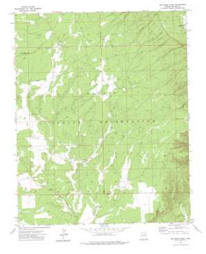
Joe Woody Well Topo Map Arizona
To zoom in, hover over the map of Joe Woody Well
USGS Topo Quad 35109e2 - 1:24,000 scale
| Topo Map Name: | Joe Woody Well |
| USGS Topo Quad ID: | 35109e2 |
| Print Size: | ca. 21 1/4" wide x 27" high |
| Southeast Coordinates: | 35.5° N latitude / 109.125° W longitude |
| Map Center Coordinates: | 35.5625° N latitude / 109.1875° W longitude |
| U.S. State: | AZ |
| Filename: | o35109e2.jpg |
| Download Map JPG Image: | Joe Woody Well topo map 1:24,000 scale |
| Map Type: | Topographic |
| Topo Series: | 7.5´ |
| Map Scale: | 1:24,000 |
| Source of Map Images: | United States Geological Survey (USGS) |
| Alternate Map Versions: |
Joe Woody Well AZ 1971, updated 1975 Download PDF Buy paper map Joe Woody Well AZ 2011 Download PDF Buy paper map Joe Woody Well AZ 2014 Download PDF Buy paper map |
1:24,000 Topo Quads surrounding Joe Woody Well
> Back to 35109e1 at 1:100,000 scale
> Back to 35108a1 at 1:250,000 scale
> Back to U.S. Topo Maps home
Joe Woody Well topo map: Gazetteer
Joe Woody Well: Lakes
Hidden Lake elevation 2317m 7601′Joe Woody Well: Wells
Joe Woody Well elevation 2311m 7582′Washington Well elevation 2231m 7319′
Joe Woody Well digital topo map on disk
Buy this Joe Woody Well topo map showing relief, roads, GPS coordinates and other geographical features, as a high-resolution digital map file on DVD:


