Kinlichee Topo Map Arizona
To zoom in, hover over the map of Kinlichee
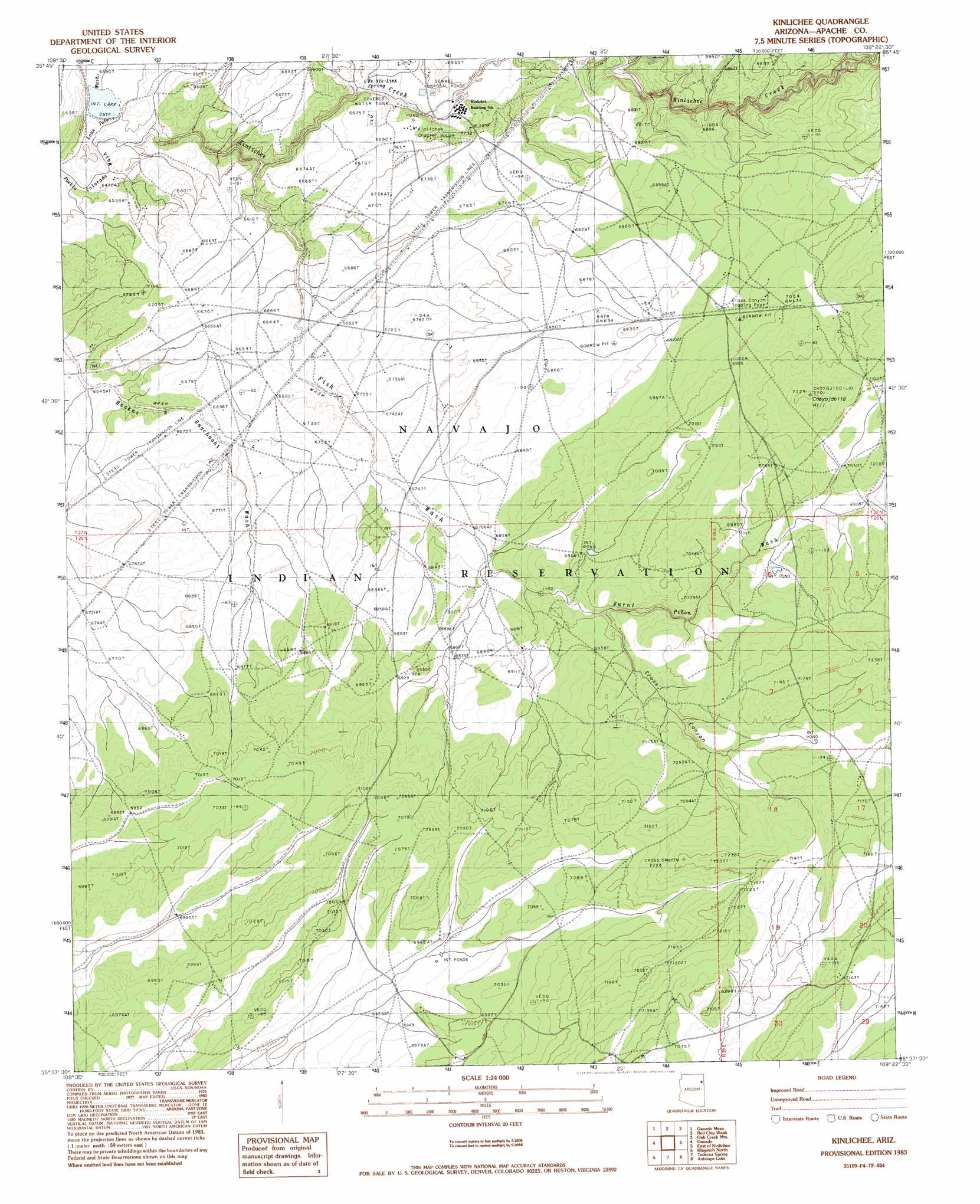
USGS Topo Quad 35109f4 - 1:24,000 scale
| Topo Map Name: | Kinlichee |
| USGS Topo Quad ID: | 35109f4 |
| Print Size: | ca. 21 1/4" wide x 27" high |
| Southeast Coordinates: | 35.625° N latitude / 109.375° W longitude |
| Map Center Coordinates: | 35.6875° N latitude / 109.4375° W longitude |
| U.S. State: | AZ |
| Filename: | o35109f4.jpg |
| Download Map JPG Image: | Kinlichee topo map 1:24,000 scale |
| Map Type: | Topographic |
| Topo Series: | 7.5´ |
| Map Scale: | 1:24,000 |
| Source of Map Images: | United States Geological Survey (USGS) |
| Alternate Map Versions: |
Zith-Tusayan Butte 3 NW AZ 1955, updated 1957 Download PDF Buy paper map Kinlichee AZ 1983, updated 1983 Download PDF Buy paper map Kinlichee AZ 2011 Download PDF Buy paper map Kinlichee AZ 2014 Download PDF Buy paper map |
1:24,000 Topo Quads surrounding Kinlichee
Tolani |
Beautiful Valley Well |
Nazlini |
White Rock Wash |
Sawmill |
Ganado Mesa Sw |
Ganado Mesa |
Red Clay Wash |
Oak Creek Mountain |
Piney Hill |
Cornfields |
Ganado |
Kinlichee |
East Of Kinlichee |
West Of Window Rock |
Sunrise Springs |
Klagetoh North |
Tudecoz Spring |
Antelope Lake |
Joe Woody Well |
Boggy Lake Well |
Klagetoh South |
Wide Ruins |
Pine Springs |
Uranium Spring |
> Back to 35109e1 at 1:100,000 scale
> Back to 35108a1 at 1:250,000 scale
> Back to U.S. Topo Maps home
Kinlichee topo map: Gazetteer
Kinlichee: Arroyos
Lone Tule Wash elevation 1970m 6463′Kinlichee: Parks
Cross Canyon Recreation Area elevation 2147m 7043′Kinlichee: Springs
Be-ite-Lini Spring elevation 2001m 6564′Kinlichee: Streams
Kinlichee Creek elevation 1970m 6463′Ruin Wash elevation 0m 0′
Kinlichee: Summits
Choyojdolid Hill elevation 2201m 7221′Kinlichee: Valleys
Burnt Piñon Wash elevation 2073m 6801′Cross Canyon elevation 2095m 6873′
Fish Wash elevation 1991m 6532′
Kinlichee digital topo map on disk
Buy this Kinlichee topo map showing relief, roads, GPS coordinates and other geographical features, as a high-resolution digital map file on DVD: