Fort Defiance Topo Map Arizona
To zoom in, hover over the map of Fort Defiance
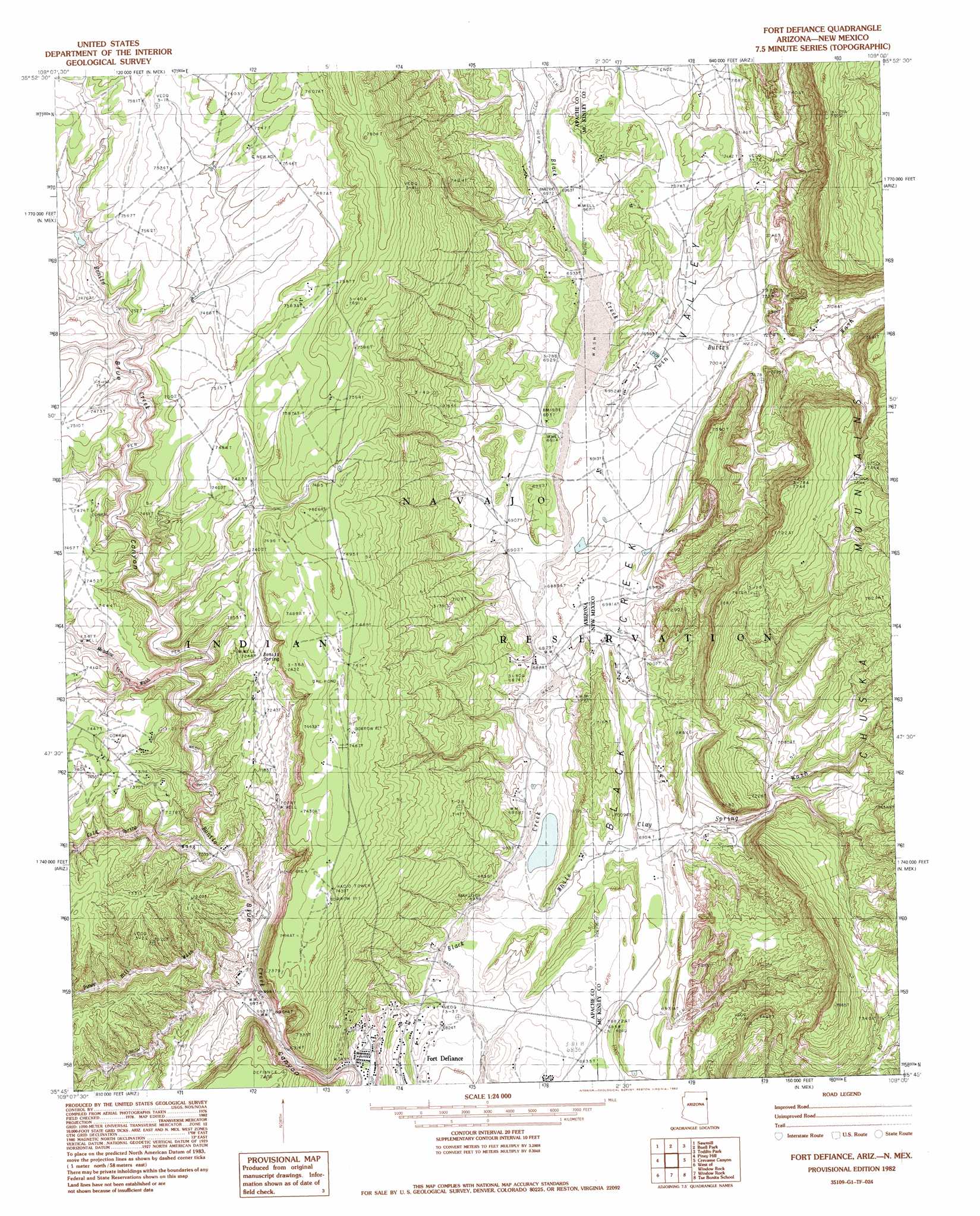
USGS Topo Quad 35109g1 - 1:24,000 scale
| Topo Map Name: | Fort Defiance |
| USGS Topo Quad ID: | 35109g1 |
| Print Size: | ca. 21 1/4" wide x 27" high |
| Southeast Coordinates: | 35.75° N latitude / 109° W longitude |
| Map Center Coordinates: | 35.8125° N latitude / 109.0625° W longitude |
| U.S. States: | AZ, NM |
| Filename: | o35109g1.jpg |
| Download Map JPG Image: | Fort Defiance topo map 1:24,000 scale |
| Map Type: | Topographic |
| Topo Series: | 7.5´ |
| Map Scale: | 1:24,000 |
| Source of Map Images: | United States Geological Survey (USGS) |
| Alternate Map Versions: |
Zith-Tusayan Butte 1 SE AZ 1955, updated 1958 Download PDF Buy paper map Fort Defiance AZ 1982, updated 1983 Download PDF Buy paper map Fort Defiance AZ 1982, updated 1983 Download PDF Buy paper map Fort Defiance AZ 2010 Download PDF Buy paper map Fort Defiance AZ 2011 Download PDF Buy paper map Fort Defiance AZ 2014 Download PDF Buy paper map |
1:24,000 Topo Quads surrounding Fort Defiance
Spider Rock |
White Clay |
Sonsela Buttes |
Crystal |
Washington Pass |
White Rock Wash |
Sawmill |
Buell Park |
Todilto Park |
Chuska Peak |
Oak Creek Mountain |
Piney Hill |
Fort Defiance |
Crevasse Canyon |
Tohatchi |
East Of Kinlichee |
West Of Window Rock |
Window Rock |
Tse Bonita School |
Twin Lakes |
Antelope Lake |
Joe Woody Well |
Hunters Point |
Samson Lake |
Gallup West |
> Back to 35109e1 at 1:100,000 scale
> Back to 35108a1 at 1:250,000 scale
> Back to U.S. Topo Maps home
Fort Defiance topo map: Gazetteer
Fort Defiance: Arroyos
Cold Water Wash elevation 2128m 6981′Sawmill Wash (historical) elevation 2261m 7417′
Fort Defiance: Springs
Bonito Spring elevation 2209m 7247′Fort Defiance: Streams
Black Creek elevation 2072m 6797′Buell Wash elevation 2125m 6971′
Cold Spring Wash elevation 2141m 7024′
Piney Hill Creek elevation 2115m 6938′
South Fork Bonito Creek elevation 2108m 6916′
Twin Buttes Wash elevation 2107m 6912′
White Clay Spring Wash elevation 2085m 6840′
White Clay Spring Wash elevation 2086m 6843′
Fort Defiance: Valleys
Black Creek Valley elevation 2073m 6801′Bonito Canyon elevation 2102m 6896′
Bonito Valley (historical) elevation 2097m 6879′
Piney Hill Wash elevation 2120m 6955′
Quartzite Canyon elevation 2133m 6998′
Fort Defiance digital topo map on disk
Buy this Fort Defiance topo map showing relief, roads, GPS coordinates and other geographical features, as a high-resolution digital map file on DVD: