Big Willow Spring Canyon Topo Map Arizona
To zoom in, hover over the map of Big Willow Spring Canyon
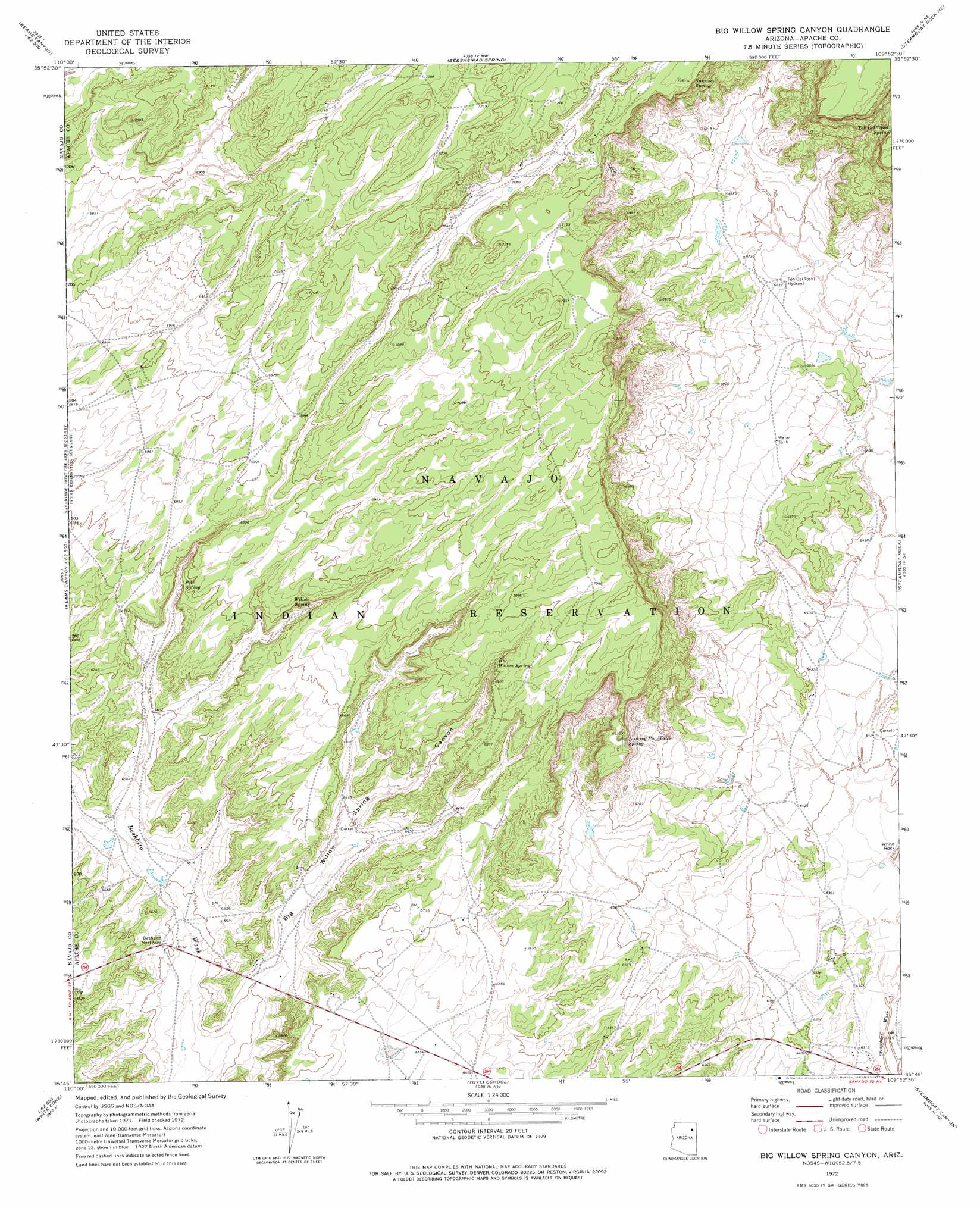
USGS Topo Quad 35109g8 - 1:24,000 scale
| Topo Map Name: | Big Willow Spring Canyon |
| USGS Topo Quad ID: | 35109g8 |
| Print Size: | ca. 21 1/4" wide x 27" high |
| Southeast Coordinates: | 35.75° N latitude / 109.875° W longitude |
| Map Center Coordinates: | 35.8125° N latitude / 109.9375° W longitude |
| U.S. State: | AZ |
| Filename: | o35109g8.jpg |
| Download Map JPG Image: | Big Willow Spring Canyon topo map 1:24,000 scale |
| Map Type: | Topographic |
| Topo Series: | 7.5´ |
| Map Scale: | 1:24,000 |
| Source of Map Images: | United States Geological Survey (USGS) |
| Alternate Map Versions: |
Big Willow Spring Canyon AZ 1972, updated 1977 Download PDF Buy paper map Big Willow Spring Canyon AZ 2011 Download PDF Buy paper map Big Willow Spring Canyon AZ 2014 Download PDF Buy paper map |
1:24,000 Topo Quads surrounding Big Willow Spring Canyon
Pinon |
Whippoorwill Spring |
Toadimdaaska Mesa |
Salina |
Toh De Niihe |
Echo Canyon |
Low Mountain |
Beeshsikad Spring |
Steamboat Rock Ne |
Tolani |
Keams Canyon |
Lamb Well |
Big Willow Spring Canyon |
Steamboat Rock |
Ganado Mesa Sw |
Jadito Spring |
Tsin Naan Tee |
Toyei School |
Steamboat Canyon |
Cornfields |
First Flat Mesa |
White Cone |
Satan Butte |
Greasewood |
Sunrise Springs |
> Back to 35109e1 at 1:100,000 scale
> Back to 35108a1 at 1:250,000 scale
> Back to U.S. Topo Maps home
Big Willow Spring Canyon topo map: Gazetteer
Big Willow Spring Canyon: Reservoirs
Toh Del Toshi Hydrant elevation 2032m 6666′Big Willow Spring Canyon: Springs
Big Willow Spring elevation 2097m 6879′Looking for Water Spring elevation 2084m 6837′
Pete Spring elevation 2049m 6722′
Sunrise Spring elevation 2192m 7191′
Toh Del Toshi Spring elevation 2186m 7171′
Willow Spring elevation 2071m 6794′
Big Willow Spring Canyon: Valleys
Big Willow Spring Canyon elevation 1974m 6476′Big Willow Spring Canyon digital topo map on disk
Buy this Big Willow Spring Canyon topo map showing relief, roads, GPS coordinates and other geographical features, as a high-resolution digital map file on DVD: