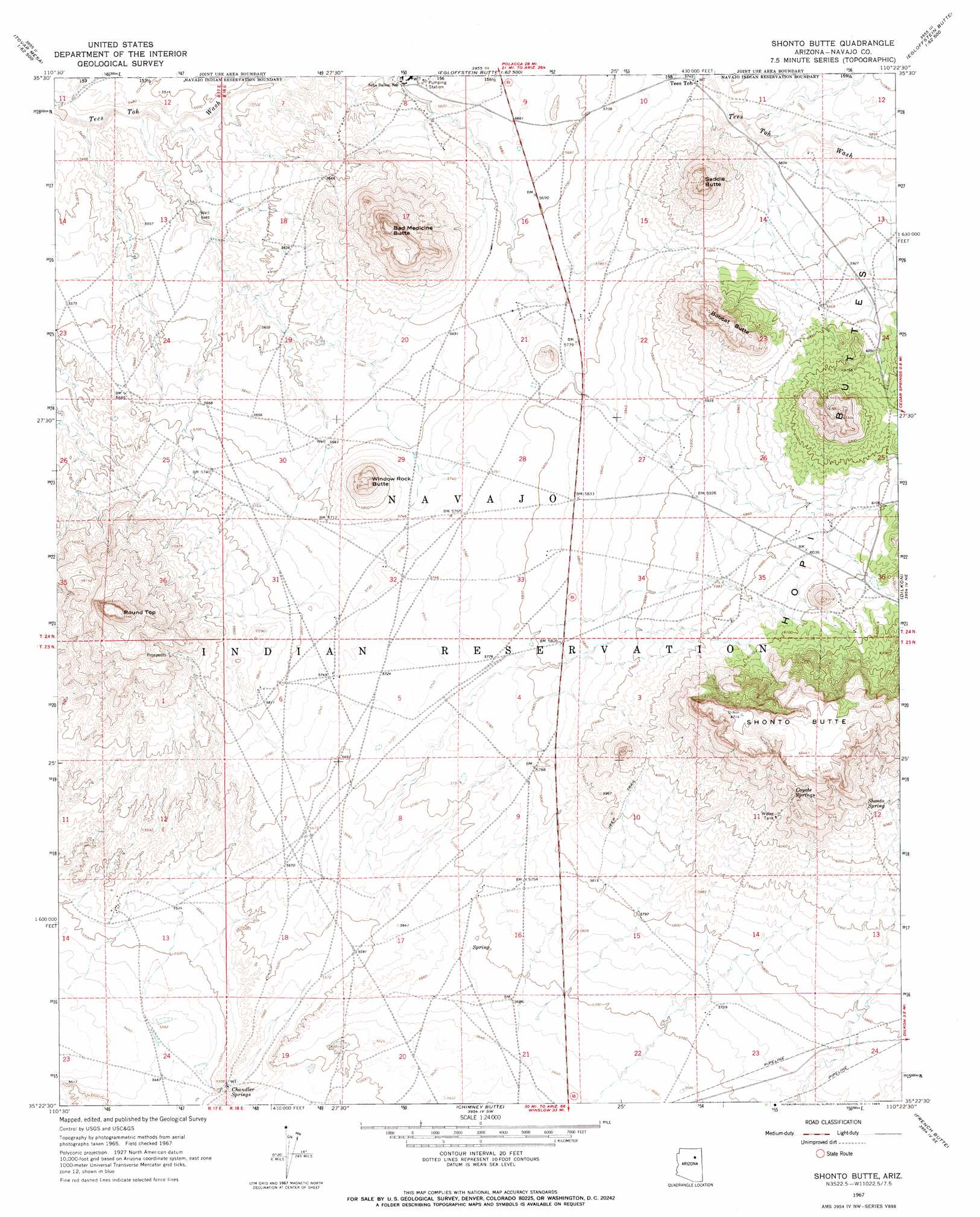
Shonto Butte Topo Map Arizona
To zoom in, hover over the map of Shonto Butte
USGS Topo Quad 35110d4 - 1:24,000 scale
| Topo Map Name: | Shonto Butte |
| USGS Topo Quad ID: | 35110d4 |
| Print Size: | ca. 21 1/4" wide x 27" high |
| Southeast Coordinates: | 35.375° N latitude / 110.375° W longitude |
| Map Center Coordinates: | 35.4375° N latitude / 110.4375° W longitude |
| U.S. State: | AZ |
| Filename: | o35110d4.jpg |
| Download Map JPG Image: | Shonto Butte topo map 1:24,000 scale |
| Map Type: | Topographic |
| Topo Series: | 7.5´ |
| Map Scale: | 1:24,000 |
| Source of Map Images: | United States Geological Survey (USGS) |
| Alternate Map Versions: |
Shonto Butte AZ 1967, updated 1969 Download PDF Buy paper map Shonto Butte AZ 2011 Download PDF Buy paper map Shonto Butte AZ 2014 Download PDF Buy paper map |
1:24,000 Topo Quads surrounding Shonto Butte
Burro Spring |
Giants Chair |
Snake Butte |
Star Mountain |
Jadito Spring |
Tovar Mesa West |
Tovar Mesa East |
Egloffstein Butte |
Hauke Mesa |
First Flat Mesa |
Montezumas Chair Nw |
Montezumas Chair |
Shonto Butte |
Dilkon |
Na Ah Tee Canyon |
Bird Springs Wash |
Elephant Butte |
Chimney Butte |
French Butte |
Sunflower Butte |
Winslow Nw |
Winslow Ne |
Standing Horse Mesa |
Rotten Bananas Butte |
Turkey Track Butte |
> Back to 35110a1 at 1:100,000 scale
> Back to 35110a1 at 1:250,000 scale
> Back to U.S. Topo Maps home
Shonto Butte topo map: Gazetteer
Shonto Butte: Arches
Window Rock elevation 1841m 6040′Shonto Butte: Populated Places
Seba Dalkai elevation 1709m 5606′Tees Toh elevation 1755m 5757′
Shonto Butte: Springs
Chandler Springs elevation 1685m 5528′Coyote Springs elevation 1907m 6256′
Shonto Spring elevation 0m 0′
Shonto Butte: Summits
Bad Medicine Butte elevation 1958m 6423′Bobcat Butte elevation 1957m 6420′
Round Top elevation 0m 0′
Saddle Butte elevation 0m 0′
Shonto Butte elevation 0m 0′
Twentieth Street School elevation 1880m 6167′
Shonto Butte digital topo map on disk
Buy this Shonto Butte topo map showing relief, roads, GPS coordinates and other geographical features, as a high-resolution digital map file on DVD: