Wepo Village Topo Map Arizona
To zoom in, hover over the map of Wepo Village
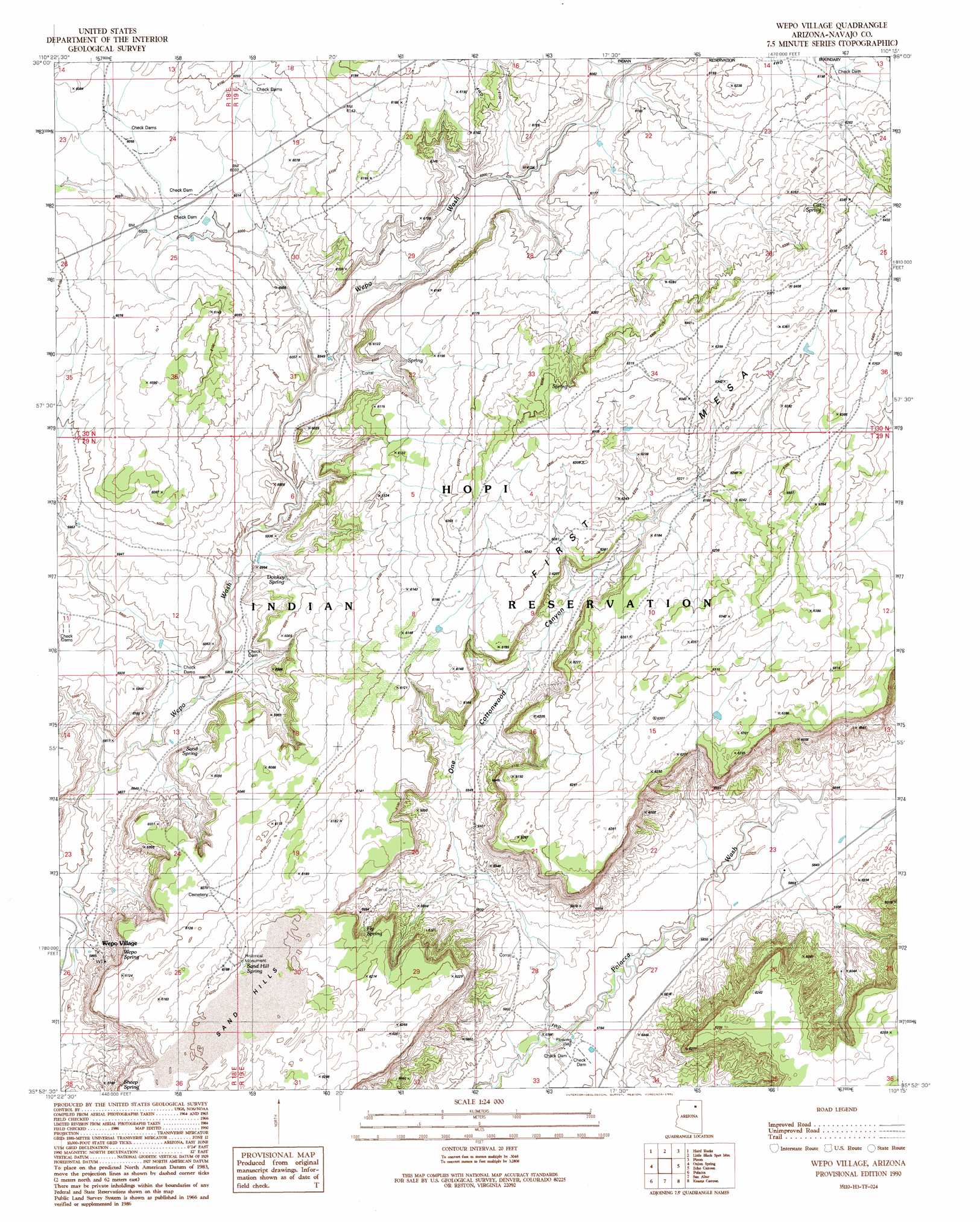
USGS Topo Quad 35110h3 - 1:24,000 scale
| Topo Map Name: | Wepo Village |
| USGS Topo Quad ID: | 35110h3 |
| Print Size: | ca. 21 1/4" wide x 27" high |
| Southeast Coordinates: | 35.875° N latitude / 110.25° W longitude |
| Map Center Coordinates: | 35.9375° N latitude / 110.3125° W longitude |
| U.S. State: | AZ |
| Filename: | o35110h3.jpg |
| Download Map JPG Image: | Wepo Village topo map 1:24,000 scale |
| Map Type: | Topographic |
| Topo Series: | 7.5´ |
| Map Scale: | 1:24,000 |
| Source of Map Images: | United States Geological Survey (USGS) |
| Alternate Map Versions: |
Wepo Village AZ 1990, updated 1991 Download PDF Buy paper map Wepo Village AZ 2011 Download PDF Buy paper map Wepo Village AZ 2014 Download PDF Buy paper map |
1:24,000 Topo Quads surrounding Wepo Village
Rocky Ridge Ne |
Big Mountain Dam |
Coat Spring |
Pinon Nw |
Burnt Corn Spring |
Rocky Ridge Se |
Hard Rocks |
Little Black Spot Mountain |
Pinon |
Whippoorwill Spring |
Oraibi |
Onion Spring |
Wepo Village |
Echo Canyon |
Low Mountain |
Shongopovi |
Polacca |
Sun Altar |
Keams Canyon |
Lamb Well |
Giants Chair |
Snake Butte |
Star Mountain |
Jadito Spring |
Tsin Naan Tee |
> Back to 35110e1 at 1:100,000 scale
> Back to 35110a1 at 1:250,000 scale
> Back to U.S. Topo Maps home
Wepo Village topo map: Gazetteer
Wepo Village: Populated Places
Wepo Village elevation 1763m 5784′Wepo Village: Springs
Cat Spring elevation 1931m 6335′Donkey Spring elevation 1820m 5971′
Fly Spring elevation 1840m 6036′
Sand Hill Spring elevation 1897m 6223′
Sand Spring elevation 0m 0′
Sheep Spring elevation 0m 0′
Wepo Spring elevation 1854m 6082′
Wepo Village: Summits
Sand Hills elevation 0m 0′Wepo Village: Valleys
One Cottonwood Canyon elevation 1778m 5833′Wepo Village digital topo map on disk
Buy this Wepo Village topo map showing relief, roads, GPS coordinates and other geographical features, as a high-resolution digital map file on DVD: