Anderson Canyon Topo Map Arizona
To zoom in, hover over the map of Anderson Canyon
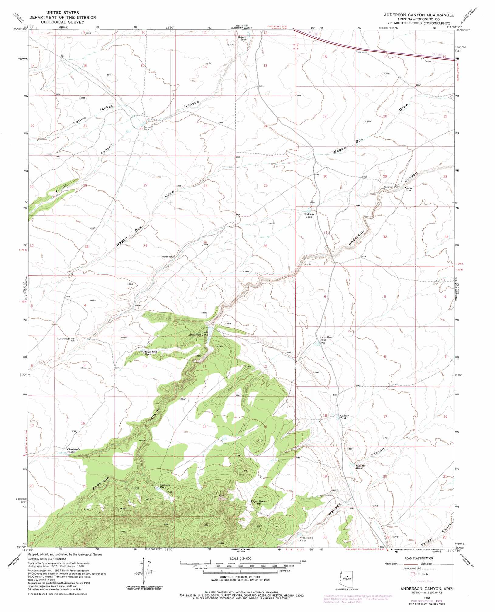
USGS Topo Quad 35111a2 - 1:24,000 scale
| Topo Map Name: | Anderson Canyon |
| USGS Topo Quad ID: | 35111a2 |
| Print Size: | ca. 21 1/4" wide x 27" high |
| Southeast Coordinates: | 35° N latitude / 111.125° W longitude |
| Map Center Coordinates: | 35.0625° N latitude / 111.1875° W longitude |
| U.S. State: | AZ |
| Filename: | o35111a2.jpg |
| Download Map JPG Image: | Anderson Canyon topo map 1:24,000 scale |
| Map Type: | Topographic |
| Topo Series: | 7.5´ |
| Map Scale: | 1:24,000 |
| Source of Map Images: | United States Geological Survey (USGS) |
| Alternate Map Versions: |
Anderson Canyon AZ 1968, updated 1971 Download PDF Buy paper map Anderson Canyon AZ 1968, updated 1982 Download PDF Buy paper map Anderson Canyon AZ 1968, updated 1983 Download PDF Buy paper map Anderson Canyon AZ 1968, updated 1983 Download PDF Buy paper map Anderson Canyon AZ 2011 Download PDF Buy paper map Anderson Canyon AZ 2014 Download PDF Buy paper map |
1:24,000 Topo Quads surrounding Anderson Canyon
Sunset Crater East |
Merriam Crater |
Grand Falls Sw |
Grand Falls Se |
Old Leupp |
Winona |
Angell |
Babbitt Wash |
Canyon Diablo |
Tucker Mesa Nw |
Ashurst Lake |
Elliott Canyon |
Anderson Canyon |
Meteor Crater |
Tucker Mesa Sw |
Mormon Lake |
Kinnikinick Lake |
Chavez Mountain Nw |
Chavez Mountain Ne |
West Sunset Mountain |
Hutch Mountain |
Jaycox Mountain |
Chavez Mountain West |
Chavez Mountain East |
Sunset Pass |
> Back to 35111a1 at 1:100,000 scale
> Back to 35110a1 at 1:250,000 scale
> Back to U.S. Topo Maps home
Anderson Canyon topo map: Gazetteer
Anderson Canyon: Dams
Gorton Dam elevation 1770m 5807′Anderson Canyon: Reservoirs
Babbit Tank elevation 1735m 5692′Big Anderson Tank elevation 1777m 5830′
Boyd Reid Tank elevation 1824m 5984′
Casner Tank elevation 1759m 5770′
Charlebois Tanks elevation 1869m 6131′
Chimney Tank elevation 1861m 6105′
Golden Dam Tank elevation 1769m 5803′
Koger Tank elevation 1852m 6076′
Lute Hart Tank elevation 1757m 5764′
Pill Two Tank elevation 1811m 5941′
Sinkhole Tank elevation 1739m 5705′
Wallace Tank elevation 1767m 5797′
Anderson Canyon: Valleys
Elliott Canyon elevation 1773m 5816′Anderson Canyon: Wells
Anderson Well elevation 1704m 5590′Courthouse Well elevation 1854m 6082′
Anderson Canyon digital topo map on disk
Buy this Anderson Canyon topo map showing relief, roads, GPS coordinates and other geographical features, as a high-resolution digital map file on DVD: