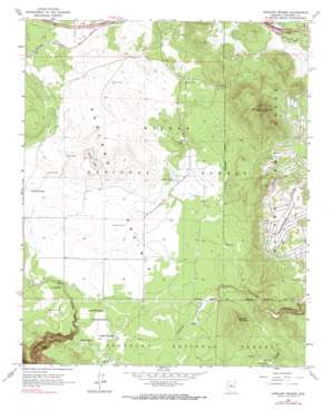
Garland Prairie Topo Map Arizona
To zoom in, hover over the map of Garland Prairie
USGS Topo Quad 35111b8 - 1:24,000 scale
| Topo Map Name: | Garland Prairie |
| USGS Topo Quad ID: | 35111b8 |
| Print Size: | ca. 21 1/4" wide x 27" high |
| Southeast Coordinates: | 35.125° N latitude / 111.875° W longitude |
| Map Center Coordinates: | 35.1875° N latitude / 111.9375° W longitude |
| U.S. State: | AZ |
| Filename: | o35111b8.jpg |
| Download Map JPG Image: | Garland Prairie topo map 1:24,000 scale |
| Map Type: | Topographic |
| Topo Series: | 7.5´ |
| Map Scale: | 1:24,000 |
| Source of Map Images: | United States Geological Survey (USGS) |
| Alternate Map Versions: |
Garland Prairie AZ 1963, updated 1965 Download PDF Buy paper map Garland Prairie AZ 1963, updated 1972 Download PDF Buy paper map Garland Prairie AZ 1963, updated 1990 Download PDF Buy paper map Garland Prairie AZ 2012 Download PDF Buy paper map Garland Prairie AZ 2014 Download PDF Buy paper map |
| FStopo: | US Forest Service topo Garland Prairie is available: Download FStopo PDF Download FStopo TIF |
1:24,000 Topo Quads surrounding Garland Prairie
> Back to 35111a1 at 1:100,000 scale
> Back to 35110a1 at 1:250,000 scale
> Back to U.S. Topo Maps home
Garland Prairie topo map: Gazetteer
Garland Prairie: Airports
Sunrise Ranch Airport elevation 2116m 6942′Garland Prairie: Crossings
Spitz Spring Overpass elevation 2122m 6961′Spitz Spring Underpass elevation 2122m 6961′
Garland Prairie: Flats
Garland Prairie elevation 2052m 6732′Long Park elevation 2175m 7135′
Garland Prairie: Lakes
Horse Lake elevation 2066m 6778′Garland Prairie: Mines
Raymond Pit elevation 2072m 6797′Garland Prairie: Ranges
Boynton Tank elevation 2077m 6814′Robin Tank elevation 2064m 6771′
Garland Prairie: Reservoirs
Alive Tank elevation 2049m 6722′Allan Tank elevation 2091m 6860′
Aso Number Two Tank elevation 2141m 7024′
Bankhead Tank elevation 2059m 6755′
Blue Tank elevation 2051m 6729′
Corsair Tank elevation 2073m 6801′
Dutch Kid Tank elevation 2050m 6725′
Garjon Tank elevation 2121m 6958′
Garland Prairie Tank elevation 2103m 6899′
Gray Tank elevation 2052m 6732′
Great Dane Tank elevation 2119m 6952′
Green Tank elevation 2099m 6886′
Horse Lake Tank elevation 2067m 6781′
Horse Tank elevation 2054m 6738′
Johnson Tank elevation 2192m 7191′
Kilgore Tank elevation 2087m 6847′
Little Joe Tank elevation 2056m 6745′
Long Park Tank elevation 2171m 7122′
Manterola Tank elevation 2060m 6758′
Mickle Tank elevation 2085m 6840′
Montezuma Tank elevation 2088m 6850′
Morgan Tank elevation 2076m 6811′
Mustang Tank elevation 2061m 6761′
Power Line Tank elevation 2045m 6709′
Powerline Tank elevation 2048m 6719′
Ramon Tank elevation 2071m 6794′
Rybery Tank elevation 2094m 6870′
Sawmill Tank elevation 2138m 7014′
Sheep Tank elevation 2060m 6758′
Stump Tank elevation 2109m 6919′
Toy Tank elevation 2085m 6840′
Volunteer Tank elevation 2121m 6958′
Wright Tanks elevation 2050m 6725′
Garland Prairie: Springs
Dow Spring elevation 2044m 6706′Garland Spring elevation 2049m 6722′
Gray Spring elevation 2043m 6702′
L O Spring elevation 2042m 6699′
Lower Hull Spring elevation 2055m 6742′
Mineral Spring elevation 2097m 6879′
Poison Spring elevation 2031m 6663′
Railroad Spring elevation 2045m 6709′
Triangle Spring elevation 2057m 6748′
Upper Hull Spring elevation 2055m 6742′
Garland Prairie: Summits
Mooney Mountain elevation 2256m 7401′Volunteer Mountain elevation 2450m 8038′
Garland Prairie: Valleys
McDermit Canyon elevation 2103m 6899′Pitman Valley elevation 2082m 6830′
Garland Prairie digital topo map on disk
Buy this Garland Prairie topo map showing relief, roads, GPS coordinates and other geographical features, as a high-resolution digital map file on DVD:


