Roden Crater Topo Map Arizona
To zoom in, hover over the map of Roden Crater
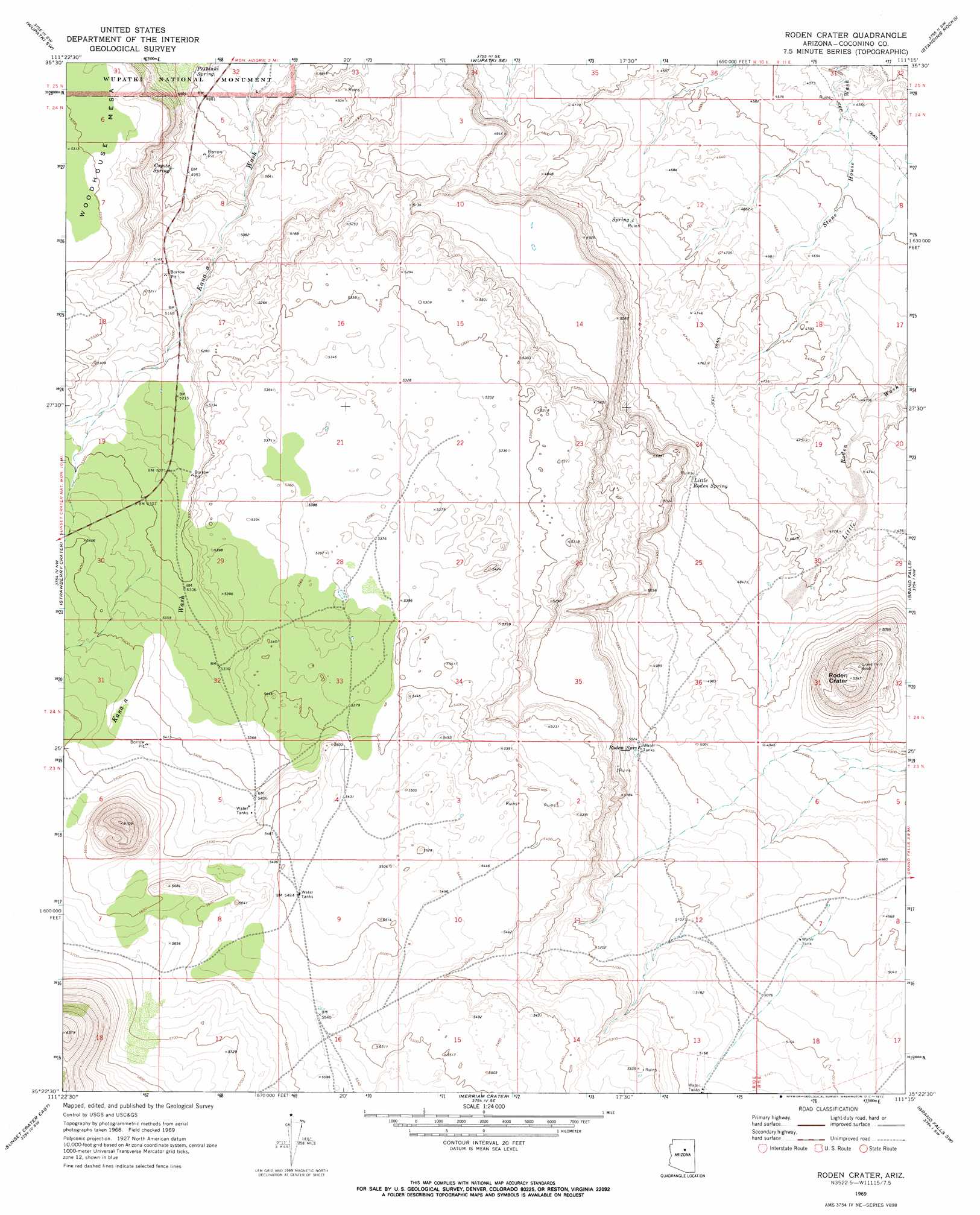
USGS Topo Quad 35111d3 - 1:24,000 scale
| Topo Map Name: | Roden Crater |
| USGS Topo Quad ID: | 35111d3 |
| Print Size: | ca. 21 1/4" wide x 27" high |
| Southeast Coordinates: | 35.375° N latitude / 111.25° W longitude |
| Map Center Coordinates: | 35.4375° N latitude / 111.3125° W longitude |
| U.S. State: | AZ |
| Filename: | o35111d3.jpg |
| Download Map JPG Image: | Roden Crater topo map 1:24,000 scale |
| Map Type: | Topographic |
| Topo Series: | 7.5´ |
| Map Scale: | 1:24,000 |
| Source of Map Images: | United States Geological Survey (USGS) |
| Alternate Map Versions: |
Roden Crater AZ 1969, updated 1972 Download PDF Buy paper map Roden Crater AZ 1969, updated 1972 Download PDF Buy paper map Roden Crater AZ 2011 Download PDF Buy paper map Roden Crater AZ 2014 Download PDF Buy paper map |
| FStopo: | US Forest Service topo Roden Crater is available: Download FStopo PDF Download FStopo TIF |
1:24,000 Topo Quads surrounding Roden Crater
Campbell Francis Wash |
Gray Mountain |
Wupatki Ne |
Badger Spring |
Rock Head |
East Of S P Mountain |
Wupatki Sw |
Wupatki Se |
Standing Rocks |
White Water Tank |
O'Leary Peak |
Strawberry Crater |
Roden Crater |
Grand Falls |
Grand Falls Ne |
Sunset Crater West |
Sunset Crater East |
Merriam Crater |
Grand Falls Sw |
Grand Falls Se |
Flagstaff East |
Winona |
Angell |
Babbitt Wash |
Canyon Diablo |
> Back to 35111a1 at 1:100,000 scale
> Back to 35110a1 at 1:250,000 scale
> Back to U.S. Topo Maps home
Roden Crater topo map: Gazetteer
Roden Crater: Craters
Roden Crater elevation 1633m 5357′Roden Crater: Springs
Coyote Spring elevation 1531m 5022′Little Roden Spring elevation 1480m 4855′
Peshlaki Spring elevation 1500m 4921′
Roden Spring elevation 1536m 5039′
Roden Crater digital topo map on disk
Buy this Roden Crater topo map showing relief, roads, GPS coordinates and other geographical features, as a high-resolution digital map file on DVD: