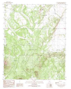
Chapel Mountain Topo Map Arizona
To zoom in, hover over the map of Chapel Mountain
USGS Topo Quad 35111e7 - 1:24,000 scale
| Topo Map Name: | Chapel Mountain |
| USGS Topo Quad ID: | 35111e7 |
| Print Size: | ca. 21 1/4" wide x 27" high |
| Southeast Coordinates: | 35.5° N latitude / 111.75° W longitude |
| Map Center Coordinates: | 35.5625° N latitude / 111.8125° W longitude |
| U.S. State: | AZ |
| Filename: | o35111e7.jpg |
| Download Map JPG Image: | Chapel Mountain topo map 1:24,000 scale |
| Map Type: | Topographic |
| Topo Series: | 7.5´ |
| Map Scale: | 1:24,000 |
| Source of Map Images: | United States Geological Survey (USGS) |
| Alternate Map Versions: |
Chapel Mountain AZ 1989, updated 1990 Download PDF Buy paper map Chapel Mountain AZ 2012 Download PDF Buy paper map Chapel Mountain AZ 2014 Download PDF Buy paper map |
| FStopo: | US Forest Service topo Chapel Mountain is available: Download FStopo PDF Download FStopo TIF |
1:24,000 Topo Quads surrounding Chapel Mountain
> Back to 35111e1 at 1:100,000 scale
> Back to 35110a1 at 1:250,000 scale
> Back to U.S. Topo Maps home
Chapel Mountain topo map: Gazetteer
Chapel Mountain: Lakes
Babbitt Lake elevation 1995m 6545′Chapel Mountain: Reservoirs
Cadillac Tank elevation 2025m 6643′Cedar Tank elevation 1958m 6423′
Cedar Tank (historical) elevation 1971m 6466′
Chapel Tank elevation 1921m 6302′
Cinder Tank elevation 2104m 6902′
CO Bar Tank elevation 2196m 7204′
Driftwood Tank elevation 1964m 6443′
East Cedar Tank elevation 1955m 6414′
North Pasture Tank elevation 1955m 6414′
Porkchop Tank elevation 2063m 6768′
Rabbit Tank elevation 1901m 6236′
Red Mountain Tank elevation 2063m 6768′
Stevens Tank elevation 2097m 6879′
Chapel Mountain: Summits
Chapel Mountain elevation 2027m 6650′Chapel Mountain: Wells
Basin Well elevation 2144m 7034′Limestone Number Two Well elevation 1963m 6440′
Limestone Well elevation 1940m 6364′
Slate Well elevation 1995m 6545′
Chapel Mountain digital topo map on disk
Buy this Chapel Mountain topo map showing relief, roads, GPS coordinates and other geographical features, as a high-resolution digital map file on DVD:


