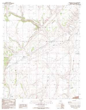
Additional Hill Topo Map Arizona
To zoom in, hover over the map of Additional Hill
USGS Topo Quad 35111f6 - 1:24,000 scale
| Topo Map Name: | Additional Hill |
| USGS Topo Quad ID: | 35111f6 |
| Print Size: | ca. 21 1/4" wide x 27" high |
| Southeast Coordinates: | 35.625° N latitude / 111.625° W longitude |
| Map Center Coordinates: | 35.6875° N latitude / 111.6875° W longitude |
| U.S. State: | AZ |
| Filename: | o35111f6.jpg |
| Download Map JPG Image: | Additional Hill topo map 1:24,000 scale |
| Map Type: | Topographic |
| Topo Series: | 7.5´ |
| Map Scale: | 1:24,000 |
| Source of Map Images: | United States Geological Survey (USGS) |
| Alternate Map Versions: |
Additional Hill AZ 1989, updated 1990 Download PDF Buy paper map Additional Hill AZ 2012 Download PDF Buy paper map Additional Hill AZ 2014 Download PDF Buy paper map |
| FStopo: | US Forest Service topo Additional Hill is available: Download FStopo PDF Download FStopo TIF |
1:24,000 Topo Quads surrounding Additional Hill
> Back to 35111e1 at 1:100,000 scale
> Back to 35110a1 at 1:250,000 scale
> Back to U.S. Topo Maps home
Additional Hill topo map: Gazetteer
Additional Hill: Dams
Lee Dam elevation 1799m 5902′Additional Hill: Reservoirs
Malpais Tank elevation 1748m 5734′Mesa Butte Tank elevation 1849m 6066′
Michelbach Tank elevation 1725m 5659′
Needmore Tank elevation 1842m 6043′
O'Dell Tank elevation 1840m 6036′
Tom Tanks elevation 1745m 5725′
Additional Hill: Summits
Additional Hill elevation 1906m 6253′Additional Hill: Valleys
Lockwood Canyon elevation 1852m 6076′Additional Hill digital topo map on disk
Buy this Additional Hill topo map showing relief, roads, GPS coordinates and other geographical features, as a high-resolution digital map file on DVD:


