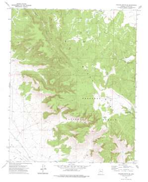
Picacho Butte Se Topo Map Arizona
To zoom in, hover over the map of Picacho Butte Se
USGS Topo Quad 35112a5 - 1:24,000 scale
| Topo Map Name: | Picacho Butte Se |
| USGS Topo Quad ID: | 35112a5 |
| Print Size: | ca. 21 1/4" wide x 27" high |
| Southeast Coordinates: | 35° N latitude / 112.5° W longitude |
| Map Center Coordinates: | 35.0625° N latitude / 112.5625° W longitude |
| U.S. State: | AZ |
| Filename: | o35112a5.jpg |
| Download Map JPG Image: | Picacho Butte Se topo map 1:24,000 scale |
| Map Type: | Topographic |
| Topo Series: | 7.5´ |
| Map Scale: | 1:24,000 |
| Source of Map Images: | United States Geological Survey (USGS) |
| Alternate Map Versions: |
Picacho Butte SE AZ 1973, updated 1976 Download PDF Buy paper map Picacho Butte SE AZ 2012 Download PDF Buy paper map Picacho Butte SE AZ 2014 Download PDF Buy paper map |
| FStopo: | US Forest Service topo Picacho Butte SE is available: Download FStopo PDF Download FStopo TIF |
1:24,000 Topo Quads surrounding Picacho Butte Se
> Back to 35112a1 at 1:100,000 scale
> Back to 35112a1 at 1:250,000 scale
> Back to U.S. Topo Maps home
Picacho Butte Se topo map: Gazetteer
Picacho Butte Se: Dams
Cotton Dam elevation 1715m 5626′Mexican Dam elevation 1634m 5360′
Upper Limestone Tank Dam elevation 1677m 5501′
Picacho Butte Se: Reservoirs
AGF Trick Tank elevation 1729m 5672′AGF Trick Tank elevation 1784m 5853′
Eddy Tank elevation 1469m 4819′
Fritsche Tank elevation 1507m 4944′
Indian Tank elevation 1697m 5567′
Mexican Tank elevation 1631m 5351′
Pool Tank elevation 1542m 5059′
Red Hat Tank elevation 1775m 5823′
Upper Limestone Tank elevation 1716m 5629′
Picacho Butte Se: Springs
Pool Seep elevation 1633m 5357′Storm Seep elevation 1673m 5488′
Picacho Butte Se: Summits
Big Black Mesa elevation 1844m 6049′Picacho Butte Se digital topo map on disk
Buy this Picacho Butte Se topo map showing relief, roads, GPS coordinates and other geographical features, as a high-resolution digital map file on DVD:


