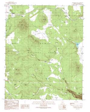
Davenport Hill Topo Map Arizona
To zoom in, hover over the map of Davenport Hill
USGS Topo Quad 35112b1 - 1:24,000 scale
| Topo Map Name: | Davenport Hill |
| USGS Topo Quad ID: | 35112b1 |
| Print Size: | ca. 21 1/4" wide x 27" high |
| Southeast Coordinates: | 35.125° N latitude / 112° W longitude |
| Map Center Coordinates: | 35.1875° N latitude / 112.0625° W longitude |
| U.S. State: | AZ |
| Filename: | o35112b1.jpg |
| Download Map JPG Image: | Davenport Hill topo map 1:24,000 scale |
| Map Type: | Topographic |
| Topo Series: | 7.5´ |
| Map Scale: | 1:24,000 |
| Source of Map Images: | United States Geological Survey (USGS) |
| Alternate Map Versions: |
Davenport Hill AZ 1989, updated 1990 Download PDF Buy paper map Davenport Hill AZ 2012 Download PDF Buy paper map Davenport Hill AZ 2014 Download PDF Buy paper map |
| FStopo: | US Forest Service topo Davenport Hill is available: Download FStopo PDF Download FStopo TIF |
1:24,000 Topo Quads surrounding Davenport Hill
> Back to 35112a1 at 1:100,000 scale
> Back to 35112a1 at 1:250,000 scale
> Back to U.S. Topo Maps home
Davenport Hill topo map: Gazetteer
Davenport Hill: Flats
McDougal Flat elevation 2088m 6850′Sunflower Flat elevation 2018m 6620′
Davenport Hill: Lakes
Mineral Lake elevation 2104m 6902′Davenport Hill: Populated Places
Bootlegger Crossing elevation 2118m 6948′Chalender elevation 2092m 6863′
Pine Tank elevation 2097m 6879′
Sherwood Forest Estates elevation 2121m 6958′
Davenport Hill: Reservoirs
Bear Tank elevation 2009m 6591′Buck Tank elevation 2056m 6745′
Buck Wildlife Guzzler elevation 2106m 6909′
Cat Tank elevation 2018m 6620′
DeadHorse Tank elevation 2150m 7053′
Dogtown Tank elevation 2147m 7043′
Double Tanks elevation 2006m 6581′
Duck Tank elevation 2049m 6722′
Frog Tank elevation 2039m 6689′
Horse Hill Wildlife Guzzler elevation 2132m 6994′
JD Tank elevation 2028m 6653′
Lucas Tank elevation 2120m 6955′
McDougal Flat Tank elevation 2089m 6853′
Moose Ranch Tank elevation 2042m 6699′
New Ranch Tank elevation 2093m 6866′
Pancho Viejo Tank elevation 2116m 6942′
Pomeroy Tank elevation 2036m 6679′
Pomeroy Tanks elevation 2008m 6587′
Pouquette Homestead Tank elevation 2125m 6971′
Rancho Viejo Tank elevation 2123m 6965′
Reed Tank elevation 2092m 6863′
Reeder Tank elevation 2135m 7004′
Rhodes Tank elevation 2138m 7014′
Santa Fe Tank elevation 2141m 7024′
Scholz Lake elevation 2054m 6738′
Whiting Tank elevation 2038m 6686′
Wilkes Tank elevation 2055m 6742′
Davenport Hill: Springs
Big Spring elevation 2082m 6830′Buck Spring elevation 2087m 6847′
Isham Spring elevation 2078m 6817′
McDougal Spring elevation 2142m 7027′
Rosilda Spring elevation 2049m 6722′
Ross Spring elevation 2082m 6830′
Willow Spring elevation 1979m 6492′
Davenport Hill: Summits
Davenport Hill elevation 2374m 7788′Horse Hill elevation 2184m 7165′
Hyde Hill elevation 2246m 7368′
KA Hill elevation 2208m 7244′
Morgan Hill elevation 2180m 7152′
Pine Hill elevation 2230m 7316′
Seven Bar K Hill elevation 2249m 7378′
Davenport Hill: Trails
Sycamore Rim Trail elevation 2101m 6893′Davenport Hill: Valleys
Frenchy Canyon elevation 2054m 6738′Isham Spring Canyon elevation 2025m 6643′
Rosilda Spring Canyon elevation 2042m 6699′
Davenport Hill: Wells
Moose Well elevation 2044m 6706′Davenport Hill digital topo map on disk
Buy this Davenport Hill topo map showing relief, roads, GPS coordinates and other geographical features, as a high-resolution digital map file on DVD:


