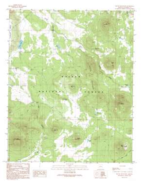
Squaw Mountain Topo Map Arizona
To zoom in, hover over the map of Squaw Mountain
USGS Topo Quad 35112d1 - 1:24,000 scale
| Topo Map Name: | Squaw Mountain |
| USGS Topo Quad ID: | 35112d1 |
| Print Size: | ca. 21 1/4" wide x 27" high |
| Southeast Coordinates: | 35.375° N latitude / 112° W longitude |
| Map Center Coordinates: | 35.4375° N latitude / 112.0625° W longitude |
| U.S. State: | AZ |
| Filename: | o35112d1.jpg |
| Download Map JPG Image: | Squaw Mountain topo map 1:24,000 scale |
| Map Type: | Topographic |
| Topo Series: | 7.5´ |
| Map Scale: | 1:24,000 |
| Source of Map Images: | United States Geological Survey (USGS) |
| Alternate Map Versions: |
Squaw Mountain AZ 1989, updated 1990 Download PDF Buy paper map Squaw Mountain AZ 2012 Download PDF Buy paper map Squaw Mountain AZ 2014 Download PDF Buy paper map |
| FStopo: | US Forest Service topo Squaw Mountain is available: Download FStopo PDF Download FStopo TIF |
1:24,000 Topo Quads surrounding Squaw Mountain
> Back to 35112a1 at 1:100,000 scale
> Back to 35112a1 at 1:250,000 scale
> Back to U.S. Topo Maps home
Squaw Mountain topo map: Gazetteer
Squaw Mountain: Lakes
Allen Lake elevation 1970m 6463′Horse Lake elevation 2107m 6912′
Smoot Lake elevation 1936m 6351′
Squaw Mountain: Reservoirs
Boulin Tank elevation 2130m 6988′Boulin Trick Tank elevation 2112m 6929′
Boulin Trick Tank elevation 2110m 6922′
Cement Tank elevation 1931m 6335′
Cowboy Tank elevation 2015m 6610′
Geronimo Tank elevation 1943m 6374′
Indian Tank elevation 2078m 6817′
Ivie Tank elevation 1971m 6466′
Jimmy Tank elevation 2053m 6735′
Laws Hill Trick Tank elevation 2096m 6876′
Laws Natural Tank elevation 2077m 6814′
Laws Trick Tank elevation 2097m 6879′
Little Boulin Tank elevation 2121m 6958′
Marteen Tank elevation 2080m 6824′
Seven Pines Tank elevation 2022m 6633′
Sowell Tank elevation 2060m 6758′
Squaw Mountain: Summits
Buck Mountain elevation 2257m 7404′Cedar Mountain elevation 2330m 7644′
Elk Hill elevation 2164m 7099′
Horse Trap Hill elevation 2247m 7372′
Laws Hill elevation 2106m 6909′
Little Squaw Mountain elevation 2406m 7893′
Scarp Hill elevation 2270m 7447′
Squaw Coxcombs elevation 2189m 7181′
Squaw Mountain elevation 2404m 7887′
Wildcat Hill elevation 2296m 7532′
Squaw Mountain digital topo map on disk
Buy this Squaw Mountain topo map showing relief, roads, GPS coordinates and other geographical features, as a high-resolution digital map file on DVD:


