Howard Lake Topo Map Arizona
To zoom in, hover over the map of Howard Lake
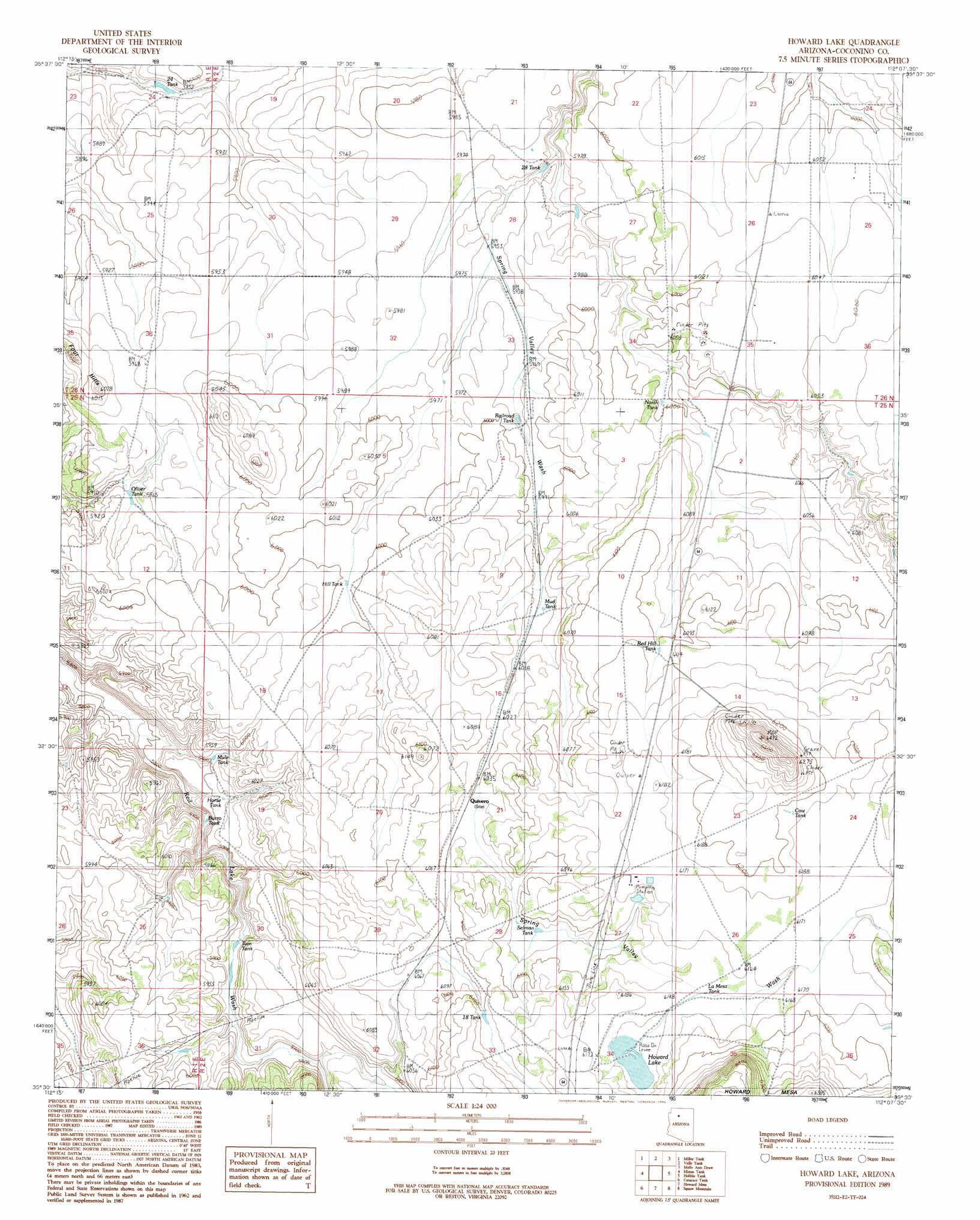
USGS Topo Quad 35112e2 - 1:24,000 scale
| Topo Map Name: | Howard Lake |
| USGS Topo Quad ID: | 35112e2 |
| Print Size: | ca. 21 1/4" wide x 27" high |
| Southeast Coordinates: | 35.5° N latitude / 112.125° W longitude |
| Map Center Coordinates: | 35.5625° N latitude / 112.1875° W longitude |
| U.S. State: | AZ |
| Filename: | o35112e2.jpg |
| Download Map JPG Image: | Howard Lake topo map 1:24,000 scale |
| Map Type: | Topographic |
| Topo Series: | 7.5´ |
| Map Scale: | 1:24,000 |
| Source of Map Images: | United States Geological Survey (USGS) |
| Alternate Map Versions: |
Howard Lake AZ 1989, updated 1990 Download PDF Buy paper map Howard Lake AZ 2011 Download PDF Buy paper map Howard Lake AZ 2014 Download PDF Buy paper map |
1:24,000 Topo Quads surrounding Howard Lake
Little Harpo Canyon |
Howard Hill |
Red Butte Sw |
Red Butte |
Harbison Tank |
Markham Dam |
Miller Tank |
Valle Tank |
Molly Ann Draw |
Dog Knobs |
Red Hill Ranch |
Mixon Tank |
Howard Lake |
Hobble Tank |
Ebert Mountain |
Stanford Tank |
Cataract Tank |
Howard Mesa |
Squaw Mountain |
Moritz Ridge |
Fitzgerald Hill |
Hearst Mountain |
Williams North |
Sitgreaves Mountain |
Parks |
> Back to 35112e1 at 1:100,000 scale
> Back to 35112a1 at 1:250,000 scale
> Back to U.S. Topo Maps home
Howard Lake topo map: Gazetteer
Howard Lake: Lakes
Howard Lake elevation 1871m 6138′Howard Lake: Populated Places
Quivero elevation 1847m 6059′Howard Lake: Reservoirs
Burro Tank elevation 1793m 5882′Cow Tank elevation 1888m 6194′
Eighteen Tank elevation 1858m 6095′
Hill Tank elevation 1829m 6000′
Horse Tank elevation 1801m 5908′
La Mesa Tank elevation 1874m 6148′
Mud Tank elevation 1833m 6013′
Mule Tank elevation 1800m 5905′
North Tank elevation 1829m 6000′
Oliver Tank elevation 1813m 5948′
Railroad Tank elevation 1824m 5984′
Red Hill Tank elevation 1861m 6105′
Selman Tank elevation 1852m 6076′
Tom Tank elevation 1787m 5862′
Twentyeight Tank elevation 1814m 5951′
Twentyfour Tank elevation 1775m 5823′
Howard Lake: Summits
Four Hills elevation 1829m 6000′Howard Lake digital topo map on disk
Buy this Howard Lake topo map showing relief, roads, GPS coordinates and other geographical features, as a high-resolution digital map file on DVD: