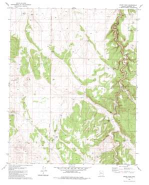
Mixon Tank Topo Map Arizona
To zoom in, hover over the map of Mixon Tank
USGS Topo Quad 35112e3 - 1:24,000 scale
| Topo Map Name: | Mixon Tank |
| USGS Topo Quad ID: | 35112e3 |
| Print Size: | ca. 21 1/4" wide x 27" high |
| Southeast Coordinates: | 35.5° N latitude / 112.25° W longitude |
| Map Center Coordinates: | 35.5625° N latitude / 112.3125° W longitude |
| U.S. State: | AZ |
| Filename: | o35112e3.jpg |
| Download Map JPG Image: | Mixon Tank topo map 1:24,000 scale |
| Map Type: | Topographic |
| Topo Series: | 7.5´ |
| Map Scale: | 1:24,000 |
| Source of Map Images: | United States Geological Survey (USGS) |
| Alternate Map Versions: |
Mixon Tank AZ 1981, updated 1981 Download PDF Buy paper map Mixon Tank AZ 2011 Download PDF Buy paper map Mixon Tank AZ 2014 Download PDF Buy paper map |
1:24,000 Topo Quads surrounding Mixon Tank
> Back to 35112e1 at 1:100,000 scale
> Back to 35112a1 at 1:250,000 scale
> Back to U.S. Topo Maps home
Mixon Tank topo map: Gazetteer
Mixon Tank: Reservoirs
Big Boy Tank elevation 1728m 5669′Big Tank elevation 1762m 5780′
Bull Pasture Tank elevation 1782m 5846′
Burro Tank elevation 1800m 5905′
Chimney Tank elevation 1758m 5767′
Little Joe Tank elevation 1824m 5984′
Little Lo Tank elevation 1773m 5816′
Little Red Hill Tank elevation 1778m 5833′
Mixon Tank elevation 1802m 5912′
New Tank elevation 1766m 5793′
Pitt Tank elevation 1771m 5810′
Pouquette Tank elevation 1780m 5839′
Rambo Tank elevation 1744m 5721′
Robber Tank elevation 1776m 5826′
Tank Twenty-Two elevation 1764m 5787′
Mixon Tank: Streams
Red Lake Wash elevation 1764m 5787′Mixon Tank digital topo map on disk
Buy this Mixon Tank topo map showing relief, roads, GPS coordinates and other geographical features, as a high-resolution digital map file on DVD:


