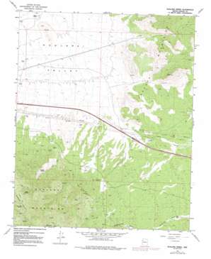
Hualapai Spring Topo Map Arizona
To zoom in, hover over the map of Hualapai Spring
USGS Topo Quad 35113b7 - 1:24,000 scale
| Topo Map Name: | Hualapai Spring |
| USGS Topo Quad ID: | 35113b7 |
| Print Size: | ca. 21 1/4" wide x 27" high |
| Southeast Coordinates: | 35.125° N latitude / 113.75° W longitude |
| Map Center Coordinates: | 35.1875° N latitude / 113.8125° W longitude |
| U.S. State: | AZ |
| Filename: | o35113b7.jpg |
| Download Map JPG Image: | Hualapai Spring topo map 1:24,000 scale |
| Map Type: | Topographic |
| Topo Series: | 7.5´ |
| Map Scale: | 1:24,000 |
| Source of Map Images: | United States Geological Survey (USGS) |
| Alternate Map Versions: |
Hualapai Peak NE AZ 1968, updated 1971 Download PDF Buy paper map Hualapai Peak NE AZ 1968, updated 1980 Download PDF Buy paper map Hualapai Spring AZ 1968, updated 1991 Download PDF Buy paper map Hualapai Spring AZ 2011 Download PDF Buy paper map Hualapai Spring AZ 2014 Download PDF Buy paper map |
1:24,000 Topo Quads surrounding Hualapai Spring
> Back to 35113a1 at 1:100,000 scale
> Back to 35112a1 at 1:250,000 scale
> Back to U.S. Topo Maps home
Hualapai Spring topo map: Gazetteer
Hualapai Spring: Mines
Century Mine elevation 1583m 5193′Dean Mine elevation 1823m 5980′
Enterprise Mine elevation 1526m 5006′
Frost Mine elevation 1399m 4589′
Hualapai Spring: Reservoirs
Butte Tank elevation 1131m 3710′Hualapai Spring: Springs
Burn Spring elevation 1671m 5482′Hualapai Spring elevation 1537m 5042′
Lion Kill Spring elevation 1695m 5561′
Hualapai Spring: Valleys
Hualapai Valley elevation 1353m 4438′Hualapai Spring digital topo map on disk
Buy this Hualapai Spring topo map showing relief, roads, GPS coordinates and other geographical features, as a high-resolution digital map file on DVD:


