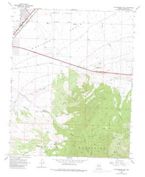
Rattlesnake Hill Topo Map Arizona
To zoom in, hover over the map of Rattlesnake Hill
USGS Topo Quad 35113b8 - 1:24,000 scale
| Topo Map Name: | Rattlesnake Hill |
| USGS Topo Quad ID: | 35113b8 |
| Print Size: | ca. 21 1/4" wide x 27" high |
| Southeast Coordinates: | 35.125° N latitude / 113.875° W longitude |
| Map Center Coordinates: | 35.1875° N latitude / 113.9375° W longitude |
| U.S. State: | AZ |
| Filename: | o35113b8.jpg |
| Download Map JPG Image: | Rattlesnake Hill topo map 1:24,000 scale |
| Map Type: | Topographic |
| Topo Series: | 7.5´ |
| Map Scale: | 1:24,000 |
| Source of Map Images: | United States Geological Survey (USGS) |
| Alternate Map Versions: |
Rattlesnake Hill AZ 1968, updated 1971 Download PDF Buy paper map Rattlesnake Hill AZ 1968, updated 1980 Download PDF Buy paper map Rattlesnake Hill AZ 1968, updated 1985 Download PDF Buy paper map Rattlesnake Hill AZ 2011 Download PDF Buy paper map Rattlesnake Hill AZ 2014 Download PDF Buy paper map |
1:24,000 Topo Quads surrounding Rattlesnake Hill
> Back to 35113a1 at 1:100,000 scale
> Back to 35112a1 at 1:250,000 scale
> Back to U.S. Topo Maps home
Rattlesnake Hill topo map: Gazetteer
Rattlesnake Hill: Crossings
Hualapai Interchange elevation 1244m 4081′Rattlesnake Hill: Reservoirs
Berry Tank elevation 1050m 3444′Berry Tank Number Two elevation 1068m 3503′
Rattlesnake Hill: Springs
Falls Spring elevation 1721m 5646′Shack Spring elevation 1389m 4557′
Rattlesnake Hill: Summits
Rattlesnake Hill elevation 1285m 4215′Rattlesnake Hill: Valleys
Hualapai Canyon elevation 1388m 4553′Rattlesnake Hill digital topo map on disk
Buy this Rattlesnake Hill topo map showing relief, roads, GPS coordinates and other geographical features, as a high-resolution digital map file on DVD:


