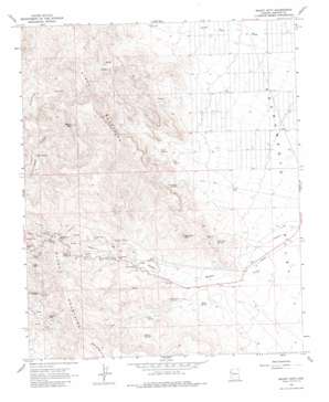
Mount Nutt Topo Map Arizona
To zoom in, hover over the map of Mount Nutt
USGS Topo Quad 35114a3 - 1:24,000 scale
| Topo Map Name: | Mount Nutt |
| USGS Topo Quad ID: | 35114a3 |
| Print Size: | ca. 21 1/4" wide x 27" high |
| Southeast Coordinates: | 35° N latitude / 114.25° W longitude |
| Map Center Coordinates: | 35.0625° N latitude / 114.3125° W longitude |
| U.S. State: | AZ |
| Filename: | o35114a3.jpg |
| Download Map JPG Image: | Mount Nutt topo map 1:24,000 scale |
| Map Type: | Topographic |
| Topo Series: | 7.5´ |
| Map Scale: | 1:24,000 |
| Source of Map Images: | United States Geological Survey (USGS) |
| Alternate Map Versions: |
Mount Nutt AZ 1967, updated 1969 Download PDF Buy paper map Mount Nutt AZ 1967, updated 1980 Download PDF Buy paper map Mount Nutt AZ 1967, updated 1983 Download PDF Buy paper map Mount Nutt AZ 2011 Download PDF Buy paper map Mount Nutt AZ 2014 Download PDF Buy paper map |
1:24,000 Topo Quads surrounding Mount Nutt
> Back to 35114a1 at 1:100,000 scale
> Back to 35114a1 at 1:250,000 scale
> Back to U.S. Topo Maps home
Mount Nutt topo map: Gazetteer
Mount Nutt: Flats
Little Meadows elevation 850m 2788′Mount Nutt: Gaps
Sitgreaves Pass elevation 1093m 3585′Mount Nutt: Mines
Black Eagle Mine elevation 957m 3139′Gold Trail Mine elevation 907m 2975′
Goldroad Mine elevation 1025m 3362′
Mount Nutt: Pillars
Elephants Tooth elevation 1081m 3546′Mount Nutt: Springs
Baker Spring elevation 769m 2522′Cave Spring elevation 899m 2949′
Cool Spring elevation 866m 2841′
Dripping Spring elevation 926m 3038′
Fig Spring elevation 865m 2837′
Flag Spring elevation 896m 2939′
Gold Trail Spring elevation 806m 2644′
Indian Spring elevation 934m 3064′
Onetto Spring elevation 1038m 3405′
Shaffer Spring elevation 0m 0′
Twin Springs elevation 856m 2808′
Walker Springs elevation 958m 3143′
Mount Nutt: Summits
Mount Nutt elevation 1522m 4993′Thimble Mountain elevation 1195m 3920′
Mount Nutt: Valleys
Hidden Valley elevation 884m 2900′Mount Nutt: Wells
Cottonwood Well elevation 877m 2877′Goldroad Well elevation 808m 2650′
Mount Nutt digital topo map on disk
Buy this Mount Nutt topo map showing relief, roads, GPS coordinates and other geographical features, as a high-resolution digital map file on DVD:
Southern Sierra Nevada, California & Southern Nevada
Buy digital topo maps: Southern Sierra Nevada, California & Southern Nevada


