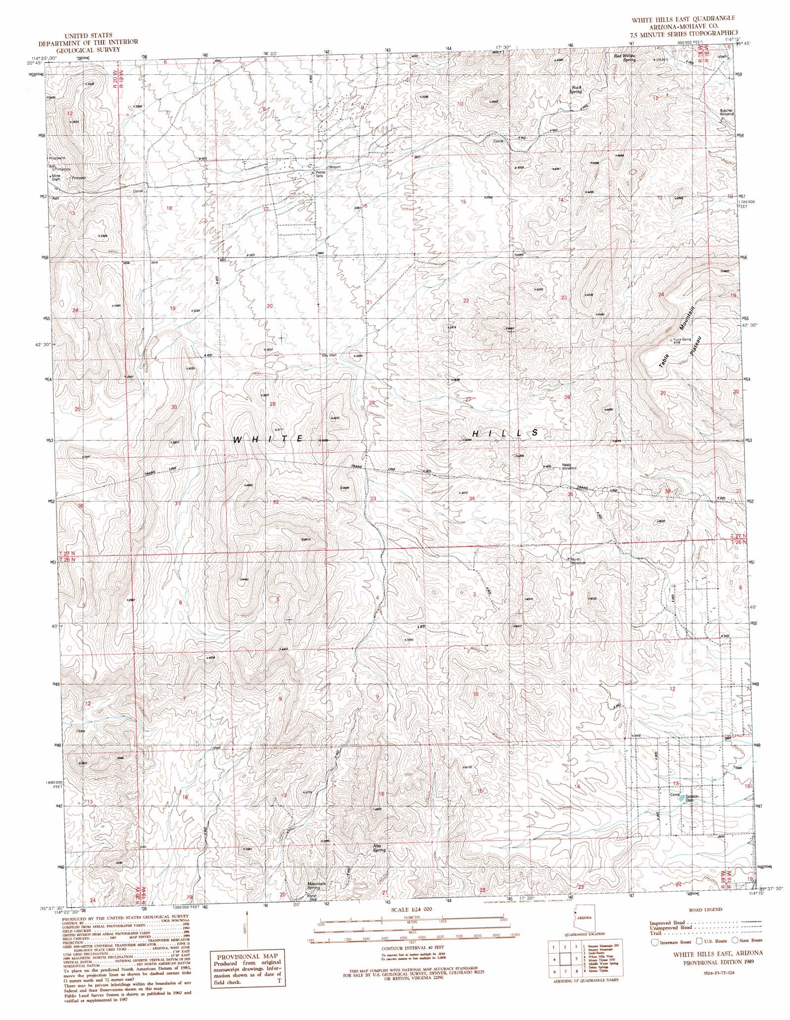
White Hills East Topo Map Arizona
To zoom in, hover over the map of White Hills East
USGS Topo Quad 35114f3 - 1:24,000 scale
| Topo Map Name: | White Hills East |
| USGS Topo Quad ID: | 35114f3 |
| Print Size: | ca. 21 1/4" wide x 27" high |
| Southeast Coordinates: | 35.625° N latitude / 114.25° W longitude |
| Map Center Coordinates: | 35.6875° N latitude / 114.3125° W longitude |
| U.S. State: | AZ |
| Filename: | o35114f3.jpg |
| Download Map JPG Image: | White Hills East topo map 1:24,000 scale |
| Map Type: | Topographic |
| Topo Series: | 7.5´ |
| Map Scale: | 1:24,000 |
| Source of Map Images: | United States Geological Survey (USGS) |
| Alternate Map Versions: |
White Hills East AZ 1989, updated 1990 Download PDF Buy paper map White Hills East AZ 2011 Download PDF Buy paper map White Hills East AZ 2014 Download PDF Buy paper map |
1:24,000 Topo Quads surrounding White Hills East
Mount Wilson |
Senator Mountain Nw |
Senator Mountain Ne |
Garnet Mountain Nw |
Meadview South |
Housholder Pass |
Senator Mountain Sw |
Senator Mountain |
Gold Basin |
Garnet Mountain |
Mohave Mine |
White Hills West |
White Hills East |
Mount Tipton Nw |
Red Lake |
Mount Perkins |
Middle Water Spring |
Dolan Springs |
Mount Tipton |
Mount Tipton Se |
Spirit Mountain Ne |
Grasshopper Junction Nw |
Grasshopper Junction |
Chloride |
Elements Canyon |
> Back to 35114e1 at 1:100,000 scale
> Back to 35114a1 at 1:250,000 scale
> Back to U.S. Topo Maps home
White Hills East topo map: Gazetteer
White Hills East: Dams
Sacaton Dam elevation 0m 0′White Hills East: Plains
Table Mountain Plateau elevation 1551m 5088′White Hills East: Reservoirs
Skipper Tank elevation 992m 3254′Valley Tank elevation 1261m 4137′
White Hills East: Springs
Alta Spring elevation 1121m 3677′Mountain Spring elevation 990m 3248′
Red Willow Spring elevation 1313m 4307′
Rock Spring elevation 1304m 4278′
White Hills East: Wells
Nealy Well elevation 1228m 4028′North Well elevation 1207m 3959′
White Hills East digital topo map on disk
Buy this White Hills East topo map showing relief, roads, GPS coordinates and other geographical features, as a high-resolution digital map file on DVD:
Southern Sierra Nevada, California & Southern Nevada
Buy digital topo maps: Southern Sierra Nevada, California & Southern Nevada