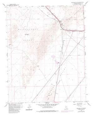
Boulder City Nw Topo Map Nevada
To zoom in, hover over the map of Boulder City Nw
USGS Topo Quad 35114h8 - 1:24,000 scale
| Topo Map Name: | Boulder City Nw |
| USGS Topo Quad ID: | 35114h8 |
| Print Size: | ca. 21 1/4" wide x 27" high |
| Southeast Coordinates: | 35.875° N latitude / 114.875° W longitude |
| Map Center Coordinates: | 35.9375° N latitude / 114.9375° W longitude |
| U.S. State: | NV |
| Filename: | o35114h8.jpg |
| Download Map JPG Image: | Boulder City Nw topo map 1:24,000 scale |
| Map Type: | Topographic |
| Topo Series: | 7.5´ |
| Map Scale: | 1:24,000 |
| Source of Map Images: | United States Geological Survey (USGS) |
| Alternate Map Versions: |
Boulder City NW NV 1958, updated 1959 Download PDF Buy paper map Boulder City NW NV 1958, updated 1968 Download PDF Buy paper map Boulder City NW NV 1958, updated 1976 Download PDF Buy paper map Boulder City NW NV 1958, updated 1983 Download PDF Buy paper map Boulder City NW NV 2012 Download PDF Buy paper map Boulder City NW NV 2015 Download PDF Buy paper map |
1:24,000 Topo Quads surrounding Boulder City Nw
> Back to 35114e1 at 1:100,000 scale
> Back to 35114a1 at 1:250,000 scale
> Back to U.S. Topo Maps home
Boulder City Nw topo map: Gazetteer
Boulder City Nw: Arroyos
Quail Wash elevation 526m 1725′Boulder City Nw: Gaps
Dutchman Pass elevation 801m 2627′Railroad Pass elevation 719m 2358′
Boulder City Nw: Mines
Alunite Mine elevation 716m 2349′Blue Quartz Mine elevation 668m 2191′
Lucky Dutchman Mine elevation 647m 2122′
Quo Vadis Mine elevation 870m 2854′
Spearhead Mine elevation 718m 2355′
Boulder City Nw: Parks
Mission Hills Park elevation 691m 2267′Boulder City Nw: Populated Places
Texas Acres elevation 718m 2355′Boulder City Nw: Springs
Klinger Spring elevation 695m 2280′Boulder City Nw: Summits
Black Hill elevation 1245m 4084′Boulder City Nw digital topo map on disk
Buy this Boulder City Nw topo map showing relief, roads, GPS coordinates and other geographical features, as a high-resolution digital map file on DVD:
Southern Sierra Nevada, California & Southern Nevada
Buy digital topo maps: Southern Sierra Nevada, California & Southern Nevada


