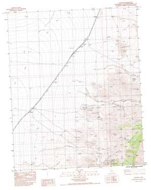
Hayden Topo Map California
To zoom in, hover over the map of Hayden
USGS Topo Quad 35115a5 - 1:24,000 scale
| Topo Map Name: | Hayden |
| USGS Topo Quad ID: | 35115a5 |
| Print Size: | ca. 21 1/4" wide x 27" high |
| Southeast Coordinates: | 35° N latitude / 115.5° W longitude |
| Map Center Coordinates: | 35.0625° N latitude / 115.5625° W longitude |
| U.S. State: | CA |
| Filename: | o35115a5.jpg |
| Download Map JPG Image: | Hayden topo map 1:24,000 scale |
| Map Type: | Topographic |
| Topo Series: | 7.5´ |
| Map Scale: | 1:24,000 |
| Source of Map Images: | United States Geological Survey (USGS) |
| Alternate Map Versions: |
Hayden CA 1983, updated 1983 Download PDF Buy paper map Hayden CA 2012 Download PDF Buy paper map Hayden CA 2015 Download PDF Buy paper map |
1:24,000 Topo Quads surrounding Hayden
> Back to 35115a1 at 1:100,000 scale
> Back to 35114a1 at 1:250,000 scale
> Back to U.S. Topo Maps home
Hayden topo map: Gazetteer
Hayden: Parks
Mojave National Preserve elevation 1037m 3402′Hayden: Populated Places
Hayden elevation 755m 2477′Hayden: Ranges
Providence Mountains elevation 1352m 4435′Hayden: Springs
Bolder Spring elevation 1077m 3533′Macedonia Spring elevation 1241m 4071′
Tough Nut Spring elevation 1270m 4166′
Hayden: Streams
Summit Wash elevation 1008m 3307′Hayden: Valleys
Globe Canyon elevation 1007m 3303′Macedonia Canyon elevation 1104m 3622′
Hayden digital topo map on disk
Buy this Hayden topo map showing relief, roads, GPS coordinates and other geographical features, as a high-resolution digital map file on DVD:
Southern Sierra Nevada, California & Southern Nevada
Buy digital topo maps: Southern Sierra Nevada, California & Southern Nevada


