Kelso Topo Map California
To zoom in, hover over the map of Kelso
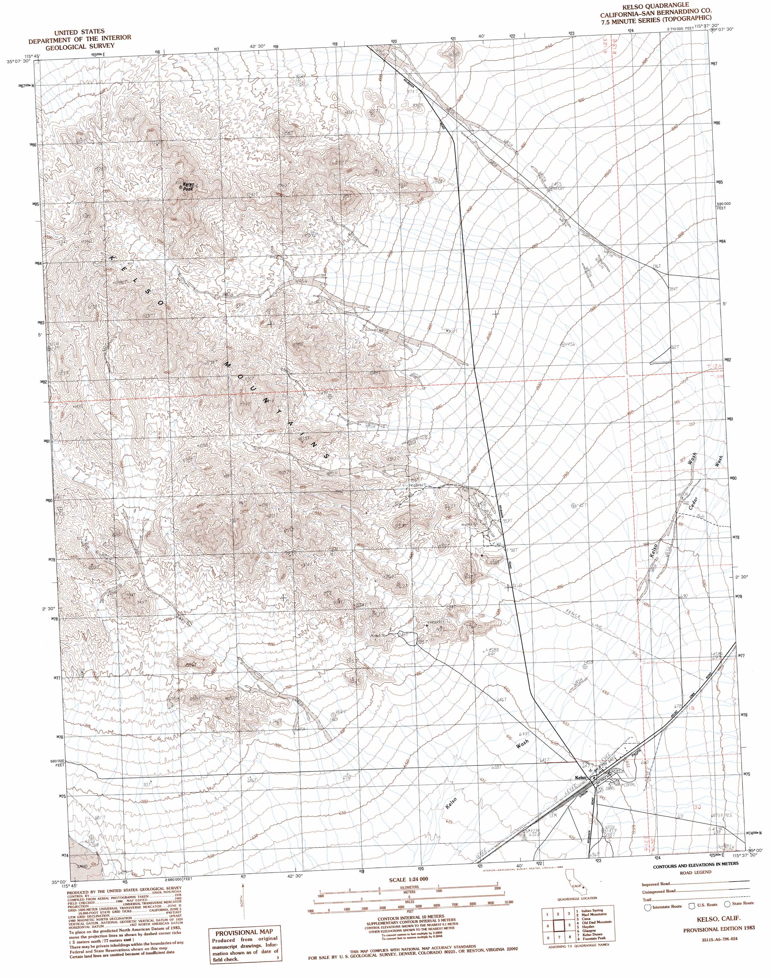
USGS Topo Quad 35115a6 - 1:24,000 scale
| Topo Map Name: | Kelso |
| USGS Topo Quad ID: | 35115a6 |
| Print Size: | ca. 21 1/4" wide x 27" high |
| Southeast Coordinates: | 35° N latitude / 115.625° W longitude |
| Map Center Coordinates: | 35.0625° N latitude / 115.6875° W longitude |
| U.S. State: | CA |
| Filename: | o35115a6.jpg |
| Download Map JPG Image: | Kelso topo map 1:24,000 scale |
| Map Type: | Topographic |
| Topo Series: | 7.5´ |
| Map Scale: | 1:24,000 |
| Source of Map Images: | United States Geological Survey (USGS) |
| Alternate Map Versions: |
Kelso CA 1983, updated 1983 Download PDF Buy paper map Kelso CA 1983, updated 1985 Download PDF Buy paper map Kelso CA 2012 Download PDF Buy paper map Kelso CA 2015 Download PDF Buy paper map |
1:24,000 Topo Quads surrounding Kelso
Halloran Spring |
Granite Spring |
Cow Cove |
Cima Dome |
Joshua |
Seventeenmile Point |
Indian Spring |
Marl Mountains |
Cima |
Mid Hills |
Cowhole Mountain |
Old Dad Mountain |
Kelso |
Hayden |
Columbia Mountain |
West Of Glasgow |
Glasgow |
Kelso Dunes |
Fountain Peak |
Colton Well |
West Of Budweiser Wash |
Budweiser Wash |
Bighorn Basin |
Van Winkle Spring |
West Of Blind Hills |
> Back to 35115a1 at 1:100,000 scale
> Back to 35114a1 at 1:250,000 scale
> Back to U.S. Topo Maps home
Kelso topo map: Gazetteer
Kelso: Populated Places
Kelso elevation 648m 2125′Kelso: Ranges
Kelso Mountains elevation 1226m 4022′Kelso: Streams
Cedar Wash elevation 714m 2342′Kelso: Summits
Kelso Peak elevation 1447m 4747′Kelso digital topo map on disk
Buy this Kelso topo map showing relief, roads, GPS coordinates and other geographical features, as a high-resolution digital map file on DVD:
Southern Sierra Nevada, California & Southern Nevada
Buy digital topo maps: Southern Sierra Nevada, California & Southern Nevada