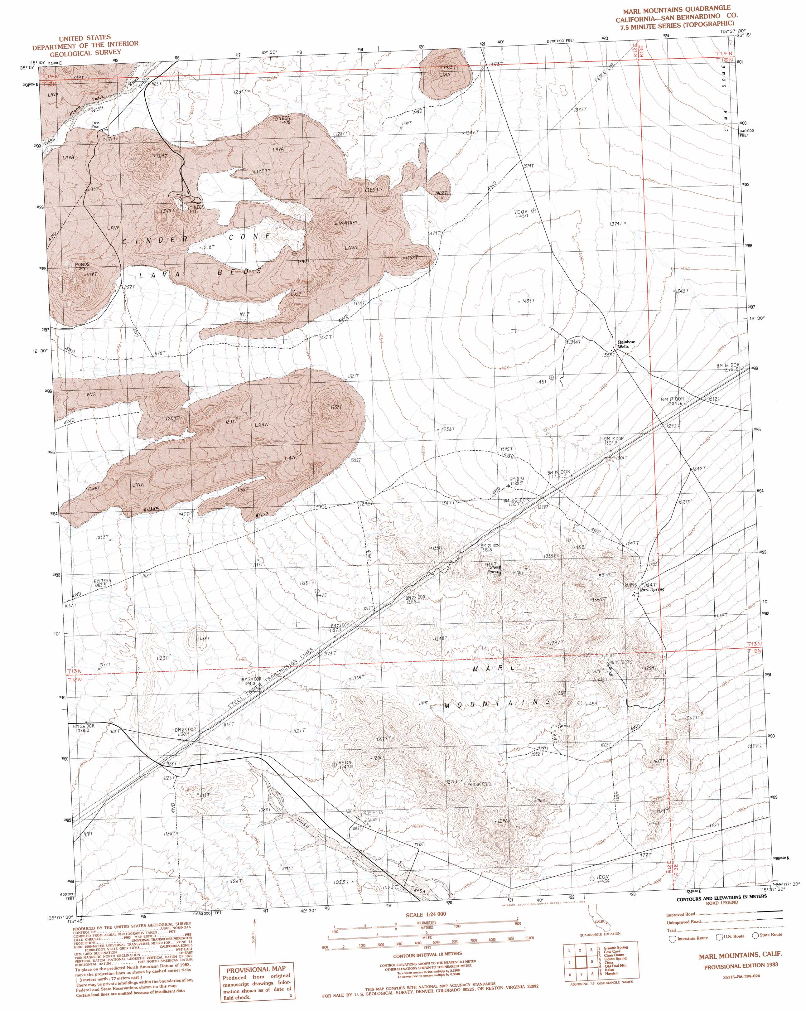
Marl Mountains Topo Map California
To zoom in, hover over the map of Marl Mountains
USGS Topo Quad 35115b6 - 1:24,000 scale
| Topo Map Name: | Marl Mountains |
| USGS Topo Quad ID: | 35115b6 |
| Print Size: | ca. 21 1/4" wide x 27" high |
| Southeast Coordinates: | 35.125° N latitude / 115.625° W longitude |
| Map Center Coordinates: | 35.1875° N latitude / 115.6875° W longitude |
| U.S. State: | CA |
| Filename: | o35115b6.jpg |
| Download Map JPG Image: | Marl Mountains topo map 1:24,000 scale |
| Map Type: | Topographic |
| Topo Series: | 7.5´ |
| Map Scale: | 1:24,000 |
| Source of Map Images: | United States Geological Survey (USGS) |
| Alternate Map Versions: |
Marl Mountains CA 1983, updated 1983 Download PDF Buy paper map Marl Mountains CA 2012 Download PDF Buy paper map Marl Mountains CA 2015 Download PDF Buy paper map |
1:24,000 Topo Quads surrounding Marl Mountains
Turquoise Mountain |
Solomons Knob |
Valley Wells |
Mescal Range |
Mineral Hill |
Halloran Spring |
Granite Spring |
Cow Cove |
Cima Dome |
Joshua |
Seventeenmile Point |
Indian Spring |
Marl Mountains |
Cima |
Mid Hills |
Cowhole Mountain |
Old Dad Mountain |
Kelso |
Hayden |
Columbia Mountain |
West Of Glasgow |
Glasgow |
Kelso Dunes |
Fountain Peak |
Colton Well |
> Back to 35115a1 at 1:100,000 scale
> Back to 35114a1 at 1:250,000 scale
> Back to U.S. Topo Maps home
Marl Mountains topo map: Gazetteer
Marl Mountains: Arches
Aikens Arch elevation 1123m 3684′Marl Mountains: Populated Places
Rainbow Wells elevation 1368m 4488′Marl Mountains: Reservoirs
Tank Four elevation 1146m 3759′Marl Mountains: Springs
Marl Spring elevation 1186m 3891′Sheep Spring elevation 1292m 4238′
Marl Mountains: Summits
Marl Mountains elevation 1192m 3910′Marl Mountains digital topo map on disk
Buy this Marl Mountains topo map showing relief, roads, GPS coordinates and other geographical features, as a high-resolution digital map file on DVD:
Southern Sierra Nevada, California & Southern Nevada
Buy digital topo maps: Southern Sierra Nevada, California & Southern Nevada