Granite Spring Topo Map California
To zoom in, hover over the map of Granite Spring
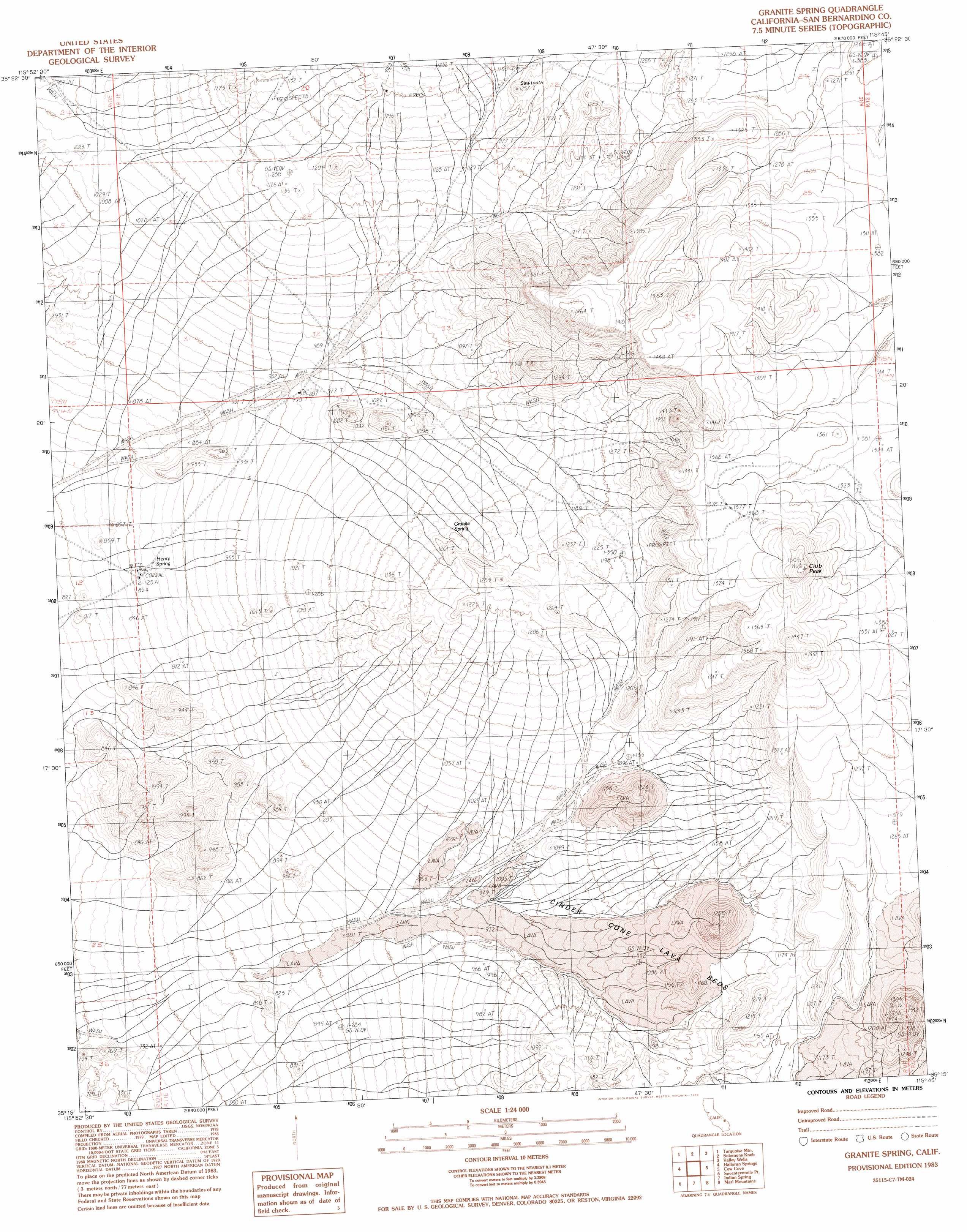
USGS Topo Quad 35115c7 - 1:24,000 scale
| Topo Map Name: | Granite Spring |
| USGS Topo Quad ID: | 35115c7 |
| Print Size: | ca. 21 1/4" wide x 27" high |
| Southeast Coordinates: | 35.25° N latitude / 115.75° W longitude |
| Map Center Coordinates: | 35.3125° N latitude / 115.8125° W longitude |
| U.S. State: | CA |
| Filename: | o35115c7.jpg |
| Download Map JPG Image: | Granite Spring topo map 1:24,000 scale |
| Map Type: | Topographic |
| Topo Series: | 7.5´ |
| Map Scale: | 1:24,000 |
| Source of Map Images: | United States Geological Survey (USGS) |
| Alternate Map Versions: |
Granite Spring CA 1983, updated 1983 Download PDF Buy paper map Granite Spring CA 1983, updated 1984 Download PDF Buy paper map Granite Spring CA 2012 Download PDF Buy paper map Granite Spring CA 2015 Download PDF Buy paper map |
1:24,000 Topo Quads surrounding Granite Spring
Silurian Hills |
Kingston Spring |
East Of Kingston Spring |
Pachalka Spring |
Clark Mountain |
North Of Baker |
Turquoise Mountain |
Solomons Knob |
Valley Wells |
Mescal Range |
Baker |
Halloran Spring |
Granite Spring |
Cow Cove |
Cima Dome |
Soda Lake North |
Seventeenmile Point |
Indian Spring |
Marl Mountains |
Cima |
Soda Lake South |
Cowhole Mountain |
Old Dad Mountain |
Kelso |
Hayden |
> Back to 35115a1 at 1:100,000 scale
> Back to 35114a1 at 1:250,000 scale
> Back to U.S. Topo Maps home
Granite Spring topo map: Gazetteer
Granite Spring: Springs
Granite Spring elevation 1142m 3746′Henry Spring elevation 862m 2828′
Granite Spring: Summits
Club Peak elevation 1505m 4937′Sawtooth elevation 1237m 4058′
Squaw Tit elevation 1183m 3881′
Granite Spring digital topo map on disk
Buy this Granite Spring topo map showing relief, roads, GPS coordinates and other geographical features, as a high-resolution digital map file on DVD:
Southern Sierra Nevada, California & Southern Nevada
Buy digital topo maps: Southern Sierra Nevada, California & Southern Nevada