Nipton Topo Map California
To zoom in, hover over the map of Nipton
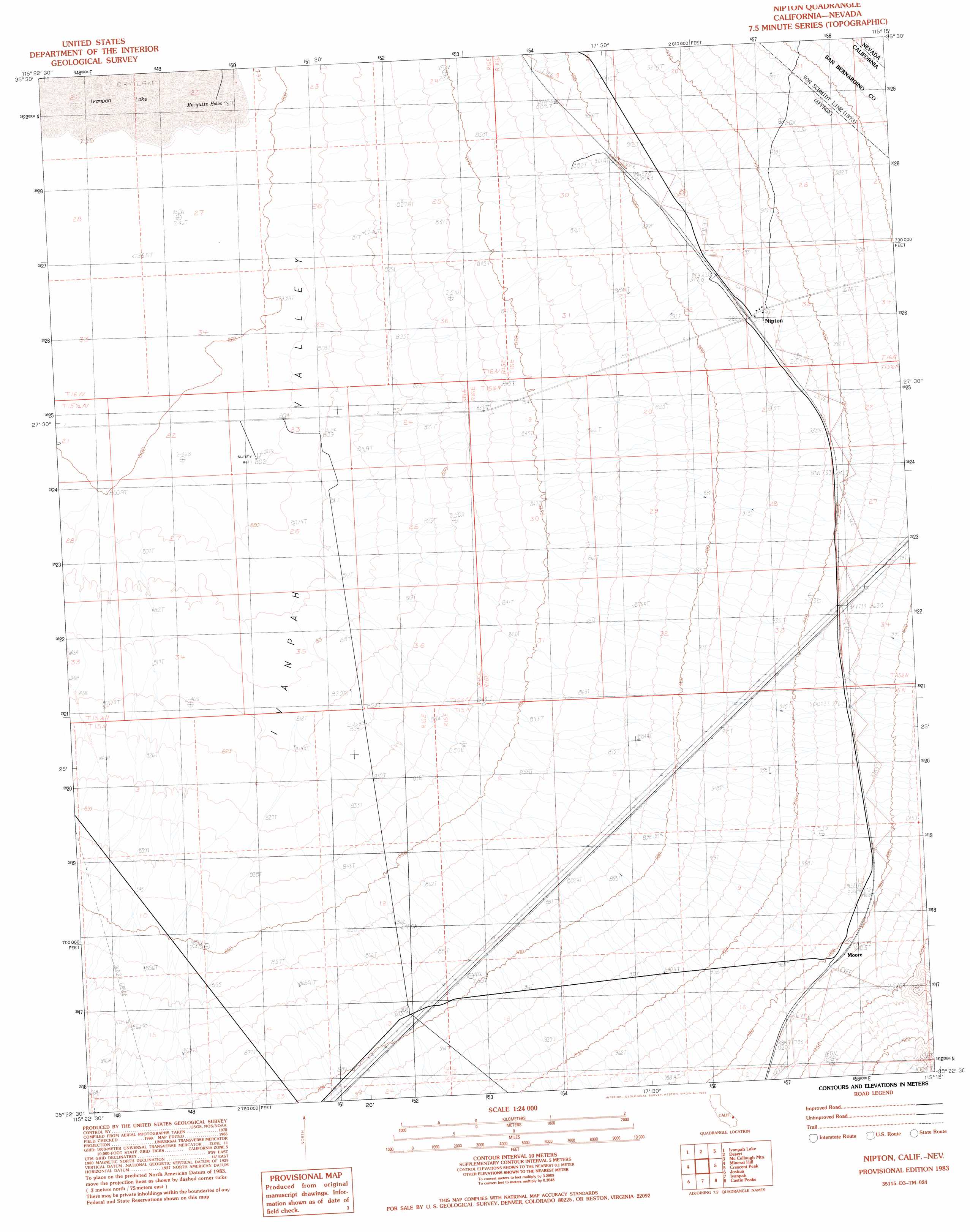
USGS Topo Quad 35115d3 - 1:24,000 scale
| Topo Map Name: | Nipton |
| USGS Topo Quad ID: | 35115d3 |
| Print Size: | ca. 21 1/4" wide x 27" high |
| Southeast Coordinates: | 35.375° N latitude / 115.25° W longitude |
| Map Center Coordinates: | 35.4375° N latitude / 115.3125° W longitude |
| U.S. States: | CA, NV |
| Filename: | o35115d3.jpg |
| Download Map JPG Image: | Nipton topo map 1:24,000 scale |
| Map Type: | Topographic |
| Topo Series: | 7.5´ |
| Map Scale: | 1:24,000 |
| Source of Map Images: | United States Geological Survey (USGS) |
| Alternate Map Versions: |
Nipton CA 1983, updated 1983 Download PDF Buy paper map Nipton CA 1983, updated 1983 Download PDF Buy paper map Nipton CA 2012 Download PDF Buy paper map Nipton CA 2015 Download PDF Buy paper map |
1:24,000 Topo Quads surrounding Nipton
Mesquite Lake |
State Line Pass |
Roach |
Mccullough Pass |
Mccullough Mountain Ne |
Clark Mountain |
Ivanpah Lake |
Desert |
Mccullough Mountain |
Highland Spring |
Mescal Range |
Mineral Hill |
Nipton |
Crescent Peak |
Hopps Well |
Cima Dome |
Joshua |
Ivanpah |
Castle Peaks |
Hart Peak |
Cima |
Mid Hills |
Pinto Valley |
Grotto Hills |
East Of Grotto Hills |
> Back to 35115a1 at 1:100,000 scale
> Back to 35114a1 at 1:250,000 scale
> Back to U.S. Topo Maps home
Nipton topo map: Gazetteer
Nipton: Basins
Ivanpah Valley elevation 810m 2657′Nipton: Lakes
Mesquite Holes elevation 795m 2608′Nipton: Populated Places
Moore elevation 1005m 3297′Nipton elevation 924m 3031′
Nipton: Streams
Willow Wash elevation 808m 2650′Nipton: Wells
Murphy Well elevation 805m 2641′Nipton digital topo map on disk
Buy this Nipton topo map showing relief, roads, GPS coordinates and other geographical features, as a high-resolution digital map file on DVD:
Southern Sierra Nevada, California & Southern Nevada
Buy digital topo maps: Southern Sierra Nevada, California & Southern Nevada